
 French
 Deutsch
Hamilton County, Kansas - Simple English Wikipedia, the free encyclopedia
Hamilton County | |
|---|---|
_from_SW.JPG) Hamilton County courthouse in Syracuse (2010) | |
 Location within the U.S. state of Kansas | |
 Kansas's location within the U.S. | |
| Coordinates: 38°01′00″N 101°40′01″W / 38.0167°N 101.667°W | |
| Country | |
| State | |
| Founded | March 20, 1873 |
| Named for | Alexander Hamilton |
| Seat | Syracuse |
| Largest city | Syracuse |
| Area | |
| • Total | 998 sq mi (2,580 km2) |
| • Land | 997 sq mi (2,580 km2) |
| • Water | 1.1 sq mi (3 km2) 0.1% |
| Population | |
| • Total | 2,518 |
| • Density | 2.5/sq mi (1.0/km2) |
| Time zone | UTC−7 (Mountain) |
| • Summer (DST) | UTC−6 (MDT) |
| Congressional district | 1st |
| Website | County Info |
Hamilton County (county code HM) is a county in the U.S. state of Kansas. In 2020, 2,518 people lived there.[1] Its county seat is Syracuse. Syracuse is also the biggest city in Hamilton County.[2] The county was created in 1873. It is named after Alexander Hamilton.[3]
Geography[change | change source]
The U.S. Census Bureau says that the county has a total area of 998 square miles (2,580 km2). Of that, 997 square miles (2,580 km2) is land and 1.1 square miles (2.8 km2) (0.1%) is water.[4]
Major highways[change | change source]
People[change | change source]
| Historical population | |||
|---|---|---|---|
| Census | Pop. | %± | |
| 1880 | 168 | — | |
| 1890 | 2,027 | 1,106.5% | |
| 1900 | 1,426 | −29.6% | |
| 1910 | 3,360 | 135.6% | |
| 1920 | 2,586 | −23.0% | |
| 1930 | 3,328 | 28.7% | |
| 1940 | 2,645 | −20.5% | |
| 1950 | 3,696 | 39.7% | |
| 1960 | 3,144 | −14.9% | |
| 1970 | 2,747 | −12.6% | |
| 1980 | 2,514 | −8.5% | |
| 1990 | 2,388 | −5.0% | |
| 2000 | 2,670 | 11.8% | |
| 2010 | 2,690 | 0.7% | |
| 2020 | 2,518 | −6.4% | |
| U.S. Decennial Census[5] 1790-1960[6] 1900-1990[7] 1990-2000[8] 2010-2020[1] | |||

Government[change | change source]
Hamilton county is very Republican. The last time a democratic candidate has won Hamilton County was in 1976 by Jimmy Carter.
Presidential elections[change | change source]
Presidential Elections Results
| Year | Republican | Democratic | Third Parties |
|---|---|---|---|
| 2020 | 81.3% 698 | 16.4% 141 | 2.3% 20 |
| 2016 | 80.5% 705 | 13.8% 121 | 5.7% 50 |
| 2012 | 79.0% 693 | 18.6% 163 | 2.4% 21 |
| 2008 | 77.0% 844 | 21.3% 233 | 1.7% 19 |
| 2004 | 78.6% 888 | 20.3% 229 | 1.2% 13 |
| 2000 | 75.6% 901 | 22.2% 264 | 2.3% 27 |
| 1996 | 64.9% 811 | 27.4% 342 | 7.7% 96 |
| 1992 | 52.0% 716 | 28.0% 386 | 20.0% 276 |
| 1988 | 60.0% 801 | 38.7% 517 | 1.3% 17 |
| 1984 | 70.6% 1,037 | 27.8% 408 | 1.6% 23 |
| 1980 | 64.7% 889 | 29.2% 402 | 6.1% 84 |
| 1976 | 41.7% 560 | 55.6% 746 | 2.8% 37 |
| 1972 | 67.3% 941 | 28.2% 394 | 4.6% 64 |
| 1968 | 56.3% 751 | 30.7% 410 | 13.0% 174 |
| 1964 | 48.2% 685 | 51.1% 726 | 0.7% 10 |
| 1960 | 59.8% 885 | 39.9% 591 | 0.3% 5 |
| 1956 | 60.7% 865 | 38.7% 552 | 0.6% 9 |
| 1952 | 72.7% 1,209 | 26.3% 437 | 1.0% 17 |
| 1948 | 50.6% 749 | 48.8% 722 | 0.5% 8 |
| 1944 | 62.4% 795 | 36.9% 471 | 0.7% 9 |
| 1940 | 58.0% 798 | 41.3% 569 | 0.7% 10 |
| 1936 | 44.6% 720 | 54.8% 885 | 0.7% 11 |
| 1932 | 36.7% 651 | 57.5% 1,021 | 5.8% 103 |
| 1928 | 68.4% 839 | 29.6% 363 | 2.0% 24 |
| 1924 | 52.3% 610 | 26.3% 307 | 21.4% 250 |
| 1920 | 57.7% 591 | 36.2% 371 | 6.2% 63 |
| 1916 | 44.1% 511 | 45.0% 522 | 11.0% 127 |
| 1912 | 21.3% 134 | 41.8% 263 | 36.9% 232 |
| 1908 | 57.3% 415 | 38.0% 275 | 4.7% 34 |
| 1904 | 58.6% 215 | 34.3% 126 | 7.1% 26 |
| 1900 | 46.3% 182 | 49.4% 194 | 4.3% 17 |
| 1896 | 45.6% 185 | 53.2% 216 | 1.2% 5 |
| 1892 | 56.3% 252 | 43.7% 196 | |
| 1888 | 59.1% 480 | 36.3% 295 | 4.6% 37 |
Education[change | change source]
Unified school districts[change | change source]
Communities[change | change source]

Cities[change | change source]
References[change | change source]
- ↑ 1.0 1.1 1.2 "QuickFacts: Hamilton County, Kansas". United States Census Bureau. Retrieved October 1, 2023.
- ↑ "Find a County". National Association of Counties. Retrieved 2011-06-07.
- ↑ Blackmar, Frank Wilson (1912). Kansas: A Cyclopedia of State History, Embracing Events, Institutions, Industries, Counties, Cities, Towns, Prominent Persons, Etc. Standard Publishing Company. p. 803. ISBN 9780722249055.
- ↑ "US Gazetteer files: 2010, 2000, and 1990". United States Census Bureau. 2011-02-12. Retrieved 2011-04-23.
- ↑ "U.S. Decennial Census". United States Census Bureau. Retrieved July 26, 2014.
- ↑ "Historical Census Browser". University of Virginia Library. Archived from the original on June 23, 2018. Retrieved July 26, 2014.
- ↑ "Population of Counties by Decennial Census: 1900 to 1990". United States Census Bureau. Retrieved July 26, 2014.
- ↑ "Census 2000 PHC-T-4. Ranking Tables for Counties: 1990 and 2000" (PDF). United States Census Bureau. Retrieved July 26, 2014.
- ↑ "Dave Leip's Atlas of U.S. Presidential Elections".
Other websites[change | change source]
Wikimedia Commons has media related to Hamilton County, Kansas.
- County
- Maps
- Hamilton County Maps: Current, Historic, KDOT
- Kansas Highway Maps: Current, Historic, KDOT
- Kansas Railroad Maps: Current, 1996, 1915, KDOT and Kansas Historical Society
Municipalities and communities of Hamilton County, Kansas, United States | ||
|---|---|---|
| Cities | 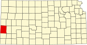 | |
| Unincorporated community | ||
| Townships | ||

38°01′N 101°40′W / 38.017°N 101.667°W
| International | |
|---|---|
| National | |