
 French
 Deutsch
Lane County, Kansas - Simple English Wikipedia, the free encyclopedia
Lane County | |
|---|---|
 Lane County Courthouse in Dighton (2015) | |
 Location within the U.S. state of Kansas | |
 Kansas's location within the U.S. | |
| Coordinates: 38°28′00″N 100°28′01″W / 38.4667°N 100.467°W | |
| Country | |
| State | |
| Founded | March 20, 1873 |
| Named for | James H. Lane |
| Seat | Dighton |
| Largest city | Dighton |
| Area | |
| • Total | 718 sq mi (1,860 km2) |
| • Land | 717 sq mi (1,860 km2) |
| • Water | 0.2 sq mi (0.5 km2) 0.03% |
| Population | |
| • Total | 1,574 |
| • Density | 2.2/sq mi (0.8/km2) |
| Time zone | UTC−6 (Central) |
| • Summer (DST) | UTC−5 (CDT) |
| Congressional district | 1st |
| Website | www |
Lane County (standard abbreviation: LE) is a county in the U.S. state of Kansas. In 2020, 1,574 people lived there.[1] This makes it the county with the third lowest number of people living in it in Kansas. The county seat is Dighton,[2] the only city in the county. The county was named after James H. Lane. He was a leader of the Jayhawker abolitionist movement, and he was one of the first U.S. Senators from Kansas.[3]
History[change | change source]
19th century[change | change source]
In 1873, Lane County was created.
Geography[change | change source]
The U.S. Census Bureau says that the county has a total area of 718 square miles (1,860 km2). Of that, 717 square miles (1,860 km2) is land and 0.2 square miles (0.52 km2) (0.03%) is water.[4]
People[change | change source]
| Historical population | |||
|---|---|---|---|
| Census | Pop. | %± | |
| 1880 | 604 | — | |
| 1890 | 2,060 | 241.1% | |
| 1900 | 1,563 | −24.1% | |
| 1910 | 2,603 | 66.5% | |
| 1920 | 2,848 | 9.4% | |
| 1930 | 3,372 | 18.4% | |
| 1940 | 2,821 | −16.3% | |
| 1950 | 2,808 | −0.5% | |
| 1960 | 3,060 | 9.0% | |
| 1970 | 2,707 | −11.5% | |
| 1980 | 2,472 | −8.7% | |
| 1990 | 2,375 | −3.9% | |
| 2000 | 2,155 | −9.3% | |
| 2010 | 1,750 | −18.8% | |
| 2020 | 1,574 | −10.1% | |
| U.S. Decennial Census[5] 1790-1960[6] 1900-1990[7] 1990-2000[8] 2010-2020[1] | |||

Government[change | change source]
Presidential elections[change | change source]
Lane County has been very Republican throughout its history. It voted for Democratic candidates only five times in presidential elections from 1888 to the present. The last time a Democrat won the county was in 1964 by Lyndon B. Johnson.
| Year | Republican | Democratic | Third Parties |
|---|---|---|---|
| 2020 | 85.1% 762 | 12.8% 115 | 2.0% 18 |
| 2016 | 82.4% 718 | 12.2% 106 | 5.4% 47 |
| 2012 | 79.6% 739 | 18.5% 172 | 1.8% 17 |
| 2008 | 79.3% 814 | 18.8% 193 | 2.0% 20 |
| 2004 | 81.2% 823 | 17.9% 181 | 1.0% 10 |
| 2000 | 74.7% 846 | 22.2% 252 | 3.1% 35 |
| 1996 | 70.7% 865 | 22.1% 271 | 7.2% 88 |
| 1992 | 51.9% 674 | 20.4% 265 | 27.7% 360 |
| 1988 | 61.4% 768 | 36.0% 450 | 2.6% 32 |
| 1984 | 77.2% 1,008 | 21.6% 282 | 1.2% 16 |
| 1980 | 67.5% 924 | 23.5% 321 | 9.0% 123 |
| 1976 | 48.9% 651 | 48.5% 646 | 2.6% 34 |
| 1972 | 73.2% 943 | 22.8% 294 | 4.0% 51 |
| 1968 | 60.6% 781 | 29.9% 385 | 9.5% 122 |
| 1964 | 42.8% 586 | 56.4% 773 | 0.8% 11 |
| 1960 | 65.4% 902 | 33.5% 462 | 1.1% 15 |
| 1956 | 72.1% 992 | 27.6% 380 | 0.3% 4 |
| 1952 | 77.9% 1,142 | 21.2% 311 | 1.0% 14 |
| 1948 | 57.5% 764 | 39.5% 525 | 2.9% 39 |
| 1944 | 65.9% 773 | 33.1% 388 | 1.0% 12 |
| 1940 | 60.8% 888 | 38.1% 557 | 1.1% 16 |
| 1936 | 43.8% 682 | 54.8% 853 | 1.5% 23 |
| 1932 | 42.9% 672 | 55.3% 866 | 1.9% 29 |
| 1928 | 71.3% 954 | 27.2% 364 | 1.5% 20 |
| 1924 | 59.1% 693 | 24.0% 281 | 17.0% 199 |
| 1920 | 63.9% 656 | 29.0% 298 | 7.0% 72 |
| 1916 | 32.1% 363 | 58.2% 659 | 9.7% 110 |
| 1912 | 25.4% 158 | 38.1% 237 | 36.5% 227 |
| 1908 | 51.5% 357 | 39.1% 271 | 9.4% 65 |
| 1904 | 63.6% 353 | 20.0% 111 | 16.4% 91 |
| 1900 | 56.5% 239 | 40.7% 172 | 2.8% 12 |
| 1896 | 54.9% 241 | 43.5% 191 | 1.6% 7 |
| 1892 | 55.6% 284 | 44.4% 227 | |
| 1888 | 57.7% 459 | 33.6% 267 | 8.7% 69 |
Laws[change | change source]
Although the Kansas Constitution was changed in 1986 to allow the sale of alcohol, Lane County is still a "dry" county.[10]
Education[change | change source]
Unified school districts[change | change source]
Communities[change | change source]

City[change | change source]
References[change | change source]
- ↑ 1.0 1.1 1.2 "QuickFacts: Lane County, Kansas". United States Census Bureau. Retrieved October 1, 2023.
- ↑ "Find a County". National Association of Counties. Retrieved 2011-06-07.
- ↑ Gannett, Henry (1905). The Origin of Certain Place Names in the United States. Government Printing Office. p. 180.
- ↑ "US Gazetteer files: 2010, 2000, and 1990". United States Census Bureau. 2011-02-12. Retrieved 2011-04-23.
- ↑ "U.S. Decennial Census". United States Census Bureau. Retrieved July 26, 2014.
- ↑ "Historical Census Browser". University of Virginia Library. Archived from the original on August 11, 2012. Retrieved July 26, 2014.
- ↑ "Population of Counties by Decennial Census: 1900 to 1990". United States Census Bureau. Retrieved July 26, 2014.
- ↑ "Census 2000 PHC-T-4. Ranking Tables for Counties: 1990 and 2000" (PDF). United States Census Bureau. Retrieved July 26, 2014.
- ↑ "Dave Leip's Atlas of U.S. Presidential Elections".
- ↑ "Map of Wet and Dry Counties". Alcoholic Beverage Control, Kansas Department of Revenue. November 2004. Archived from the original on 2007-10-08. Retrieved 2007-01-21.
More reading[change | change source]
- Early Lane County History: 12,000 B.C. - A.D. 1884; Ellen May Stanley; Mennonite Press; 1993.
- Standard Atlas of Lane County, Kansas; Geo. A. Ogle & Co; 62 pages; 1920.
Other websites[change | change source]
- County
- Maps
- Lane County Maps: Current, Historic, KDOT
- Kansas Highway Maps: Current, Historic, KDOT
- Kansas Railroad Maps: Current, 1996, 1915, KDOT and Kansas Historical Society
Municipalities and communities of Lane County, Kansas, United States | ||
|---|---|---|
| City | 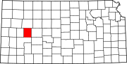 | |
| Unincorporated communities | ||
| Footnotes | †This community is designated a Census-Designated Place (CDP) by the United States Census Bureau. | |

| International | |
|---|---|
| National | |
38°28′N 100°28′W / 38.467°N 100.467°W