
 French
 Deutsch
Jefferson County, Kansas - Simple English Wikipedia, the free encyclopedia
Jefferson County | |
|---|---|
 Jefferson County Courthouse in Oskaloosa (1971) | |
 Location within the U.S. state of Kansas | |
 Kansas's location within the U.S. | |
| Coordinates: 39°13′N 95°24′W / 39.217°N 95.400°W | |
| Country | |
| State | |
| Founded | August 25, 1855 |
| Named for | Thomas Jefferson |
| Seat | Oskaloosa |
| Largest city | Valley Falls |
| Area | |
| • Total | 557 sq mi (1,440 km2) |
| • Land | 533 sq mi (1,380 km2) |
| • Water | 24 sq mi (60 km2) 4.3% |
| Population | |
| • Total | 18,368 |
| • Density | 34.5/sq mi (13.3/km2) |
| Time zone | UTC−6 (Central) |
| • Summer (DST) | UTC−5 (CDT) |
| Congressional district | 1st |
| Website | jfcountyks.com |
Jefferson County (county code JF) is a county in the U.S. state of Kansas. In 2020, 18,368 people lived there.[1] Its county seat is Oskaloosa.[2] Its biggest city is Valley Falls.
Geography[change | change source]
The U.S. Census Bureau says that the county has a total area of 557 square miles (1,440 km2). Of that, 533 square miles (1,380 km2) is land and 2.4 square miles (6.2 km2) (4.3%) is water.[3]
People[change | change source]
| Historical population | |||
|---|---|---|---|
| Census | Pop. | %± | |
| 1860 | 4,459 | — | |
| 1870 | 12,526 | 180.9% | |
| 1880 | 15,563 | 24.2% | |
| 1890 | 16,620 | 6.8% | |
| 1900 | 17,533 | 5.5% | |
| 1910 | 15,826 | −9.7% | |
| 1920 | 14,750 | −6.8% | |
| 1930 | 14,129 | −4.2% | |
| 1940 | 12,718 | −10.0% | |
| 1950 | 11,084 | −12.8% | |
| 1960 | 11,252 | 1.5% | |
| 1970 | 11,945 | 6.2% | |
| 1980 | 15,207 | 27.3% | |
| 1990 | 15,905 | 4.6% | |
| 2000 | 18,426 | 15.9% | |
| 2010 | 19,126 | 3.8% | |
| 2020 | 18,368 | −4.0% | |
| U.S. Decennial Census[4] 1790-1960[5] 1900-1990[6] 1990-2000[7] 2010-2020[1] | |||

Jefferson County is included in the Topeka, KS Metropolitan Statistical Area.
Government[change | change source]
Presidential elections[change | change source]
Presidential Elections Results
| Year | Republican | Democratic | Third Parties |
|---|---|---|---|
| 2020 | 64.8% 6,334 | 32.7% 3,194 | 2.6% 254 |
| 2016 | 61.8% 5,213 | 29.8% 2,518 | 8.4% 709 |
| 2012 | 60.2% 4,827 | 37.2% 2,977 | 2.6% 209 |
| 2008 | 58.3% 5,220 | 39.6% 3,542 | 2.1% 188 |
| 2004 | 61.5% 5,408 | 37.0% 3,253 | 1.5% 132 |
| 2000 | 56.2% 4,423 | 38.1% 3,000 | 5.8% 454 |
| 1996 | 49.3% 3,781 | 36.0% 2,757 | 14.7% 1,130 |
| 1992 | 33.0% 2,569 | 32.6% 2,538 | 34.4% 2,673 |
| 1988 | 55.5% 3,605 | 43.3% 2,810 | 1.2% 77 |
| 1984 | 68.9% 4,524 | 30.3% 1,990 | 0.8% 49 |
| 1980 | 64.6% 4,046 | 28.4% 1,776 | 7.0% 441 |
| 1976 | 55.1% 3,225 | 42.2% 2,470 | 2.7% 156 |
| 1972 | 72.7% 3,679 | 24.4% 1,237 | 2.9% 145 |
| 1968 | 56.6% 2,781 | 27.6% 1,355 | 15.9% 779 |
| 1964 | 53.1% 2,380 | 46.1% 2,066 | 0.9% 39 |
| 1960 | 65.7% 3,353 | 34.1% 1,739 | 0.2% 9 |
| 1956 | 70.2% 3,677 | 29.3% 1,536 | 0.4% 22 |
| 1952 | 73.5% 3,980 | 26.1% 1,411 | 0.5% 26 |
| 1948 | 59.0% 2,986 | 39.7% 2,010 | 1.2% 62 |
| 1944 | 68.7% 3,504 | 30.9% 1,575 | 0.4% 19 |
| 1940 | 65.8% 4,330 | 33.6% 2,212 | 0.6% 38 |
| 1936 | 54.3% 3,711 | 45.4% 3,105 | 0.4% 25 |
| 1932 | 47.4% 2,974 | 50.8% 3,185 | 1.8% 112 |
| 1928 | 74.8% 4,810 | 24.9% 1,601 | 0.3% 22 |
| 1924 | 72.7% 4,422 | 21.7% 1,320 | 5.6% 340 |
| 1920 | 68.9% 3,463 | 30.5% 1,535 | 0.6% 31 |
| 1916 | 50.5% 3,174 | 46.4% 2,919 | 3.1% 193 |
| 1912 | 29.8% 1,155 | 39.6% 1,537 | 30.7% 1,190 |
| 1908 | 55.6% 2,270 | 42.1% 1,720 | 2.3% 95 |
| 1904 | 65.3% 2,568 | 30.5% 1,199 | 4.3% 168 |
| 1900 | 54.7% 2,374 | 44.0% 1,912 | 1.3% 57 |
| 1896 | 50.0% 2,322 | 49.0% 2,276 | 1.0% 47 |
| 1892 | 50.0% 2,026 | 50.0% 2,030[a] | |
| 1888 | 57.0% 2,268 | 40.2% 1,601 | 2.8% 110 |
Education[change | change source]
Unified school districts[change | change source]
- Valley Falls USD 338
- Jefferson County North USD 339
- Jefferson West USD 340
- Oskaloosa USD 341
- McLouth USD 342
- Perry-Lecompton USD 343
Communities[change | change source]

Cities[change | change source]
References[change | change source]
- ↑ 1.0 1.1 1.2 "QuickFacts: Jefferson County, Kansas". United States Census Bureau. Retrieved October 1, 2023.
- ↑ "Find a County". National Association of Counties. Archived from the original on 2011-05-31. Retrieved 2011-06-07.
- ↑ "US Gazetteer files: 2010, 2000, and 1990". United States Census Bureau. 2011-02-12. Retrieved 2011-04-23.
- ↑ "U.S. Decennial Census". United States Census Bureau. Archived from the original on April 26, 2015. Retrieved July 26, 2014.
- ↑ "Historical Census Browser". University of Virginia Library. Archived from the original on August 11, 2012. Retrieved July 26, 2014.
- ↑ "Population of Counties by Decennial Census: 1900 to 1990". United States Census Bureau. Retrieved July 26, 2014.
- ↑ "Census 2000 PHC-T-4. Ranking Tables for Counties: 1990 and 2000" (PDF). United States Census Bureau. Retrieved July 26, 2014.
- ↑ "Dave Leip's Atlas of U.S. Presidential Elections".
- Notes
- ↑ This comprises 1,973 votes (48.6%) were for Populist James B. Weaver (who was supported by the state’s Democrats) and 57 votes (1.4%) for Prohibition Party candidate John Bidwell.
More reading[change | change source]
- Standard Atlas of Jefferson County, Kansas; Geo. A. Ogle & Co; 69 pages; 1916.
- Descriptive Atlas of Jefferson County, Kansas; Acme Publishing Co; 44 pages; 1899.
Other websites[change | change source]
Wikimedia Commons has media related to Jefferson County, Kansas.
- County
- Jefferson County - Official
- Jefferson County - Directory of Public Officials
- Jefferson County - Economic Development Archived 2019-04-08 at the Wayback Machine
- Maps
- Jefferson County Maps: Current, Historic, KDOT
- Kansas Highway Maps: Current, Historic, KDOT
- Kansas Railroad Maps: Current, 1996, 1915, KDOT and Kansas Historical Society
Municipalities and communities of Jefferson County, Kansas, United States | ||
|---|---|---|
| Cities | 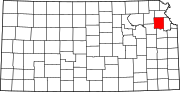 | |
| Unincorporated communities | ||
| Townships | ||
| Footnotes | †This community is designated a Census-Designated Place (CDP) by the United States Census Bureau. | |

| International | |
|---|---|
| National | |