
 French
 Deutsch
Greeley County, Kansas - Simple English Wikipedia, the free encyclopedia
Greeley County | |
|---|---|
 Greeley County Courthouse in Tribune (2010) | |
 Location within the U.S. state of Kansas | |
 Kansas's location within the U.S. | |
| Coordinates: 38°28′00″N 101°49′59″W / 38.4667°N 101.833°W | |
| Country | |
| State | |
| Founded | March 20, 1873 |
| Named for | Horace Greeley |
| Seat | Tribune |
| Largest city | Tribune |
| Area | |
| • Total | 778 sq mi (2,020 km2) |
| • Land | 778 sq mi (2,020 km2) |
| • Water | 0.0 sq mi (0 km2) 0.0% |
| Population | |
| • Total | 1,284 |
| • Density | 1.7/sq mi (0.7/km2) |
| Time zone | UTC−7 (Mountain) |
| • Summer (DST) | UTC−6 (MDT) |
| Congressional district | 1st |
| Website | greeleycounty.org |
Greeley County (county code GL) is a county in western Kansas. It is in the Central United States. In 2020, 1,284 people lived there.[1] It is the county with the fewest number of people living in it in Kansas. Its county seat is Tribune. Tribune is also the biggest city in the county.[2] The county is named after Horace Greeley[3] of Chappaqua, New York, editor of the New York Tribune. Greeley helped western settlement with the motto "Go West, young man".[4]
Geography[change | change source]
The U.S. Census Bureau says that the county has a total area of 778 square miles (2,020 km2). All of it is land.[5]
People[change | change source]
| Historical population | |||
|---|---|---|---|
| Census | Pop. | %± | |
| 1890 | 1,264 | — | |
| 1900 | 493 | −61.0% | |
| 1910 | 1,335 | 170.8% | |
| 1920 | 1,028 | −23.0% | |
| 1930 | 1,712 | 66.5% | |
| 1940 | 1,638 | −4.3% | |
| 1950 | 2,010 | 22.7% | |
| 1960 | 2,087 | 3.8% | |
| 1970 | 1,819 | −12.8% | |
| 1980 | 1,845 | 1.4% | |
| 1990 | 1,774 | −3.8% | |
| 2000 | 1,534 | −13.5% | |
| 2010 | 1,247 | −18.7% | |
| 2020 | 1,284 | 3.0% | |
| U.S. Decennial Census[6] 1790-1960[7] 1900-1990[8] 1990-2000[9] 2010-2020[1] | |||

Government[change | change source]
County[change | change source]
Since January 1, 2009, Greeley County and Tribune have been a unified government.[10]
Presidential elections[change | change source]
This county is often chooses Republican candidates. The last time a Democratic candidate won the county was in 1976. A Democratic candidate has only won the county three times in its history: 1932 (Franklin D. Roosevelt), 1964 (Lyndon B. Johnson), and most recently in 1976 by Jimmy Carter.
| Year | Republican | Democratic | Third Parties |
|---|---|---|---|
| 2020 | 85.6% 549 | 12.2% 78 | 2.2% 14 |
| 2016 | 82.2% 534 | 12.8% 83 | 5.1% 33 |
| 2012 | 81.0% 543 | 16.9% 113 | 2.1% 14 |
| 2008 | 79.3% 591 | 20.3% 151 | 0.4% 3 |
| 2004 | 79.5% 584 | 18.8% 138 | 1.8% 13 |
| 2000 | 78.2% 628 | 17.8% 143 | 4.0% 32 |
| 1996 | 72.0% 567 | 20.4% 161 | 7.6% 60 |
| 1992 | 57.7% 504 | 21.9% 191 | 20.4% 178 |
| 1988 | 59.3% 506 | 37.2% 317 | 3.5% 30 |
| 1984 | 73.3% 699 | 23.8% 227 | 2.9% 28 |
| 1980 | 63.4% 600 | 24.8% 235 | 11.8% 112 |
| 1976 | 43.4% 389 | 53.5% 479 | 3.1% 28 |
| 1972 | 68.5% 639 | 22.7% 212 | 8.8% 82 |
| 1968 | 59.9% 465 | 29.2% 227 | 10.9% 85 |
| 1964 | 44.8% 388 | 54.2% 469 | 1.0% 9 |
| 1960 | 70.6% 645 | 28.7% 262 | 0.8% 7 |
| 1956 | 77.1% 599 | 22.4% 174 | 0.5% 4 |
| 1952 | 79.1% 725 | 19.7% 181 | 1.2% 11 |
| 1948 | 53.3% 391 | 44.5% 326 | 2.2% 16 |
| 1944 | 63.0% 378 | 35.8% 215 | 1.2% 7 |
| 1940 | 64.6% 497 | 34.8% 268 | 0.7% 5 |
| 1936 | 50.5% 396 | 49.4% 388 | 0.1% 1 |
| 1932 | 42.6% 359 | 52.3% 440 | 5.1% 43 |
| 1928 | 78.3% 439 | 21.6% 121 | 0.2% 1 |
| 1924 | 64.2% 357 | 13.5% 75 | 22.3% 124 |
| 1920 | 69.5% 273 | 23.7% 93 | 6.9% 27 |
| 1916 | 43.6% 210 | 34.9% 168 | 21.6% 104 |
| 1912 | 35.6% 95 | 12.4% 33 | 52.1% 139[a] |
| 1908 | 64.6% 206 | 27.9% 89 | 7.5% 24 |
| 1904 | 85.6% 149 | 8.1% 14 | 6.3% 11 |
| 1900 | 75.6% 118 | 23.1% 36 | 1.3% 2 |
| 1896 | 60.8% 121 | 38.2% 76 | 1.0% 2 |
| 1892 | 67.9% 241 | 32.1% 114 | |
| 1888 | 59.0% 422 | 25.2% 180 | 15.8% 113 |
Education[change | change source]
Unified school districts[change | change source]
- Greeley County Schools, USD 200 Archived 2018-08-12 at the Wayback Machine
Communities[change | change source]

Cities[change | change source]
References[change | change source]
- ↑ 1.0 1.1 1.2 "QuickFacts: Greeley County, Kansas". United States Census Bureau. Retrieved October 1, 2023.
- ↑ "Find a County". National Association of Counties. Archived from the original on 2011-05-31. Retrieved 2011-06-07.
- ↑ Gannett, Henry (1905). The Origin of Certain Place Names in the United States. Govt. Print. Off. p. 143.
- ↑ Josiah Busnell Grinnell (1891). Men and Events of Forty Years. Boston: D. Lothrop. p. 87. Retrieved 2009-02-13.
- ↑ "US Gazetteer files: 2010, 2000, and 1990". United States Census Bureau. 2011-02-12. Retrieved 2011-04-23.
- ↑ "U.S. Decennial Census". United States Census Bureau. Archived from the original on April 26, 2015. Retrieved July 24, 2014.
- ↑ "Historical Census Browser". University of Virginia Library. Archived from the original on August 11, 2012. Retrieved July 24, 2014.
- ↑ "Population of Counties by Decennial Census: 1900 to 1990". United States Census Bureau. Retrieved July 24, 2014.
- ↑ "Census 2000 PHC-T-4. Ranking Tables for Counties: 1990 and 2000" (PDF). United States Census Bureau. Retrieved July 24, 2014.
- ↑ "Unified Greeley County, Kansas - Innovative Government - Greeley County, Kansas". greeleycounty.org. February 2012. Retrieved March 3, 2019.
- ↑ "Dave Leip's Atlas of U.S. Presidential Elections". uselectionatlas.org. Retrieved March 3, 2019.
- Notes
- ↑ This total comprises 106 votes (39.70 percent) for Progressive Theodore Roosevelt (who carried the county) and 33 votes (12.36 percent) for Socialist Eugene V. Debs.
Other websites[change | change source]
- County
- Other
- Maps
- Greeley County Maps: Current, Historic, KDOT
- Kansas Highway Maps: Current, Historic, KDOT
- Kansas Railroad Maps: Current, 1996, 1915, KDOT and Kansas Historical Society
Municipalities and communities of Greeley County, Kansas, United States | ||
|---|---|---|
| Cities | 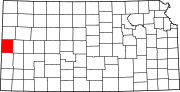 | |
| Ghost towns | ||
| Townships | ||

38°28′N 101°50′W / 38.467°N 101.833°W
| International | |
|---|---|
| National | |