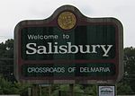
Salisbury metropolitan area
Salisbury metropolitan area Salisbury, MD Metropolitan Statistical Area | |
|---|---|
 Main Street in Salisbury | |
 | |
| Country | United States |
| State | Maryland |
| Largest city | Salisbury |
| Other cities | - Pocomoke City - Princess Anne - Ocean Pines - Ocean City |
| Time zone | UTC−5 (EST) |
| • Summer (DST) | UTC−4 (EDT) |
The Salisbury, MD Metropolitan Statistical Area is a United States Census Bureau–designated metropolitan area centered in and around Salisbury, Maryland, including two counties in Maryland: Somerset and Wicomico. Until 2023, the Salisbury MSA also included Worcester County.[1]
Under the previous CBSA definition, the metropolitan area had a population of 423,481 residents as of the 2020 census. And respectively, Under the previous Combined Statistical Area definition, the Salisbury-Cambridge, MD-DE Combined Statistical Area combined the Salisbury metropolitan area with the Cambridge micropolitan statistical area,[2] with a total 2020 population of 456,012.
Demographics
[edit]As of the 2000 census,[3] of there were 109,931 people, 40,579 households, and 27,223 families residing within the MSA. The racial makeup of the MSA was 68.92% White, 27.32% African American, 0.25% Native American, 1.46% Asian, 0.02% Pacific Islander, 0.73% from other races, and 1.30% from two or more races. Hispanic or Latino of any race were 1.99% of the population.
The median income for a household in the area was $34,469, and the median income for a family was $42,386. Males had a median income of $29,989 versus $23,292 for females. The per capita income for the MSA was $17,568.
History
[edit]Prior to the 2010 census, the Salisbury metropolitan area consisted only of Wicomico and Somerset counties in Maryland. As of the 2000 census, the MSA had a population of 109,391 (though a July 1, 2009 estimate placed the population at 120,181).[4] Worcester County, Maryland was considered a part of the Ocean Pines Micropolitan Statistical Area and Sussex County, Delaware was considered a part of the Seaford Micropolitan Statistical Area.[5]
In 2018, the United States Census Bureau defined the Salisbury-Cambridge, MD-DE Combined Statistical Area, which combined the Salisbury metropolitan area with the Cambridge, Maryland Micropolitan Statistical Area (Dorchester County).[2]
The 2018 designation was reversed effective July 2023 as Dorchester County was re-admitted to the Washington-Baltimore Combined Statistical Area and Worcester County, Maryland was separated into its own micropolitan area.[1]
The current Salisbury–Ocean Pines Combined Statistical Area consists of the Salisbury metropolitan area and the Ocean Pines micropolitan area. As of the 2000 Census, the CSA had a population of 155,934 (though a July 1, 2009 estimate placed the population at 169,303).[6]
Counties
[edit]Communities
[edit]Places with more than 20,000 inhabitants
[edit]- Salisbury, Maryland (principal city)
Places with 5,000 to 20,000 inhabitants
[edit]- Ocean City, Maryland
- Ocean Pines, Maryland (census-designated place)
Places with 1,000 to 5,000 inhabitants
[edit]- Berlin, Maryland
- Crisfield, Maryland
- Delmar, Maryland
- Fruitland, Maryland
- Pittsville, Maryland
- Pocomoke City, Maryland
- Princess Anne, Maryland
- Snow Hill, Maryland
- West Ocean City, Maryland (census-designated place)
Places with 500 to 1,000 inhabitants
[edit]- Deal Island, Maryland (census-designated place)
- Eden, Maryland (census-designated place)
- Fairmount, Maryland (census-designated place)
- Hebron, Maryland
- Mount Vernon, Maryland (census-designated place)
- Sharptown, Maryland
- Willards, Maryland
Places with less than 500 inhabitants
[edit]- Allen, Maryland (census-designated place)
- Bishopville, Maryland (census-designated place)
- Bivalve, Maryland (census-designated place)
- Chance, Maryland (census-designated place)
- Dames Quarter, Maryland (census-designated place)
- Frenchtown-Rumbly, Maryland (census-designated place)
- Girdletree, Maryland (census-designated place)
- Jesterville, Maryland (census-designated place)
- Mardela Springs, Maryland
- Nanticoke, Maryland (census-designated place)
- Nanticoke Acres, Maryland (census-designated place)
- Newark, Maryland (census-designated place)
- Parsonsburg, Maryland (census-designated place)
- Powellville, Maryland (census-designated place)
- Quantico, Maryland (census-designated place)
- Smith Island, Maryland (census-designated place)
- Stockton, Maryland (census-designated place)
- Tyaskin, Maryland (census-designated place)
- Waterview, Maryland (census-designated place)
- West Pocomoke, Maryland (census-designated place)
- Whaleyville, Maryland (census-designated place)
- Whitehaven, Maryland (census-designated place)
Transportation
[edit]Major highways
[edit] US 9
US 9 US 13
US 13 US 50
US 50 US 113
 DE 1
DE 1 DE 16
DE 16 DE 20
DE 20 DE 24
DE 24 DE 26
DE 26
 Route 54
 DE 404
 MD 12
MD 12 MD 90
MD 90 MD 313
 MD 413
 MD 528
Airports
[edit]- Salisbury–Ocean City–Wicomico Regional Airport
- Bennett Airport
- Crisfield Municipal Airport
- Ocean City Municipal Airport
Mass transit
[edit]- Shore Transit serves Somerset, Wicomico, and Worcester counties with local routes in Salisbury and commuter routes between cities and towns in the three counties.
- Ocean City Transportation A Bus service in Ocean City with connections to Shore Transit and DART First State.
Colleges and universities
[edit]Media
[edit]Radio
[edit]Television
[edit]See also
[edit]References
[edit]- ^ a b "OMB Bulletin No. 23-01" (PDF). www.whitehouse.gov. July 21, 2023. Retrieved May 3, 2024.
- ^ a b OMB BULLETIN NO. 18-04: Revised Delineations of Metropolitan Statistical Areas, Micropolitan Statistical Areas, and Combined Statistical Areas, and Guidance on Uses of the Delineations of These Areas Archived 2020-03-04 at the Wayback Machine. Office of Management and Budget. September 14, 2018.
- ^ "U.S. Census website". United States Census Bureau. Retrieved 2008-01-31.
- ^ "Table 1. Annual Estimates of the Population of Metropolitan and Micropolitan Statistical Areas: April 1, 2000 to July 1, 2009 (CBSA-EST2009-01)". 2009 Population Estimates. United States Census Bureau, Population Division. 2010-03-23. Archived from the original (CSV) on June 15, 2010. Retrieved 2010-03-29.
- ^ "METROPOLITAN AND MICROPOLITAN STATISTICAL AREAS AND COMPONENTS, December 2009, WITH CODES". United States Census Bureau. Retrieved October 31, 2013.
- ^ "Table 2. Annual Estimates of the Population of Combined Statistical Areas: April 1, 2000 to July 1, 2009 (CBSA-EST2009-02)". 2009 Population Estimates. United States Census Bureau, Population Division. 2010-03-23. Archived from the original (CSV) on April 20, 2010. Retrieved 2010-03-29.


 French
 Deutsch