
 French
 Deutsch
File:Txu-oclc-6557994-index-451.jpg - 维基百科,自由的百科全书

本预览的尺寸:789 × 600像素。 其他分辨率:316 × 240像素 | 632 × 480像素 | 1,011 × 768像素 | 1,280 × 973像素 | 2,560 × 1,946像素 | 5,000 × 3,800像素。
原始文件 (5,000 × 3,800像素,文件大小:4.44 MB,MIME类型:image/jpeg)
摘要
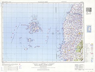
| 描述 | English: Tawian AMS Topographic Maps |
| 日期 | 1950年代 |
| 来源 | Courtesy of the University of Texas Libraries, The University of Texas at Austin. ([1]) |
| 作者 | Army Map Service, Corps of Engineers |
-
 Index Map

![[1]](http://legacy.lib.utexas.edu/maps/ams/taiwan/txu-oclc-6557994-nf50-4-450.jpg)
许可协议
This image or file is a work of a U.S. Army Corps of Engineers soldier or employee, taken or made as part of that person's official duties. As a work of the U.S. federal government, the image is in the public domain.
|
文件历史
点击某个日期/时间查看对应时刻的文件。
| 日期/时间 | 缩略图 | 大小 | 用户 | 备注 | |
|---|---|---|---|---|---|
| 当前 | 2019年9月13日 (五) 07:18 | | 5,000 × 3,800(4.44 MB) | Geographyinitiative | User created page with UploadWizard |
文件用途
以下页面使用本文件:
全域文件用途
以下其他wiki使用此文件:
- en.wikipedia.org上的用途
- Penghu
- Magong
- Chiayi
- Sinhua District
- Puzi
- Xinying District
- Qimei
- Madou District
- Huxi, Penghu
- Baisha, Penghu
- Zuojhen District
- Wangan, Penghu
- Beigang, Yunlin
- Tainan
- Kouhu
- Shuilin
- Xiyu, Penghu
- Jibei Island
- Mudou Island
- Gupo Island
- Yuanbei Island
- Xianjiao Island
- West District, Chiayi
- East District, Chiayi
- Penghu Channel
- Hua Islet
- Hujing Island
- Dongji Island
- Tongpan Island
- en.wiktionary.org上的用途
- fr.wikipedia.org上的用途
- he.wikipedia.org上的用途
- hy.wikipedia.org上的用途