
 French
 Deutsch
Washington, Kansas - Simple English Wikipedia, the free encyclopedia
Washington, Kansas | |
|---|---|
City and County seat | |
 Location within Washington County and Kansas | |
 | |
| Coordinates: 39°48′58″N 97°02′55″W / 39.81611°N 97.04861°W[1] | |
| Country | United States |
| State | Kansas |
| County | Washington |
| Founded | 1860 |
| Incorporated | 1875 |
| Named for | George Washington |
| Area | |
| • Total | 1.01 sq mi (2.62 km2) |
| • Land | 0.97 sq mi (2.52 km2) |
| • Water | 0.04 sq mi (0.10 km2) |
| Elevation | 1,319 ft (402 m) |
| Population | |
| • Total | 1,071 |
| • Density | 1,100/sq mi (410/km2) |
| Time zone | UTC-6 (CST) |
| • Summer (DST) | UTC-5 (CDT) |
| ZIP code | 66968 |
| Area code | 785 |
| FIPS code | 20-75825 |
| GNIS ID | 485656[1] |
| Website | washingtonks.net |
Washington is a city in, and the county seat of, Washington County, Kansas, United States.[4] As of the 2020 census, the city population was 1,071.[3]
History[change | change source]
Washington was created in spring 1860. In 1860, it became the county seat.[5] Until the end of the American Civil War, it was protected by two stockaded buildings, the Washington Company House and Woolbert's Stockade Hotel.[6][7]
The first post office in Washington was created in November 1861.[8]
Geography[change | change source]
Washington is at 39°N 97°W / 39°N 97°W (39.816877, -97.052503).[9] The United States Census Bureau says that the city has a total area of 1.01 square miles (2.62 km2). Of that, 0.97 square miles (2.51 km2) is land and 0.04 square miles (0.10 km2) is water.[2]
People[change | change source]
| Historical population | |||
|---|---|---|---|
| Census | Pop. | %± | |
| 1880 | 675 | — | |
| 1890 | 1,613 | 139.0% | |
| 1900 | 1,575 | −2.4% | |
| 1910 | 1,547 | −1.8% | |
| 1920 | 1,406 | −9.1% | |
| 1930 | 1,370 | −2.6% | |
| 1940 | 1,598 | 16.6% | |
| 1950 | 1,527 | −4.4% | |
| 1960 | 1,506 | −1.4% | |
| 1970 | 1,584 | 5.2% | |
| 1980 | 1,488 | −6.1% | |
| 1990 | 1,304 | −12.4% | |
| 2000 | 1,223 | −6.2% | |
| 2010 | 1,131 | −7.5% | |
| 2020 | 1,071 | −5.3% | |
| U.S. Decennial Census | |||
2020 census[change | change source]
The 2020 census says that there were 1,071 people, 479 households, and 267 families living in Washington. Of the households, 74.1% owned their home and 25.9% rented their home.
The median age was 42.4 years. Of the people, 90.8% were White, 0.6% were Black, 0.1% were Pacific Islanders, 2.1% were from some other race, and 6.3% were two or more races. Hispanic or Latino of any race were 5.0% of the people.[3][10]
2010 census[change | change source]
The 2010 census says that there were 1,131 people, 512 households, and 311 families living in Washington.[11]
Famous people[change | change source]
- Charlie Becker - actor, lived in town for short time.
References[change | change source]
- ↑ 1.0 1.1 1.2 U.S. Geological Survey Geographic Names Information System: Washington, Kansas
- ↑ 2.0 2.1 "2020 U.S. Gazetteer Files". United States Census Bureau. Retrieved December 12, 2023.
- ↑ 3.0 3.1 3.2 "DP1: PROFILE OF GENERAL POPULATION AND HOUSING CHARACTERISTICS". United States Census Bureau. Retrieved December 12, 2023.
- ↑ "Find a County". National Association of Counties. Retrieved 2011-06-07.
- ↑ Blackmar, Frank Wilson (1912). Kansas: A Cyclopedia of State History, Volume 2. Standard Publishing Company. p. 890.
- ↑ Historical Plat Book of Washington County, Kansas (Chicago: J. S. Bird, 1882),p. 30.
- ↑ "Washington County History," Washington County Register, July 12, 1935, Sec. 2, p. 6.
- ↑ "Kansas Post Offices, 1828-1961, page 2". Kansas Historical Society. Archived from the original on October 9, 2013. Retrieved 27 June 2014.
- ↑ "US Gazetteer files: 2010, 2000, and 1990". United States Census Bureau. 2011-02-12. Retrieved 2011-04-23.
- ↑ "P16: HOUSEHOLD TYPE". United States Census Bureau. Retrieved January 2, 2024.
- ↑ "American FactFinder". United States Census Bureau. Retrieved 2012-07-06.
Other websites[change | change source]
- City
- Schools
- USD 108, local school district
- Maps
- Washington City Map, KDOT
Municipalities and communities of Washington County, Kansas, United States | ||
|---|---|---|
| Cities | 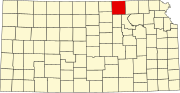 | |
| Unincorporated communities | ||
| Footnotes | ‡This populated place also has portions in an adjacent county or counties | |
| Authority control: Geographic |
|---|