
 French
 Deutsch
Valley Falls, Kansas - Simple English Wikipedia, the free encyclopedia
Valley Falls, Kansas | |
|---|---|
 Downtown Valley Falls (2014) | |
 Location within Jefferson County and Kansas | |
 | |
| Coordinates: 39°20′35″N 95°27′38″W / 39.34306°N 95.46056°W[1] | |
| Country | United States |
| State | Kansas |
| County | Jefferson |
| Founded | 1854 |
| Platted | 1855 |
| Incorporated | 1869 |
| Area | |
| • Total | 0.71 sq mi (1.84 km2) |
| • Land | 0.70 sq mi (1.82 km2) |
| • Water | 0.01 sq mi (0.01 km2) |
| Elevation | 942 ft (287 m) |
| Population | |
| • Total | 1,092 |
| • Density | 1,500/sq mi (590/km2) |
| Time zone | UTC-6 (CST) |
| • Summer (DST) | UTC-5 (CDT) |
| ZIP code | 66088 |
| Area code | 785 |
| FIPS code | 20-73300 [1] |
| GNIS ID | 478332 [1] |
| Website | valleyfalls.org |
Valley Falls is a city in Jefferson County, Kansas, United States. In 2020, 1,092 people lived there.[3]
History[change | change source]
Valley Falls was first called Grasshopper Falls. It was named after the falls in the Grasshopper River (now known as the Delaware River).[4] The first settlement was made there in 1854, and the town was platted in 1855. Many of the town's streets were named after women pioneer settlers.[5]
Geography[change | change source]
Valley Falls is at 39°20′35″N 95°27′38″W / 39.34306°N 95.46056°W (39.342936, -95.460584).[6] The United States Census Bureau says that the city has a total area of 0.71 square miles (1.84 km2). Of that, 0.70 square miles (1.81 km2) is land and 0.01 square miles (0.03 km2) is water.[2]
Climate[change | change source]
Valley Falls has hot, humid summers and generally mild to cool winters. The Köppen Climate Classification system says that Valley Falls has a humid subtropical climate, abbreviated "Cfa" on climate maps.[7]
People[change | change source]
| Historical population | |||
|---|---|---|---|
| Census | Pop. | %± | |
| 1860 | 202 | — | |
| 1870 | 603 | 198.5% | |
| 1880 | 1,016 | 68.5% | |
| 1890 | 1,180 | 16.1% | |
| 1900 | 1,078 | −8.6% | |
| 1910 | 1,129 | 4.7% | |
| 1920 | 1,218 | 7.9% | |
| 1930 | 1,238 | 1.6% | |
| 1940 | 1,241 | 0.2% | |
| 1950 | 1,139 | −8.2% | |
| 1960 | 1,193 | 4.7% | |
| 1970 | 1,169 | −2.0% | |
| 1980 | 1,189 | 1.7% | |
| 1990 | 1,253 | 5.4% | |
| 2000 | 1,254 | 0.1% | |
| 2010 | 1,192 | −4.9% | |
| 2020 | 1,092 | −8.4% | |
| U.S. Decennial Census | |||
Valley Falls is part of the Topeka, Kansas Metropolitan Statistical Area.
2020 census[change | change source]
The 2020 census says that there were 1,092 people, 441 households, and 271 families living in Valley Falls. Of the households, 62.8% owned their home and 37.2% rented their home.
The median age was 39.8 years. Of the people, 89.1% were White, 1.6% were Black, 0.3% were Native American, 0.2% were Asian, 0.9% were from some other race, and 7.9% were two or more races. Hispanic or Latino of any race were 5.1% of the people.[3][8]
2010 census[change | change source]
The 2010 census says that there were 1,192 people, 444 households, and 290 families living in Valley Falls.[9]
Famous people[change | change source]
- Puella Dornblaser, temperance activist, lived in Valley Falls and edited at a newspaper in Oskaloosa
- Fred Marsh, professional baseball player, born in Valley Falls in 1924.[10]
- King O'Malley, member of the Australian House of Representatives in the early 20th century, although he also claimed he was born in Quebec, Canada
- George Stafford, former chairman for the Interstate Commerce Commission was born and schooled in Valley Falls
References[change | change source]
- ↑ 1.0 1.1 1.2 1.3 "Valley Falls, Kansas". Geographic Names Information System. United States Geological Survey.
- ↑ 2.0 2.1 "2020 U.S. Gazetteer Files". United States Census Bureau. Retrieved November 19, 2023.
- ↑ 3.0 3.1 3.2 "DP1: PROFILE OF GENERAL POPULATION AND HOUSING CHARACTERISTICS". United States Census Bureau. Retrieved November 19, 2023.
- ↑ Kansas State Historical Society (1916). Biennial Report of the Board of Directors of the Kansas State Historical Society. Kansas State Printing Plant. p. 209.
- ↑ Blackmar, Frank Wilson (1912). Kansas: A Cyclopedia of State History, Volume 2. Standard Publishing Company. p. 840.
- ↑ "US Gazetteer files: 2010, 2000, and 1990". United States Census Bureau. 2011-02-12. Retrieved 2011-04-23.
- ↑ Climate Summary for Valley Falls, Kansas
- ↑ "P16: HOUSEHOLD TYPE". United States Census Bureau. Retrieved January 2, 2024.
- ↑ "American FactFinder". United States Census Bureau. Retrieved 2012-07-06.
- ↑ "Fred Marsh". Baseball-reference.com. Retrieved 9 August 2014.
Other websites[change | change source]
- City
- Schools
- USD 338, local school district
- Maps
- Valley Falls City Map, KDOT
Municipalities and communities of Jefferson County, Kansas, United States | ||
|---|---|---|
| Cities | 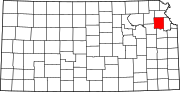 | |
| Unincorporated communities | ||
| Townships | ||
| Footnotes | †This community is designated a Census-Designated Place (CDP) by the United States Census Bureau. | |
