
 French
 Deutsch
Sharon Springs, Kansas - Simple English Wikipedia, the free encyclopedia
Sharon Springs, Kansas | |
|---|---|
City and County seat | |
 Wallace County Courthouse (2010) | |
 Location within Wallace County and Kansas | |
 | |
| Coordinates: 38°53′40″N 101°45′04″W / 38.89444°N 101.75111°W[1] | |
| Country | United States |
| State | Kansas |
| County | Wallace |
| Founded | 1868 |
| Incorporated | 1890 |
| Named for | Sharon Springs, New York |
| Area | |
| • Total | 0.90 sq mi (2.34 km2) |
| • Land | 0.90 sq mi (2.34 km2) |
| • Water | 0.00 sq mi (0.00 km2) |
| Elevation | 3,442 ft (1,049 m) |
| Population | |
| • Total | 751 |
| • Density | 830/sq mi (320/km2) |
| Time zone | UTC-7 (Mountain (MST)) |
| • Summer (DST) | UTC-6 (MDT) |
| ZIP code | 67758 |
| Area code | 785 |
| FIPS code | 20-64375 |
| GNIS ID | 2395858[1] |
| Website | Info |
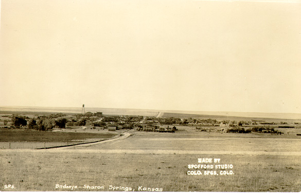
Sharon Springs is a city in Wallace County, Kansas, United States.[4] It is also the county seat Wallace County. In 2020, 751 people lived there.[3]
History[change | change source]
Sharon Springs was first called Eagle Tail station when it was created in 1868. It was renamed Sharon Springs in 1886, after Sharon Springs, New York.[5][6] Sharon Springs was incorporated as a city in 1890.[7]
In 2013, the biggest sinkhole in Kansas opened north of Sharon Springs. As of December 2013, the sinkhole was about 88 feet (27 m) deep and 243 feet (74 m) across.[8]
Geography[change | change source]
Sharon Springs is at 38°53′40″N 101°45′4″W / 38.89444°N 101.75111°W (38.894334, -101.751163). The United States Census Bureau says that the city has a total area of 0.90 square miles (2.33 km2). All of it is land.[2]
Climate[change | change source]
The Köppen Climate Classification system says that Sharon Springs has a semi-arid climate, abbreviated "BSk" on climate maps.[9]
People[change | change source]
| Historical population | |||
|---|---|---|---|
| Census | Pop. | %± | |
| 1890 | 178 | — | |
| 1900 | 180 | 1.1% | |
| 1910 | 440 | 144.4% | |
| 1920 | 815 | 85.2% | |
| 1930 | 792 | −2.8% | |
| 1940 | 760 | −4.0% | |
| 1950 | 994 | 30.8% | |
| 1960 | 966 | −2.8% | |
| 1970 | 1,012 | 4.8% | |
| 1980 | 982 | −3.0% | |
| 1990 | 872 | −11.2% | |
| 2000 | 835 | −4.2% | |
| 2010 | 748 | −10.4% | |
| 2020 | 751 | 0.4% | |
| U.S. Decennial Census | |||
2020 census[change | change source]
The 2020 census says that there were 751 people, 320 households, and 182 families living in Sharon Springs. Of the households, 75.0% owned their home and 25.0% rented their home.
The median age was 47.4 years. Of the people, 88.4% were White, 0.5% were Native American, 0.3% were Black, 0.1% were Pacific Islanders, 4.4% were from some other race, and 6.3% were two or more races. Hispanic or Latino of any race were 7.5% of the people.[3][10]
2010 census[change | change source]
The 2010 census says that there were 748 people, 327 households, and 197 families living in Sharon Springs.[11]
Infrastructure[change | change source]
Sharon Springs is on U.S. Route 40.
References[change | change source]
- ↑ 1.0 1.1 1.2 U.S. Geological Survey Geographic Names Information System: Sharon Springs, Kansas
- ↑ 2.0 2.1 "2020 U.S. Gazetteer Files". United States Census Bureau. Retrieved November 18, 2023.
- ↑ 3.0 3.1 3.2 "DP1: PROFILE OF GENERAL POPULATION AND HOUSING CHARACTERISTICS". United States Census Bureau. Retrieved November 18, 2023.
- ↑ "Find a County". National Association of Counties. Retrieved 2011-06-07.
- ↑ Kansas State Historical Society (1916). Biennial Report of the Board of Directors of the Kansas State Historical Society. Kansas State Printing Plant. p. 310.
- ↑ "Profile for Sharon Springs, Kansas". ePodunk. Archived from the original on 13 January 2017. Retrieved 27 June 2014.
- ↑ Blackmar, Frank Wilson (1912). Kansas: A Cyclopedia of State History, Volume 2. Standard Publishing Company. p. 682.
- ↑ "Kansas Sinkhole". UPI. Retrieved 2013-08-04.
- ↑ Climate Summary for Sharon Springs, Kansas
- ↑ "P16: HOUSEHOLD TYPE". United States Census Bureau. Retrieved January 2, 2024.
- ↑ "American FactFinder". United States Census Bureau. Retrieved 2012-07-06.
Other websites[change | change source]
- City
- City of Sharon Springs Archived 2013-06-20 at the Wayback Machine
- Sharon Springs - Directory of Public Officials
- Wallace County Archived 2019-10-23 at the Wayback Machine, Wallace County economic development alliance
- Wallace County, skyways.lib.ks.us
- Sharon Springs and Wallace County, kansastowns.us
- Schools
- USD 241, local school district
- Historic
- Historic Photograph of City
- Pet Kansas badger once roamed White House Archived 2013-10-29 at the Wayback Machine, Wichita Eagle
- Maps
- Sharon Springs City Map, KDOT
Municipalities and communities of Wallace County, Kansas, United States | ||
|---|---|---|
| Cities | 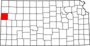 | |
| Unincorporated communities | ||
| Footnotes | †This community is designated a Census-Designated Place (CDP) by the United States Census Bureau. | |
