
 French
 Deutsch
Oberlin, Kansas - Simple English Wikipedia, the free encyclopedia
Oberlin, Kansas | |
|---|---|
City and County seat | |
 Downtown Oberlin (1999) | |
 Location within Decatur County and Kansas | |
 | |
| Coordinates: 39°49′23″N 100°31′51″W / 39.82306°N 100.53083°W[1] | |
| Country | United States |
| State | Kansas |
| County | Decatur |
| Founded | 1872 |
| Platted | 1878 |
| Incorporated | 1885 [2] |
| Named for | Oberlin, Ohio |
| Government | |
| • Mayor | Ladd Wendelin |
| • Administrator | Haley Roberson |
| Area | |
| • Total | 1.91 sq mi (4.95 km2) |
| • Land | 1.91 sq mi (4.95 km2) |
| • Water | 0.00 sq mi (0.00 km2) |
| Elevation | 2,569 ft (783 m) |
| Population | |
| • Total | 1,644 |
| • Density | 860/sq mi (330/km2) |
| Time zone | UTC-6 (CST) |
| • Summer (DST) | UTC-5 (CDT) |
| ZIP code | 67749 |
| Area code | 785 |
| FIPS code | 20-52000 |
| GNIS ID | 485632[1] |
| Website | oberlin-kansas.com |
Oberlin is a city in Decatur County, Kansas, United States.[5] It is also the county seat of Decatur County. In 2020, 1,644 people lived there.
History[change | change source]
Oberlin was platted as a town in 1878.[6] It was named after Oberlin, Ohio.[7]
The first post office in Oberlin was created in April 1878.[8]
On September 30, 1878, Northern Cheyenne were running from the Indian Territory to their homes in the north. The Northern Cheyenne Exodus, attacked people near Oberlin.[9][10]
Oberlin was incorporated as a city in 1885.[11]
Geography[change | change source]
Oberlin is at 39°49′23″N 100°31′51″W / 39.82306°N 100.53083°W (39.82304, -100.530737).[3] It has an elevation of 2,569 feet (783 m).[1] It is on the northwest side of Sappa Creek, a tributary of the Republican River, in the High Plains region of the Great Plains.[12] It is at the intersection of U.S. Route 36 and U.S. Route 83 in northwest Kansas. Oberlin is 228 miles (367 km) northwest of Wichita, 238 miles (383 km) east of Denver, and 320 miles (510 km) west-northwest of Kansas City.[12][13]
The United States Census Bureau says that the city has a total area of 1.91 square miles (4.95 km2). All of it is land.[3]
Weather[change | change source]
Oberlin has a humid continental climate (Köppen Dfa). It has hot, dry summers and cold, dry winters. The average temperature in Oberlin is 52 °F (11 °C). Temperatures hotter than 90 °F (32 °C) happen on average 62 days per year and dropping below 32 °F (0 °C) an average of 158 days a year. Oberlin gets precipitation 66 days a year and snowfall happens 11 days a year. Precipitation averages 23 inches (574 mm) per year, and snowfall averages 32 inches (80 cm) per year.[14] On average, January is the coldest month, and July is both the hottest month and the wettest month. The hottest temperature ever in Oberlin was 111 °F (44 °C) in 1954; the coldest temperature ever was -31 °F (-35 °C) in 1989.[15]
| Climate data for Oberlin, Kansas | |||||||||||||
|---|---|---|---|---|---|---|---|---|---|---|---|---|---|
| Month | Jan | Feb | Mar | Apr | May | Jun | Jul | Aug | Sep | Oct | Nov | Dec | Year |
| Record high °F (°C) | 78 (26) | 85 (29) | 93 (34) | 97 (36) | 103 (39) | 110 (43) | 111 (44) | 109 (43) | 107 (42) | 99 (37) | 88 (31) | 83 (28) | 111 (44) |
| Average high °F (°C) | 40 (4) | 46 (8) | 55 (13) | 65 (18) | 74 (23) | 86 (30) | 92 (33) | 89 (32) | 81 (27) | 69 (21) | 51 (11) | 43 (6) | 66 (19) |
| Daily mean °F (°C) | 28 (−2) | 33 (1) | 41 (5) | 51 (11) | 61 (16) | 72 (22) | 77 (25) | 75 (24) | 66 (19) | 54 (12) | 38 (3) | 30 (−1) | 52 (11) |
| Average low °F (°C) | 13 (−11) | 17 (−8) | 25 (−4) | 35 (2) | 47 (8) | 57 (14) | 63 (17) | 60 (16) | 50 (10) | 36 (2) | 24 (−4) | 16 (−9) | 37 (3) |
| Record low °F (°C) | −28 (−33) | −19 (−28) | −25 (−32) | 10 (−12) | 22 (−6) | 34 (1) | 41 (5) | 40 (4) | 22 (−6) | 9 (−13) | −19 (−28) | −31 (−35) | −31 (−35) |
| Average precipitation inches (mm) | 0.49 (12) | 0.63 (16) | 1.65 (42) | 2.20 (56) | 3.65 (93) | 3.30 (84) | 3.75 (95) | 2.74 (70) | 1.50 (38) | 1.17 (30) | 1.03 (26) | 0.48 (12) | 22.59 (574) |
| Average snowfall inches (cm) | 6.5 (17) | 4.8 (12) | 6.7 (17) | 2.4 (6.1) | 0 (0) | 0 (0) | 0 (0) | 0 (0) | 0.3 (0.76) | 1.1 (2.8) | 4.5 (11) | 5.2 (13) | 31.6 (80) |
| Average precipitation days (≥ 0.01 in) | 2.7 | 3.1 | 5.5 | 6.1 | 9.3 | 7.7 | 8.0 | 7.3 | 5.3 | 4.5 | 3.8 | 2.8 | 66.2 |
| Average snowy days (≥ 0.1 in) | 2.5 | 1.8 | 2.3 | 0.8 | 0 | 0 | 0 | 0 | 0.1 | 0.2 | 1.4 | 2.1 | 11.2 |
| Source: National Weather Service;[14] The Weather Channel[15] | |||||||||||||
People[change | change source]
| Historical population | |||
|---|---|---|---|
| Census | Pop. | %± | |
| 1890 | 976 | — | |
| 1900 | 937 | −4.0% | |
| 1910 | 1,157 | 23.5% | |
| 1920 | 1,247 | 7.8% | |
| 1930 | 1,629 | 30.6% | |
| 1940 | 1,878 | 15.3% | |
| 1950 | 2,019 | 7.5% | |
| 1960 | 2,337 | 15.8% | |
| 1970 | 2,291 | −2.0% | |
| 1980 | 2,387 | 4.2% | |
| 1990 | 2,197 | −8.0% | |
| 2000 | 1,994 | −9.2% | |
| 2010 | 1,788 | −10.3% | |
| 2020 | 1,644 | −8.1% | |
| U.S. Decennial Census | |||
2020 census[change | change source]
The 2020 census says that there were 1,644 people, 771 households, and 428 families living in Oberlin. Of the households, 72.6% owned their home and 27.4% rented their home.
The median age was 49.1 years. Of the people, 93.3% were White, 0.4% were Black, 0.4% were Asian, 0.2% were Native American, 0.4% were from some other race, and 5.3% were two or more races. Hispanic or Latino of any race were 3.2% of the people.[4][16]
2010 census[change | change source]
The 2010 census says that there were 1,788 people, 824 households, and 477 families living in Oberlin.[17]
Education[change | change source]
Oberlin USD 294 has two public schools in the city: Oberlin Elementary School (Grades Pre-K-6) and Decatur Community Junior/Senior High School (7-12).[18][19]
Media[change | change source]
The Oberlin Herald is Oberlin's only newspaper. It is published once per week.[20]
Oberlin is in the Wichita-Hutchinson, Kansas television market.[21] NBC affiliate KSNK is licensed to McCook, Nebraska. It broadcasts on channel 8 from studios west of Oberlin.[22] KSNK is a satellite station of KSNW in Wichita.[23]
Famous people[change | change source]
- Brun Campbell – ragtime composer, pianist[24]
- Sam Francis – Overall #1 pick in 1937 NFL Draft, football coach at Kansas State University
- Elmer Hackney – NFL running back[25]
- Richard Rogers – U.S. federal judge[26]
- Cora Simpson – nurse and nurse educator, founder of nursing school in Fuzhou, China
References[change | change source]
- ↑ 1.0 1.1 1.2 1.3 U.S. Geological Survey Geographic Names Information System: Oberlin, Kansas
- ↑ "Oberlin - History". Archived from the original on 2012-03-16. Retrieved 2019-11-06.
- ↑ 3.0 3.1 3.2 "2020 U.S. Gazetteer Files". United States Census Bureau. Retrieved November 18, 2023.
- ↑ 4.0 4.1 "DP1: PROFILE OF GENERAL POPULATION AND HOUSING CHARACTERISTICS". United States Census Bureau. Retrieved November 18, 2023.
- ↑ "Find a County". National Association of Counties. Archived from the original on May 31, 2011. Retrieved 2011-06-07.
- ↑ Columbia-Lippincott Gazetteer, 1952 Edition, p. 1361
- ↑ Kansas State Historical Society (1916). Biennial Report of the Board of Directors of the Kansas State Historical Society. Kansas State Printing Plant. p. 174.
- ↑ "Kansas Post Offices, 1828-1961 (archived)". Kansas Historical Society. Archived from the original on October 9, 2013. Retrieved 8 June 2014.
- ↑ ""Last Indian Raid Museum"". Archived from the original on 2009-12-21. Retrieved 2019-11-06.
- ↑ Alan Boye (September 1, 2001). Holding Stone Hands: On the Trail of the Cheyenne Exodus. Bison Books. pp. 177–191. ISBN 0-8032-6185-3. ISBN 978-0803261853
- ↑ Blackmar, Frank Wilson (1912). Kansas: A Cyclopedia of State History, Volume 2. Standard Publishing Company. p. 380.
- ↑ 12.0 12.1 "2003-2004 Official Transportation Map" (PDF). Kansas Department of Transportation. 2003. Retrieved 2011-05-24.
- ↑ "City Distance Tool". Geobytes. Archived from the original on 2010-10-05. Retrieved 2011-05-24.
- ↑ 14.0 14.1 "NOWData - NOAA Online Weather Data". National Weather Service Forecast Office - Goodland, KS. Retrieved 2011-05-27.
- ↑ 15.0 15.1 "Average weather for Oberlin, KS". The Weather Channel. Archived from the original on 2010-11-17. Retrieved 2011-05-27.
- ↑ "P16: HOUSEHOLD TYPE". United States Census Bureau. Retrieved January 2, 2024.
- ↑ "American FactFinder". United States Census Bureau. Retrieved 2012-07-06.
- ↑ "USD 294". Oberlin USD 294. Archived from the original on 2011-07-20. Retrieved 2011-05-27.
- ↑ "Oberlin, Kansas". City-Data. Retrieved 2011-05-27.
- ↑ "Oberlin Herald". Mondo Times. Retrieved 2011-05-27.
- ↑ "TV Market Maps". EchoStar Knowledge Base. Archived from the original on 2008-08-20. Retrieved 2011-05-27.
- ↑ "Station Search". BIA Kelsey. Archived from the original on 2012-08-28. Retrieved 2011-05-27.
- ↑ "Stations for Goodland, Kansas". RabbitEars.Info. Retrieved 2011-05-27.
- ↑ "Brun Campbell". AllMusic. Retrieved 2011-05-27.[permanent dead link]
- ↑ "Elmer Hackney". National Football League. Retrieved 2011-05-27.
- ↑ "Rogers, Richard Dean". Biographical Directory of Federal Judges. Federal Judicial Center. Retrieved 2011-05-27.
Other websites[change | change source]
- City
- Schools
- USD 294, local school district
- Maps
- Oberlin City Map, KDOT
Municipalities and communities of Decatur County, Kansas, United States | ||
|---|---|---|
| Cities | 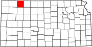 | |
| Unincorporated communities | ||
| Ghost towns | ||
| Townships | ||
| Footnotes | ‡This community also has portions in an adjacent county or counties. | |
