Lone Star, Kansas - Simple English Wikipedia, the free encyclopedia
Lone Star, Kansas | |
|---|---|
 Lone Star Church of the Brethren | |
 | |
| Coordinates: 38°52′0″N 95°21′19″W / 38.86667°N 95.35528°W[1] | |
| Country | United States |
| State | Kansas |
| County | Douglas |
| Elevation | 879 ft (268 m) |
| Time zone | UTC-6 (CST) |
| • Summer (DST) | UTC-5 (CDT) |
| Area code | 785 |
| FIPS code | 20-42475 [1] |
| GNIS ID | 479512 [1] |
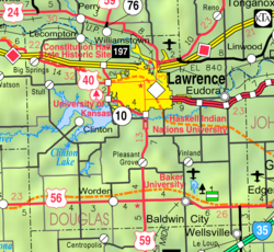
Lone Star is an unincorporated area in Douglas County, in the U.S. state of Kansas.[1] It is 7 miles (11 km) southwest of Lawrence.
History[change | change source]
The first people came in 1854. These people were mostly people who wanted slavery in Kansas. By 1860, many of these people left when Kansas was going to be an anti-slavery state.
Lone Star Lake is close to Lone Star. The Civilian Conservation Corps built it in the 1930s.[2]
References[change | change source]
- ↑ 1.0 1.1 1.2 1.3 1.4 Geographic Names Information System (GNIS) details for Lone Star, Kansas; United States Geological Survey (USGS); October 13, 1978.
- ↑ "Lone Star Lake Park". DouglasCountyKS.org. Archived from the original on March 5, 2018. Retrieved January 24, 2018.


 French
 Deutsch

