
 French
 Deutsch
Kensington, Kansas - Simple English Wikipedia, the free encyclopedia
Kensington, Kansas | |
|---|---|
 Kensington in 2021 | |
 Location within Smith County and Kansas | |
 | |
| Coordinates: 39°46′00″N 99°01′58″W / 39.76667°N 99.03278°W[1] | |
| Country | United States |
| State | Kansas |
| County | Smith |
| Founded | 1887 |
| Incorporated | 1900 |
| Government | |
| • Type | Mayor–Council |
| Area | |
| • Total | 0.34 sq mi (0.87 km2) |
| • Land | 0.34 sq mi (0.87 km2) |
| • Water | 0.00 sq mi (0.00 km2) |
| Elevation | 1,778 ft (542 m) |
| Population | |
| • Total | 399 |
| • Density | 1,200/sq mi (460/km2) |
| Time zone | UTC-6 (CST) |
| • Summer (DST) | UTC-5 (CDT) |
| ZIP code | 66951 |
| Area code | 785 |
| FIPS code | 20-36550 |
| GNIS ID | 2395511[1] |
| Website | kensingtonks.net |
Kensington is a city in Smith County, Kansas, United States. In 2020, 399 people lived there.[3]
History[change | change source]
Kensington was created in 1887.[4] It was incorporated as a city in 1900.[5]
Kensington was on the Chicago, Rock Island and Pacific Railroad.[6]
The first post office in Kensington was created in January 1888.[7]
Geography[change | change source]
Kensington is at 39°46′0″N 99°1′58″W / 39.76667°N 99.03278°W (39.766702, -99.03285). The United States Census Bureau says that the city has a total area of 0.34 square miles (0.87 km2). All of it is land.[2]
People[change | change source]
| Historical population | |||
|---|---|---|---|
| Census | Pop. | %± | |
| 1910 | 497 | — | |
| 1920 | 595 | 19.7% | |
| 1930 | 546 | −8.2% | |
| 1940 | 597 | 9.3% | |
| 1950 | 635 | 6.4% | |
| 1960 | 619 | −2.5% | |
| 1970 | 653 | 5.5% | |
| 1980 | 681 | 4.3% | |
| 1990 | 553 | −18.8% | |
| 2000 | 529 | −4.3% | |
| 2010 | 473 | −10.6% | |
| 2020 | 399 | −15.6% | |
| U.S. Decennial Census | |||
2020 census[change | change source]
The 2020 census says that there were 399 people, 181 households, and 109 families living in Kensington. Of the households, 85.6% owned their home and 14.4% rented their home.
The median age was 46.8 years. Of the people, 94.7% were White, 0.8% were Black, 0.3% were Native American, 0.3% were Asian, 0.3% were Pacific Islanders, 0.3% were from some other race, and 3.5% were two or more races. Hispanic or Latino of any race were 1.0% of the people.[3][8]
2010 census[change | change source]
The 2010 census says that there were 473 people, 203 households, and 126 families living in Kensington.[9]
Government[change | change source]
The Kensington government consists of a mayor and five council members. The council meets the 2nd Monday of each month at 5:30PM.[10]
- City Hall, 101 S Main.
Education[change | change source]
Kensington is a part of USD 110 Thunder Ridge Schools. The Thunder Ridge High School mascot is the Thunder Ridge Longhorns.[11]
Before school unification, the Kensington High School mascot was Kensington Goldbugs.[12]
References[change | change source]
- ↑ 1.0 1.1 1.2 U.S. Geological Survey Geographic Names Information System: Kensington, Kansas
- ↑ 2.0 2.1 "2020 U.S. Gazetteer Files". United States Census Bureau. Retrieved December 8, 2023.
- ↑ 3.0 3.1 3.2 "DP1: PROFILE OF GENERAL POPULATION AND HOUSING CHARACTERISTICS". United States Census Bureau. Retrieved December 8, 2023.
- ↑ Kansas State Historical Society (1916). Biennial Report of the Board of Directors of the Kansas State Historical Society. Kansas State Printing Plant. p. 301.
- ↑ Blackmar, Frank Wilson (1912). Kansas: A Cyclopedia of State History. Standard Publishing Company. p. 68.
- ↑ Gannett, Henry (1898). A Gazetteer of Kansas. Govt. Print. Off. p. 123.
- ↑ "Kansas Post Offices, 1828-1961". Kansas Historical Society. Archived from the original on 9 October 2013. Retrieved 23 June 2014.
- ↑ "P16: HOUSEHOLD TYPE". United States Census Bureau. Retrieved December 31, 2023.
- ↑ "American FactFinder". United States Census Bureau. Retrieved 2012-07-06.
- ↑ Kensington - Directory of Public Officials
- ↑ "USD 110 Thunder Ridge". USD 110. Retrieved 1 January 2017.
- ↑ "Kengsington Has 28 Candidates", The Salina Journal, 27 November 1962, p..
Other websites[change | change source]
- City
- Schools
- USD 110, local school district
- Maps
- Kensington City Map, KDOT
Municipalities and communities of Smith County, Kansas, United States | ||
|---|---|---|
| Cities | 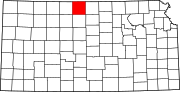 | |
| Unincorporated communities | ||
| Ghost towns | ||