
 French
 Deutsch
Elkhart, Kansas - Simple English Wikipedia, the free encyclopedia
Elkhart, Kansas | |
|---|---|
City and County seat | |
 Morton County Court House (2009) | |
 Location within Morton County and Kansas | |
 | |
| Coordinates: 37°0′11″N 101°53′40″W / 37.00306°N 101.89444°W[1] | |
| Country | United States |
| State | Kansas |
| County | Morton |
| Founded | 1913 |
| Incorporated | 1913 |
| Named for | Elkhart, Indiana |
| Area | |
| • Total | 2.05 sq mi (5.32 km2) |
| • Land | 2.05 sq mi (5.32 km2) |
| • Water | 0.00 sq mi (0.00 km2) |
| Elevation | 3,596 ft (1,096 m) |
| Population | |
| • Total | 1,888 |
| • Density | 920/sq mi (350/km2) |
| Time zone | UTC-6 (CST) |
| • Summer (DST) | UTC-5 (CDT) |
| ZIP code | 67950 |
| Area code | 620 |
| FIPS code | 20-20350 |
| GNIS ID | 2394655[1] |
| Website | City website |
Elkhart is a city in Morton County, Kansas, United States.[4] It is also the county seat of Morton County. The south part of the city is the Kansas-Oklahoma state border. Elkhart is 8.5 miles (13.7 km) from the Kansas-Colorado border. In 2020, 1,888 people lived there.[3]
History[change | change source]
.jpg)
Elkhart was created in 1913.[5] It was named after Elkhart, Indiana.[6]
In 1961, the county seat was moved from Richfield to Elkhart.[7]
Geography[change | change source]
The United States Census Bureau says that the city has a total area of 2.05 square miles (5.31 km2). All of it is land.[2]
Weather[change | change source]
Elkhart has a cool semi-arid climate (Köppen BSk). It has dry winters with big temperature differences, and it has hot summers, and it sometimes has a lot of precipitation from thunder showers or storms.
During winter, because western Kansas lies both on the edge of the subtropical anticyclones and in the rain shadow of westerly winds crossing the Rocky Mountains, the region is generally dry: no measurable precipitation fell in Elkhart between 25 December 1903 and 2 April 1904, while monthly precipitation above 2 inches or 50.8 millimetres has never been recorded during January and is observed fewer than one year in ten during November, December or February. Temperatures can vary greatly during this season: strong chinook winds can drive temperatures above 80 °F or 26.7 °C even in the depth of winter, with 70 °F or 21.1 °C reached on average during six days between December and February, seven during November and eight during March. Nevertheless, cold outbreaks from Canada drive temperatures to or below 0 °F or −17.8 °C on an average of 3.6 nights per winter. The coldest temperature recorded in Elkhart has been −22 °F or −30 °C on January 19, 1984, while the hottest winter temperature has been 87 °F or 30.6 °C on February 1, 1963.
In the summer, the climate is generally very hot. It sometime gets thunderstorms. Those storms provide most of the 18.9 inches or 480 millimetres of precipitation expected during one year.The wettest calendar year has been 1941 with 29.74 inches or 755.4 millimetres and the driest 1937 when only 9.03 inches or 229.4 millimetres fell.
| Climate data for Elkhart, Kansas (1971-2000; extremes since 1900) | |||||||||||||
|---|---|---|---|---|---|---|---|---|---|---|---|---|---|
| Month | Jan | Feb | Mar | Apr | May | Jun | Jul | Aug | Sep | Oct | Nov | Dec | Year |
| Record high °F (°C) | 83 (28) | 87 (31) | 91 (33) | 96 (36) | 104 (40) | 110 (43) | 110 (43) | 108 (42) | 105 (41) | 96 (36) | 91 (33) | 85 (29) | 110 (43) |
| Average high °F (°C) | 45.1 (7.3) | 50.6 (10.3) | 58.6 (14.8) | 68.1 (20.1) | 77.8 (25.4) | 88.9 (31.6) | 93.4 (34.1) | 90.9 (32.7) | 82.3 (27.9) | 71.6 (22.0) | 56.3 (13.5) | 46.9 (8.3) | 69.2 (20.7) |
| Average low °F (°C) | 18.3 (−7.6) | 22.2 (−5.4) | 29.9 (−1.2) | 38.9 (3.8) | 49.0 (9.4) | 58.9 (14.9) | 64.2 (17.9) | 62.7 (17.1) | 54.0 (12.2) | 41.1 (5.1) | 28.9 (−1.7) | 20.6 (−6.3) | 40.7 (4.8) |
| Record low °F (°C) | −22 (−30) | −18 (−28) | −18 (−28) | 8 (−13) | 21 (−6) | 33 (1) | 45 (7) | 43 (6) | 25 (−4) | 6 (−14) | −7 (−22) | −18 (−28) | −22 (−30) |
| Average precipitation inches (mm) | 0.54 (14) | 0.44 (11) | 1.38 (35) | 1.67 (42) | 2.75 (70) | 2.50 (64) | 2.82 (72) | 2.74 (70) | 1.69 (43) | 1.11 (28) | 0.78 (20) | 0.48 (12) | 18.9 (481) |
| Average snowfall inches (cm) | 5.5 (14) | 4.4 (11) | 4.9 (12) | 1.2 (3.0) | 0.2 (0.51) | 0.0 (0.0) | 0.0 (0.0) | 0.0 (0.0) | 0.1 (0.25) | 1.0 (2.5) | 1.6 (4.1) | 3.4 (8.6) | 22.3 (55.96) |
| Average precipitation days (≥ 0.01 inch) | 3.3 | 3.1 | 5.2 | 5.4 | 7.8 | 7.4 | 7.3 | 6.9 | 5.2 | 3.7 | 3.6 | 3.1 | 62 |
| Average snowy days (≥ 0.1 inch) | 2.3 | 2.0 | 1.5 | 0.4 | trace | 0.0 | 0.0 | 0.0 | trace | 0.2 | 1.0 | 1.9 | 9.3 |
| Source 1: National Oceanic and Atmospheric Administriation[8] | |||||||||||||
| Source 2: National Weather Service Dodge City[9] | |||||||||||||
People[change | change source]
| Historical population | |||
|---|---|---|---|
| Census | Pop. | %± | |
| 1920 | 1,160 | — | |
| 1930 | 1,485 | 28.0% | |
| 1940 | 902 | −39.3% | |
| 1950 | 1,132 | 25.5% | |
| 1960 | 1,780 | 57.2% | |
| 1970 | 2,089 | 17.4% | |
| 1980 | 2,243 | 7.4% | |
| 1990 | 2,318 | 3.3% | |
| 2000 | 2,233 | −3.7% | |
| 2010 | 2,205 | −1.3% | |
| 2020 | 1,888 | −14.4% | |
| U.S. Decennial Census | |||
2020 census[change | change source]
The 2020 census says that there were 1,888 people, 729 households, and 469 families living in Elkhart. Of the households, 69.3% owned their home and 30.7% rented their home.
The median age was 41.1 years. Of the people, 75.1% were White, 1.2% were Asian, 0.7% were Native American, 0.7% were Black, 0.3% were Pacific Islanders, 10.2% were from some other race, and 11.8% were two or more races. Hispanic or Latino of any race were 23.5% of the people.[3][10]
2010 census[change | change source]
The 2010 census says that there were 2,205 people, 856 households, and 571 families living in Elkhart.[11]
Education[change | change source]
Elkhart is served by USD 218 Elkhart. The Elkhart High School mascot is the Wildcats.[12]
Famous people[change | change source]
- Sanora Babb, American writer, came at the age of 11 to attend school for the first time in 1918 with her parents and sister from a farm near the town of Artesia, Baca County, Colorado, following an attempt at homesteading in Lamar, Colorado, as described in her 1970 fictionalized memoir An Owl on Every Post.
- Walter Baker, winner of Olympic medals at the 1952 Summer Olympics and 1956 Summer Olympics.
- Glenn Cunningham, nicknamed the "Elkhart Express", former world record-holder in the mile run and silver medalist in the 1500 meter run at the 1936 Summer Olympics.
- Robelyn Garcia, Professional Women’s Basketball Association (WBA) 4X All-Star and WBA Championship MVP. Collegiate All-American basketball player and College Athletic Hall Of Fame Inductee.
- Darrin Simmons, Cincinnati Bengals special teams coach.
References[change | change source]
- ↑ 1.0 1.1 1.2 U.S. Geological Survey Geographic Names Information System: Elkhart, Kansas
- ↑ 2.0 2.1 "2020 U.S. Gazetteer Files". United States Census Bureau. Retrieved November 17, 2023.
- ↑ 3.0 3.1 3.2 "DP1: PROFILE OF GENERAL POPULATION AND HOUSING CHARACTERISTICS". United States Census Bureau. Retrieved November 17, 2023.
- ↑ "Find a County". National Association of Counties. Archived from the original on 2011-05-31. Retrieved 2011-06-07.
- ↑ Kansas State Historical Society (1916). Biennial Report of the Board of Directors of the Kansas State Historical Society. Kansas State Printing Plant. p. 248.
- ↑ "Profile for Elkhart, Kansas". ePodunk. Archived from the original on 14 July 2014. Retrieved 16 June 2014.
- ↑ "Morton County Facts; mtcoks.com". Archived from the original on 2020-10-30. Retrieved 2019-11-05.
- ↑ "Climatography of the United States No. 20: 1971-2000 – Elkhart, KS" (PDF). Retrieved September 29, 2016.
- ↑ "NOW Data". Retrieved September 29, 2016.
- ↑ "P16: HOUSEHOLD TYPE". United States Census Bureau. Retrieved December 31, 2023.
- ↑ "American FactFinder". United States Census Bureau. Retrieved 2012-07-06.
- ↑ "Elkhart USD 218". USD 218. Retrieved 8 January 2017.
Other websites[change | change source]
- City
- Schools
- USD 218, local school district
- Historical
- Morton County Historical Society Museum Archived 2020-10-18 at the Wayback Machine
- Maps
- Elkhart City Map, KDOT
Municipalities and communities of Morton County, Kansas, United States | ||
|---|---|---|
| Cities | 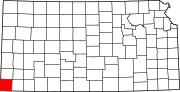 | |
| Unincorporated community | ||

| International | |
|---|---|
| National | |