
 French
 Deutsch
Cimarron, Kansas - Simple English Wikipedia, the free encyclopedia
Cimarron, Kansas | |
|---|---|
City and County seat | |
_from_E_1.JPG) Historic 1886 Cimarron Hotel | |
 Flag | |
 Location within Gray County and Kansas | |
 | |
| Coordinates: 37°48′35″N 100°20′43″W / 37.80972°N 100.34528°W[1] | |
| Country | United States |
| State | Kansas |
| County | Gray |
| Founded | 1878 |
| Incorporated | 1885 |
| Named for | Fork in Chisholm Trail towards Cimarron River |
| Area | |
| • Total | 1.15 sq mi (2.98 km2) |
| • Land | 1.15 sq mi (2.98 km2) |
| • Water | 0.00 sq mi (0.00 km2) |
| Elevation | 2,687 ft (819 m) |
| Population | |
| • Total | 1,981 |
| • Density | 1,700/sq mi (660/km2) |
| Time zone | UTC-6 (CST) |
| • Summer (DST) | UTC-5 (CDT) |
| ZIP code | 67835 |
| Area code | 620 |
| FIPS code | 20-13275 |
| GNIS ID | 2393524[1] |
| Website | cimarronks.org |
Cimarron is a city in Gray County, Kansas, United States.[4] It is also the county seat of Gray County. In 2020 census, 1,981 people lived there.[3]
History[change | change source]

Cimarron was first settled in 1878.[5] It took its name from a fork in the Chisholm Trail. The fork led people to the Cimarron River.[6]
Between 1887 and 1893, a county seat war happened in Gray County. It involved several famous Old West figures, such as Bat Masterson, Bill Tilghman, and Ben Daniels. Because of the dispute, Cimarron became the permanent county seat of Gray County.[7]
In the early morning of June 10, 1893, Bill Doolin and four members of his gang robbed a train one-half mile east of Cimarron.[8]
In 2016, the Southwest Chief owned by Amtrak derailed. Amtrak and BNSF filed a lawsuit against one of the companies in Cimarron for using a road vehicle to damage the rails.
Geography[change | change source]
Cimarron is at 37°48′30″N 100°20′51″W / 37.80833°N 100.34750°W (37.808332, −100.347413).[9] The United States Census Bureau says that the city has a total area of 1.15 square miles (2.98 km2). All of it is land.[2]
Weather[change | change source]
The Köppen Climate Classification system says that Cimarron has a semi-arid climate, abbreviated "BSk" on climate maps.[10]
People[change | change source]
| Historical population | |||
|---|---|---|---|
| Census | Pop. | %± | |
| 1900 | 237 | — | |
| 1910 | 587 | 147.7% | |
| 1920 | 599 | 2.0% | |
| 1930 | 1,035 | 72.8% | |
| 1940 | 1,004 | −3.0% | |
| 1950 | 1,189 | 18.4% | |
| 1960 | 1,115 | −6.2% | |
| 1970 | 1,373 | 23.1% | |
| 1980 | 1,491 | 8.6% | |
| 1990 | 1,626 | 9.1% | |
| 2000 | 1,934 | 18.9% | |
| 2010 | 2,184 | 12.9% | |
| 2020 | 1,981 | −9.3% | |
| U.S. Decennial Census | |||
2020 census[change | change source]
The 2020 census says that there were 1,981 people, 745 households, and 526 families living in Cimarron. Of the households, 71.5% owned their home and 28.5% rented their home.
The median age was 37.1 years. Of the people, 80.3% were White, 0.7% were Native American, 0.6% were Black, 0.4% were Asian, 7.6% were from some other race, and 10.4% were two or more races. Hispanic or Latino of any race were 20.4% of the people.[3][11]
2010 census[change | change source]
The 2010 census says that there were 2,184 people, 789 households, and 569 families living in Cimarron.[12]
Famous people[change | change source]
- Ian Campbell, former defensive end for Kansas State University
- Nicholas Klaine, journalist (editor of the Dodge City Times and New West Echo), built the Cimarron Hotel
Related pages[change | change source]
References[change | change source]
- ↑ 1.0 1.1 1.2 U.S. Geological Survey Geographic Names Information System: Cimarron, Kansas
- ↑ 2.0 2.1 "2020 U.S. Gazetteer Files". United States Census Bureau. Retrieved December 12, 2023.
- ↑ 3.0 3.1 3.2 "DP1: PROFILE OF GENERAL POPULATION AND HOUSING CHARACTERISTICS". United States Census Bureau. Retrieved December 12, 2023.
- ↑ "Find a County". National Association of Counties. Archived from the original on 2011-05-31. Retrieved 2011-06-07.
- ↑ Blackmar, Frank Wilson (1912). Kansas: A Cyclopedia of State History, Embracing Events, Institutions, Industries, Counties, Cities, Towns, Prominent Persons, Etc. Standard Publishing Company. p. 349. ISBN 9780722249055.
- ↑ "Profile for Cimarron, Kansas". ePodunk. Retrieved 10 June 2014.
- ↑ "Feudin' and Fightin' Friday: County Seat Wars - Diggin' History". Archived from the original on 2014-04-07. Retrieved 2014-04-06.
- ↑ Bailey C. Hanes, Bill Doolin: Outlaw O.T., Norman, 1968, pages 79-85
- ↑ "US Gazetteer files: 2010, 2000, and 1990". United States Census Bureau. 2011-02-12. Retrieved 2011-04-23.
- ↑ Climate Summary for Cimarron, Kansas
- ↑ "P16: HOUSEHOLD TYPE". United States Census Bureau. Retrieved December 30, 2023.
- ↑ "American FactFinder". United States Census Bureau. Retrieved 2012-07-06.
Other websites[change | change source]
- City
- Schools
- USD 102, local school district
- Maps
- Cimarron City Map, KDOT
Municipalities and communities of Gray County, Kansas, United States | ||
|---|---|---|
| Cities | 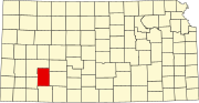 | |
| Unincorporated communities | ||
| Townships | ||
| International | |
|---|---|
| National | |
| Other | |