
 French
 Deutsch
Bushton, Kansas - Simple English Wikipedia, the free encyclopedia
Bushton, Kansas | |
|---|---|
 Grain elevator in Bushton (2004) | |
 Location within Rice County and Kansas | |
 | |
| Coordinates: 38°30′44″N 98°23′46″W / 38.51222°N 98.39611°W[1] | |
| Country | United States |
| State | Kansas |
| County | Rice |
| Township | Farmer |
| Founded | 1880s |
| Incorporated | 1907 |
| Named for | wild bushes |
| Area | |
| • Total | 0.23 sq mi (0.59 km2) |
| • Land | 0.23 sq mi (0.59 km2) |
| • Water | 0.00 sq mi (0.00 km2) |
| Elevation | 1,768 ft (539 m) |
| Population | |
| • Total | 203 |
| • Density | 880/sq mi (340/km2) |
| Time zone | UTC-6 (CST) |
| • Summer (DST) | UTC-5 (CDT) |
| ZIP code | 67427 |
| Area code | 620 |
| FIPS code | 20-09700 |
| GNIS ID | 2393480[1] |
Bushton is a city in Rice County, Kansas, United States. In 2020, 203 people lived there.[3]
History[change | change source]
Bushton was originally called Sorghum. It was created in the early 1880s. The name changed to Bushton in 1887. It was named "Bushton" because there were many wild bushes growing at the town site.[4][5] Bushton was incorporated in 1907.[6]
Geography[change | change source]
Bushton is at 38°30′44″N 98°23′46″W / 38.51222°N 98.39611°W (38.512275, -98.396003). The United States Census Bureau says that the city has a total area of 0.23 square miles (0.60 km2). All of it is land.[2]
People[change | change source]
| Historical population | |||
|---|---|---|---|
| Census | Pop. | %± | |
| 1910 | 222 | — | |
| 1920 | 326 | 46.8% | |
| 1930 | 325 | −0.3% | |
| 1940 | 473 | 45.5% | |
| 1950 | 532 | 12.5% | |
| 1960 | 499 | −6.2% | |
| 1970 | 397 | −20.4% | |
| 1980 | 388 | −2.3% | |
| 1990 | 341 | −12.1% | |
| 2000 | 314 | −7.9% | |
| 2010 | 279 | −11.1% | |
| 2020 | 203 | −27.2% | |
| U.S. Decennial Census | |||
2020 census[change | change source]
The 2020 census says that there were 203 people, 92 households, and 59 families living in Bushton. Of the households, 76.1% owned their home and 23.9% rented their home.
The median age was 48.8 years. Of the people, 87.7% were White, 1.5% were Native American, 0.5% were from some other race, and 10.3% were two or more races. Hispanic or Latino of any race were 5.9% of the people.[3][7]
2010 census[change | change source]
The 2010 census says that there were 279 people, 117 households, and 78 families living in Bushton.[8]
Education[change | change source]
Bushton is a part of Central Plains USD 112 school district. Central Plains Middle School was in Bushton, but it closed in 2019.[9]
References[change | change source]
- ↑ 1.0 1.1 1.2 U.S. Geological Survey Geographic Names Information System: Bushton, Kansas
- ↑ 2.0 2.1 "2020 U.S. Gazetteer Files". United States Census Bureau. Retrieved December 1, 2023.
- ↑ 3.0 3.1 3.2 "DP1: PROFILE OF GENERAL POPULATION AND HOUSING CHARACTERISTICS". United States Census Bureau. Retrieved December 1, 2023.
- ↑ Kansas State Historical Society (1916). Biennial Report of the Board of Directors of the Kansas State Historical Society. Kansas State Printing Plant. p. 273.
- ↑ "Profile for Bushton, Kansas". ePodunk. Retrieved 22 June 2014.[permanent dead link]
- ↑ Blackmar, Frank Wilson (1912). Kansas: A Cyclopedia of State History, Embracing Events, Institutions, Industries, Counties, Cities, Towns, Prominent Persons, Etc. Standard Publishing Company. p. 260. ISBN 9780722249055.
- ↑ "P16: HOUSEHOLD TYPE". United States Census Bureau. Retrieved December 30, 2023.
- ↑ "American FactFinder". United States Census Bureau. Retrieved 2012-07-06.
- ↑ "Central Plains school district closing middle school; KWCH; June 11, 2019". Archived from the original on 2019-06-12.
Other websites[change | change source]
- City
- Schools
- USD 112[permanent dead link], local school district
- Maps
- Bushton City Map, KDOT
Municipalities and communities of Rice County, Kansas, United States | ||
|---|---|---|
| Cities | 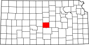 | |
| Unincorporated communities | ||
| Townships | ||