
 French
 Deutsch
Brewster, Kansas - Simple English Wikipedia, the free encyclopedia
Brewster, Kansas | |
|---|---|
 Location within Thomas County and Kansas | |
 | |
| Coordinates: 39°21′47″N 101°22′36″W / 39.36306°N 101.37667°W[1] | |
| Country | United States |
| State | Kansas |
| County | Thomas |
| Founded | 1880s |
| Incorporated | 1920 |
| Named for | L.D. Brewster |
| Area | |
| • Total | 0.26 sq mi (0.67 km2) |
| • Land | 0.26 sq mi (0.67 km2) |
| • Water | 0.00 sq mi (0.00 km2) |
| Elevation | 3,429 ft (1,045 m) |
| Population | |
| • Total | 291 |
| • Density | 1,100/sq mi (430/km2) |
| Time zone | UTC-6 (CST) |
| • Summer (DST) | UTC-5 (CDT) |
| ZIP code | 67732 |
| Area code | 785 |
| FIPS code | 20-08425 |
| GNIS ID | 2393413[1] |
| Website | brewsterkansas.com |
Brewster is a city in Thomas County, Kansas, United States. In 2020, 291 people lived there.[3]
History[change | change source]
Brewster was named after L. D. Brewster, a railroad official.[4] Brewster was a station and shipping point on the Chicago, Rock Island and Pacific Railroad.[5]
The first post office in Brewster was created in September 1888.[6]
Geography[change | change source]
Brewster is at 39°21′46″N 101°22′36″W / 39.362878°N 101.376552°W (39.362878, -101.376552).[7] The United States Census Bureau says that the city has a total area of 0.26 square miles (0.67 km2). All of it is land.[2]
Weather[change | change source]
The Köppen Climate Classification system says that Brewster has a semi-arid climate, abbreviated "BSk" on climate maps.[8]
People[change | change source]
| Historical population | |||
|---|---|---|---|
| Census | Pop. | %± | |
| 1930 | 487 | — | |
| 1940 | 408 | −16.2% | |
| 1950 | 467 | 14.5% | |
| 1960 | 317 | −32.1% | |
| 1970 | 320 | 0.9% | |
| 1980 | 327 | 2.2% | |
| 1990 | 296 | −9.5% | |
| 2000 | 285 | −3.7% | |
| 2010 | 305 | 7.0% | |
| 2020 | 291 | −4.6% | |
| U.S. Decennial Census | |||
2020 census[change | change source]
The 2020 census says that there were 291 people, 110 households, and 67 families living in Brewster. Of the households, 69.1% owned their home and 30.9% rented their home.
The median age was 34.3 years. Of the people, 88.3% were White, 1.0% were Black, 0.3% were Asian, 5.2% were from some other race, and 5.2% were two or more races. Hispanic or Latino of any race were 8.2% of the people.[3][9]
2010 census[change | change source]
The 2010 census says that there were 305 people, 122 households, and 87 families living in Brewster.[10]
Education[change | change source]
Brewster is a part of USD 314 Brewster.[11]
References[change | change source]
- ↑ 1.0 1.1 1.2 U.S. Geological Survey Geographic Names Information System: Brewster, Kansas
- ↑ 2.0 2.1 "2020 U.S. Gazetteer Files". United States Census Bureau. Retrieved December 8, 2023.
- ↑ 3.0 3.1 3.2 "DP1: PROFILE OF GENERAL POPULATION AND HOUSING CHARACTERISTICS". United States Census Bureau. Retrieved December 8, 2023.
- ↑ Heim, Michael (2007). Exploring Kansas Highways. p. 27. ISBN 9780974435886.
- ↑ Blackmar, Frank Wilson (1912). Kansas: A Cyclopedia of State History, Embracing Events, Institutions, Industries, Counties, Cities, Towns, Prominent Persons, Etc. Standard Publishing Company. p. 233. ISBN 9780722249055.
- ↑ "Kansas Post Offices, 1828-1961". Kansas Historical Society. Archived from the original on October 9, 2013. Retrieved 27 June 2014.
- ↑ "US Gazetteer files: 2010, 2000, and 1990". United States Census Bureau. 2011-02-12. Retrieved 2011-04-23.
- ↑ Climate Summary for Brewster, Kansas
- ↑ "P16: HOUSEHOLD TYPE". United States Census Bureau. Retrieved December 30, 2023.
- ↑ "American FactFinder". United States Census Bureau. Retrieved 2012-07-06.
- ↑ "Brewster USD 314". USD 314. Retrieved 6 January 2017.
Other websites[change | change source]
- City
- Schools
- USD 314 Archived 2011-07-09 at the Wayback Machine, local school district
- Maps
- Brewster City Map, KDOT
Municipalities and communities of Thomas County, Kansas, United States | ||
|---|---|---|
| Cities | 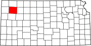 | |
| CDP | ||
| Unincorporated communities | ||
| Ghost towns | ||
| Footnotes | ‡This populated place also has portions in an adjacent county or counties | |