
 French
 Deutsch
Allen, Kansas - Simple English Wikipedia, the free encyclopedia
Allen, Kansas | |
|---|---|
 Aerial view of Allen (2013) | |
 Location within Lyon County and Kansas | |
 | |
| Coordinates: 38°39′18″N 96°10′11″W / 38.65500°N 96.16972°W[1] | |
| Country | United States |
| State | Kansas |
| County | Lyon |
| Founded | 1854 |
| Incorporated | 1909[2] |
| Government | |
| • Type | Mayor–Council |
| Area | |
| • Total | 0.28 sq mi (0.72 km2) |
| • Land | 0.28 sq mi (0.72 km2) |
| • Water | 0.00 sq mi (0.00 km2) |
| Elevation | 1,326 ft (404 m) |
| Population | |
| • Total | 160 |
| • Density | 570/sq mi (220/km2) |
| Time zone | UTC-6 (CST) |
| • Summer (DST) | UTC-5 (CDT) |
| ZIP code | 66833 |
| Area code | 620 |
| FIPS code | 20-01275 |
| GNIS ID | 2393921[1] |
Allen is a city in Lyon County, Kansas, United States. In 2020, 160 people lived there.[4]
History[change | change source]
Allen was created in 1854.[5] It was incorporated as a city in 1909.[6]
Allen was a station on the Missouri Pacific Railroad.[7]
Geography[change | change source]
Allen is at 38°39′23″N 96°10′14″W / 38.65639°N 96.17056°W (38.656472, -96.170511).[8] The United States Census Bureau says that the city has a total area of 0.28 square miles (0.73 km2). All of it is land.[3]
Weather[change | change source]
Allen has hot, humid summers and generally mild to cool winters. The Köppen Climate Classification system says that Allen has a humid subtropical climate, abbreviated "Cfa" on climate maps.[9]
People[change | change source]
| Historical population | |||
|---|---|---|---|
| Census | Pop. | %± | |
| 1910 | 286 | — | |
| 1920 | 295 | 3.1% | |
| 1930 | 343 | 16.3% | |
| 1940 | 279 | −18.7% | |
| 1950 | 241 | −13.6% | |
| 1960 | 205 | −14.9% | |
| 1970 | 175 | −14.6% | |
| 1980 | 205 | 17.1% | |
| 1990 | 191 | −6.8% | |
| 2000 | 211 | 10.5% | |
| 2010 | 177 | −16.1% | |
| 2020 | 160 | −9.6% | |
| U.S. Decennial Census | |||
Allen is part of the Emporia Micropolitan Statistical Area.
2020 census[change | change source]
The 2020 census says that there were 160 people, 77 households, and 44 families living in Allen. Of the households, 68.8% owned their home and 31.2% rented their home.
The median age was 43.0 years. Of the people, 87.5% were White, 1.9% were Asian, 4.4% were some other race, and 6.3% were two or more races. Hispanic or Latino of any race were 5.6% of the people.[4][10]
2010 census[change | change source]
The 2010 census says that there were 177 people, 77 households, and 46 families living in Allen.[11]
2000 census[change | change source]
The 2000 census says that there were 211 people, 83 households, and 62 families living in Allen.[12]
Education[change | change source]
Allen is part of USD 251 North Lyon County. The Northern Heights High School is in Allen. The Northern Heights High School mascot is Northern Heights Wildcats.[13]
References[change | change source]
- ↑ 1.0 1.1 1.2 U.S. Geological Survey Geographic Names Information System: Allen, Kansas
- ↑ 2.0 2.1 "City of Allen". The League of Kansas Municipalities. May 24, 2019.
- ↑ 3.0 3.1 "2020 U.S. Gazetteer Files". United States Census Bureau. Retrieved November 29, 2023.
- ↑ 4.0 4.1 4.2 "DP1: PROFILE OF GENERAL POPULATION AND HOUSING CHARACTERISTICS". United States Census Bureau. Retrieved November 29, 2023.
- ↑ Kansas State Historical Society (1916). Biennial Report of the Board of Directors of the Kansas State Historical Society. Kansas State Printing Plant. p. 229.
- ↑ Blackmar, Frank Wilson (1912). Kansas: A Cyclopedia of State History, Embracing Events, Institutions, Industries, Counties, Cities, Towns, Prominent Persons, Etc. Standard Publishing Company. p. 59. ISBN 9780722249055.
- ↑ Gannett, Henry (1898). A Gazetteer of Kansas. Govt. Print. Off. p. 25.
- ↑ "US Gazetteer files: 2010, 2000, and 1990". United States Census Bureau. 2011-02-12. Retrieved 2011-04-23.
- ↑ Climate Summary for Allen, Kansas
- ↑ "P16: HOUSEHOLD TYPE". United States Census Bureau. Retrieved December 30, 2023.
- ↑ "American FactFinder". United States Census Bureau. Retrieved 2012-07-06.
- ↑ "American FactFinder". United States Census Bureau. Archived from the original on September 11, 2013. Retrieved 2008-01-31.
- ↑ "North Lyon County USD 251". USD 251. Retrieved 4 January 2017.
Other websites[change | change source]
- City
- Schools
- USD 251, local school district
- Maps
- Allen City Map, KDOT
Municipalities and communities of Lyon County, Kansas, United States | ||
|---|---|---|
| Cities | 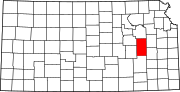 | |
| Unincorporated communities | ||
| Townships | ||