
 French
 Deutsch
ファイル:Satellite image of Hokkaido, Japan in January 2003.jpg

このプレビューのサイズ: 471 × 599 ピクセル。 その他の解像度: 188 × 240 ピクセル | 377 × 480 ピクセル | 603 × 768 ピクセル | 804 × 1,024 ピクセル | 2,200 × 2,800 ピクセル。
元のファイル (2,200 × 2,800 ピクセル、ファイルサイズ: 1.74メガバイト、MIME タイプ: image/jpeg)
ウィキメディア・コモンズのファイルページにある説明を、以下に表示します。 |
概要
概要
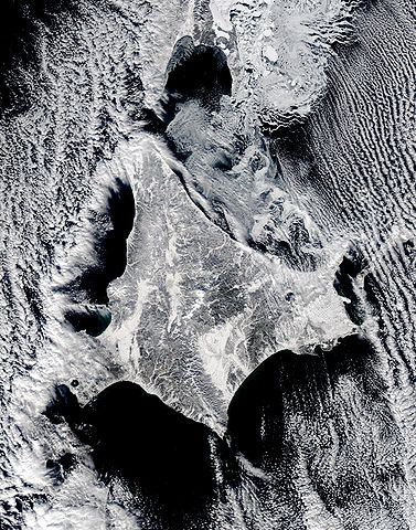
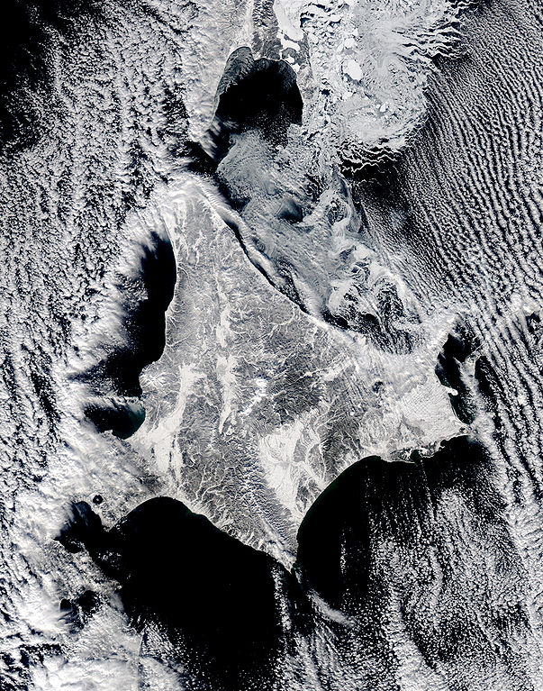
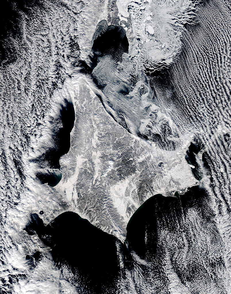
| 解説 | English: Satellite image of Hokkaido, Japan in January 2003. This stunning true-color image shows clouds surrounding northern Japan’s snow-dusted Hokkaido Island in between the black waters of two seas and an ocean. Hokkaido Island is home to the city of Sapporo, which is located on the lower western side near where the island’s tail begins to curve south toward the main island of Japan (middle lower left) and not far from the Ishikari-wan, the north-facing bay that has a streak of clouds moving horizontally across it. Hokkaido’s northern point reaches toward the Russian island of Sakhalin (top center), while the eastern point stretches toward the Kuril Islands, a volcanic chain that eventually connects to the Russian Kamchatka Peninsula. Between Hokkaido’s northern and eastern points lies the southern reaches of the Sea of Okhotsk (upper right), while the northern and southern points lie along the Sea of Japan. From its southern to eastern point, the Pacific Ocean laps at Hokkaido’s shores. This Aqua MODIS image was acquired January 15, 2003. |
| 日付 | |
| 原典 | NASA's Visible Earth http://visibleearth.nasa.gov/view_rec.php?id=4720 |
| 作者 | NASA's Visible Earth |
ライセンス
| このファイルはアメリカ航空宇宙局(NASA)によって作成されたものです。NASAの著作権の方針では、特記事項が無い場合、NASAの資料はパブリックドメインとなります。 (詳しくはTemplate:PD-USGov、NASAの著作権の方針について(英語)又はジェット推進研究所(JPL)の画像使用に関するガイドライン(英語)をご覧ください。) | ||
 | 注意事項:
|
ファイルの履歴
過去の版のファイルを表示するには、その版の日時をクリックしてください。
| 日付と時刻 | サムネイル | 寸法 | 利用者 | コメント | |
|---|---|---|---|---|---|
| 現在の版 | 2006年5月7日 (日) 22:02 | | 2,200 × 2,800 (1.74メガバイト) | Akanemoto~commonswiki | Satellite image of Hokkaido, Japan in January 2003. Taken from NASA's Visible Earth http://visibleearth.nasa.gov/view_rec.php?id=4720 : This stunning true-color image shows clouds surrounding northern Japan’s snow-dusted Hokkaido Island in between the |
ファイルの使用状況
以下のページがこのファイルを使用しています:
グローバルなファイル使用状況
以下に挙げる他のウィキがこの画像を使っています:
- ast.wikipedia.org での使用状況
- az.wikipedia.org での使用状況
- ba.wikipedia.org での使用状況
- en.wikipedia.org での使用状況
- es.wikipedia.org での使用状況
- id.wikipedia.org での使用状況
- it.wikipedia.org での使用状況
- km.wikipedia.org での使用状況
- pam.wikipedia.org での使用状況
- pt.wikipedia.org での使用状況
- ru.wikinews.org での使用状況
- tg.wikipedia.org での使用状況
- vi.wikipedia.org での使用状況