ناحیههای سریلانکا - ویکیپدیا، دانشنامهٔ آزاد
| ناحیه දිස්ත්රික්ක மாவட்டம் | |
|---|---|
 | |
| ردهها | تقسیمات کشوری سطح دوم |
| مکان | سریلانکا |
| تعداد | ۲۵ (بنا بر فوریه ۱۹۸۴) |
| جمعیت | ۹۲٬۲۳۸–۲٬۳۲۴٬۳۴۹ |
| مساحت | ۶۹۹–۷٬۱۷۹ کیلومتر مربع |
| زیربخشها | DS Division |
در سریلانکا، ناحیهها (سینهالی: දිස්ත්රික්ක، تامیلی: மாவட்டம்) دومین سطح تقسیمات کشوری هستند و درون استانها واقع شدهاند. در این کشور ۲۵ ناحیه و ۹ استان وجود دارد.[۱]
ناحیهها[ویرایش]
همهٔ آمار جمعیتی براساس سرشماری سال ۲۰۱۲ میلادی استخراج شدهاند.
| ناحیه | نقشه | استان | مرکز ناحیه | مساحت km2 (mi2)[۲] | مساحت آبهای داخلی km2 (mi2)[۲] | مجموع مساحت km2 (mi2)[۲] | جمعیت (۲۰۱۲)[۳] | تراکم جمعیت برحسب km2 (per mi2) |
|---|---|---|---|---|---|---|---|---|
| بخش امپرا |  | استان شرقی (سریلانکا) | امپرا | ۴٬۲۲۲ (۱٬۶۳۰) | ۱۹۳ (۷۵) | ۴٬۴۱۵ (۱٬۷۰۵) | ۶۴۹٬۴۰۲ | ۱۵۴ (۴۰۰) |
| ناحیه انورادهاپورا | 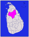 | استان شمال مرکزی، سریلانکا | انورادهاپورا | ۶٬۶۶۴ (۲٬۵۷۳) | ۵۱۵ (۱۹۹) | ۷٬۱۷۹ (۲٬۷۷۲) | ۸۶۰٬۵۷۵ | ۱۲۹ (۳۳۰) |
| ناحیه بادولا |  | استان یووا | بادولا | ۲٬۸۲۷ (۱٬۰۹۲) | ۳۴ (۱۳) | ۲٬۸۶۱ (۱٬۱۰۵) | ۸۱۵٬۴۰۵ | ۲۸۸ (۷۵۰) |
| ناحیه باتیکالوا |  | استان شرقی (سریلانکا) | باتیکالوا | ۲٬۶۱۰ (۱٬۰۱۰) | ۲۴۴ (۹۴) | ۲٬۸۵۴ (۱٬۱۰۲) | ۵۲۶٬۵۶۷ | ۲۰۲ (۵۲۰) |
| ناحیه کلمبو |  | استان غربی، سریلانکا | کلمبو | ۶۷۶ (۲۶۱) | ۲۳ (۸٫۹) | ۶۹۹ (۲۷۰) | ۲٬۳۲۴٬۳۴۹ | ۳٬۴۳۸ (۸٬۹۰۰) |
| ناحیه گاله | 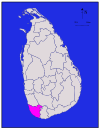 | استان جنوبی (سریلانکا) | گالی (شهر) | ۱٬۶۱۷ (۶۲۴) | ۳۵ (۱۴) | ۱٬۶۵۲ (۶۳۸) | ۱٬۰۶۳٬۳۳۴ | ۶۵۸ (۱٬۷۰۰) |
| ناحیه گامپاها | 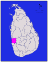 | استان غربی، سریلانکا | گامپاها | ۱٬۳۴۱ (۵۱۸) | ۴۶ (۱۸) | ۱٬۳۸۷ (۵۳۶) | ۲٬۳۰۴٬۸۳۳ | ۱٬۷۱۹ (۴٬۴۵۰) |
| ناحیه هامبانتوتا |  | استان جنوبی (سریلانکا) | هامبانتوتا | ۲٬۴۹۶ (۹۶۴) | ۱۱۳ (۴۴) | ۲٬۶۰۹ (۱٬۰۰۷) | ۵۹۹٬۹۰۳ | ۲۴۰ (۶۲۰) |
| ناحیه جفنا |  | استان شمالی (سریلانکا) | جافنا | ۹۲۹ (۳۵۹) | ۹۶ (۳۷) | ۱٬۰۲۵ (۳۹۶) | ۵۸۳٬۸۸۲ | ۶۲۹ (۱٬۶۳۰) |
| ناحیه کالوتارا | 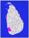 | استان غربی، سریلانکا | کالوتارا | ۱٬۵۷۶ (۶۰۸) | ۲۲ (۸٫۵) | ۱٬۵۹۸ (۶۱۷) | ۱٬۲۲۱٬۹۴۸ | ۷۷۵ (۲٬۰۱۰) |
| ناحیه کندی | 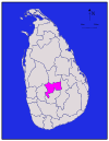 | استان مرکزی (سریلانکا) | کندی (سریلانکا) | ۱٬۹۱۷ (۷۴۰) | ۲۳ (۸٫۹) | ۱٬۹۴۰ (۷۵۰) | ۱٬۳۷۵٬۳۸۲ | ۷۱۶ (۱٬۸۵۰) |
| ناحیه کگاله | 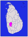 | استان ساباراگامووا | کگاله | ۱٬۶۸۵ (۶۵۱) | ۸ (۳٫۱) | ۱٬۶۹۳ (۶۵۴) | ۸۴۰٬۶۴۸ | ۴۹۹ (۱٬۲۹۰) |
| ناحیه کیلینوچی |  | استان شمالی (سریلانکا) | کیلینوچی | ۱٬۲۰۵ (۴۶۵) | ۷۴ (۲۹) | ۱٬۲۷۹ (۴۹۴) | ۱۱۳٬۵۱۰ | ۹۴ (۲۴۰) |
| ناحیه کورونیگالا |  | استان شمال غربی، سریلانکا | کورونیگالا | ۴٬۶۲۴ (۱٬۷۸۵) | ۱۹۲ (۷۴) | ۴٬۸۱۶ (۱٬۸۵۹) | ۱٬۶۱۸٬۴۶۵ | ۳۵۰ (۹۱۰) |
| ناحیه منار | 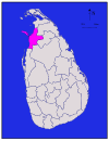 | استان شمالی (سریلانکا) | منار (سریلانکا) | ۱٬۸۸۰ (۷۳۰) | ۱۱۶ (۴۵) | ۱٬۹۹۶ (۷۷۱) | ۹۹٬۵۷۰ | ۵۳ (۱۴۰) |
| ناحیه متاله |  | استان مرکزی (سریلانکا) | متاله (شهر) | ۱٬۹۵۲ (۷۵۴) | ۴۱ (۱۶) | ۱٬۹۹۳ (۷۷۰) | ۴۸۴٬۵۳۱ | ۲۴۸ (۶۴۰) |
| ناحیه ماتارا |  | استان جنوبی (سریلانکا) | ماتارا | ۱٬۲۷۰ (۴۹۰) | ۱۳ (۵٫۰) | ۱٬۲۸۳ (۴۹۵) | ۸۱۴٬۰۴۸ | ۶۴۱ (۱٬۶۶۰) |
| ناحیه موناراگالا |  | استان یووا | موناراگالا | ۵٬۵۰۸ (۲٬۱۲۷) | ۱۳۱ (۵۱) | ۵٬۶۳۹ (۲٬۱۷۷) | ۴۵۱٬۰۵۸ | ۸۲ (۲۱۰) |
| ناحیه مولایتیوو |  | استان شمالی (سریلانکا) | مولایتیوو | ۲٬۴۱۵ (۹۳۲) | ۲۰۲ (۷۸) | ۲٬۶۱۷ (۱٬۰۱۰) | ۹۲٬۲۳۸ | ۳۸ (۹۸) |
| ناحیه نووارا الییا | 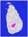 | استان مرکزی (سریلانکا) | نووارا الییا | ۱٬۷۰۶ (۶۵۹) | ۳۵ (۱۴) | ۱٬۷۴۱ (۶۷۲) | ۷۱۱٬۶۴۴ | ۴۱۷ (۱٬۰۸۰) |
| ناحیه پولونارووا |  | استان شمال مرکزی، سریلانکا | پولونارووا | ۳٬۰۷۷ (۱٬۱۸۸) | ۲۱۶ (۸۳) | ۳٬۲۹۳ (۱٬۲۷۱) | ۴۰۶٬۰۸۸ | ۱۳۲ (۳۴۰) |
| ناحیه پوتالام |  | استان شمال غربی، سریلانکا | پوتالام | ۲٬۸۸۲ (۱٬۱۱۳) | ۱۹۰ (۷۳) | ۳٬۰۷۲ (۱٬۱۸۶) | ۷۶۲٬۳۹۶ | ۲۶۵ (۶۹۰) |
| ناحیه راتناپورا |  | استان ساباراگامووا | راتناپورا | ۳٬۲۳۶ (۱٬۲۴۹) | ۳۹ (۱۵) | ۳٬۲۷۵ (۱٬۲۶۴) | ۱٬۰۸۸٬۰۰۷ | ۳۳۶ (۸۷۰) |
| ناحیه ترینکومالی |  | استان شرقی (سریلانکا) | ینکومالی | ۲٬۵۲۹ (۹۷۶) | ۱۹۸ (۷۶) | ۲٬۷۲۷ (۱٬۰۵۳) | ۳۷۹٬۵۴۱ | ۱۵۰ (۳۹۰) |
| ناحیه واوونیا |  | استان شمالی (سریلانکا) | واوونیا | ۱٬۸۶۱ (۷۱۹) | ۱۰۶ (۴۱) | ۱٬۹۶۷ (۷۵۹) | ۱۷۲٬۱۱۵ | ۹۲ (۲۴۰) |
| مجموع | ۶۲٬۷۰۵ (۲۴٬۲۱۱) | ۲٬۹۰۵ (۱٬۱۲۲) | ۶۵٬۶۱۰ (۲۵٬۳۳۰) | ۲۰٬۳۵۹٬۴۳۹ | ۳۲۵ (۸۴۰) |
پانویس[ویرایش]
- ↑ "At a Glance". Sri Lanka in Brief. Government of Sri Lanka. Archived from the original on 10 December 2009. Retrieved 21 July 2009.
- ↑ ۲٫۰ ۲٫۱ ۲٫۲ "Table 1.1: Area of Sri Lanka by province and district" (PDF). Statistical Abstract 2014. Department of Census and Statistics, Sri Lanka.
- ↑ "Census of Population and Housing of Sri Lanka, 2012 - Table A1: Population by district,sex and sector" (PDF). Department of Census & Statistics, Sri Lanka. Archived from the original (PDF) on 28 December 2014. Retrieved 24 March 2016.
منابع[ویرایش]
- "Administrative Districts and Main Towns of Sri Lanka". International Centre for Ethnic Studies. Archived from the original on 8 June 2009. Retrieved 2009-07-18.
- Siriweera, W. I. (2004). History of Sri Lanka: From Earliest Times Up to the Sixteenth Century. Dayawansa Jayakodi & Company. ISBN 955-551-257-4.
- Yogasundaram, Nath (2006). A Comprehensive History of Sri Lanka from Prehistory to Tsunami. Vijitha Yapa Publishers. ISBN 978-955-665-002-0.
- Peebles, Patrick (2006). The History of Sri Lanka. Greenwood Publishing Group. ISBN 0-313-33205-3.
پیوند به بیرون[ویرایش]
| در ویکیانبار پروندههایی دربارهٔ ناحیههای سریلانکا موجود است. |
- Provinces of Sri Lanka at statoids.com


 French
 Deutsch