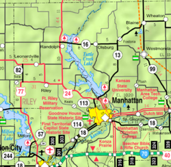
Zeandale, Kansas
Zeandale, Kansas | |
|---|---|
 Zeandale (2022) | |
 | |
| Coordinates: 39°09′34″N 96°25′36″W / 39.15944°N 96.42667°W[1] | |
| Country | United States |
| State | Kansas |
| Counties | Riley |
| Founded | 1855 |
| Elevation | 1,011 ft (308 m) |
| Population | |
| • Total | 62 |
| Time zone | UTC-6 (CST) |
| • Summer (DST) | UTC-5 (CDT) |
| Area code | 785 |
| FIPS code | 20-80875 |
| GNIS ID | 2804661[1] |
Zeandale is an unincorporated community in Riley County, Kansas, United States.[1] As of the 2020 census, the population of the community and nearby areas was 62.[2] It is located about 6.8 miles (10.9 km) east of Manhattan at the intersection of Tabor Valley Rd and K-18 highway (aka Zeandale Rd).
History[edit]

Zeandale was named by J.H. Pillsbury who settled the township in 1855.[3] The name is said to have been taken from the Greek, zea meaning "corn" and the English, dale.[4] Zeandale had a post office between 1857 and 1944.[5]
It is also home to Zeandale Community Church, established in 1896. The church was originally associated with the Stone-Campbell Restoration movement (Christian Church), but was re-established in the 1950s as a non-denominational community church.
The community has a rural, volunteer fire department, updated in 2002 with a new building.
Zeandale almost grew by a factor of four in 2005, when a Manhattan developer cited land for sale surrounding Zeandale as prime real-estate for the growing Manhattan market. However, Riley County zoning regulations prevented the subdivision, and inevitable incorporation.
Geography[edit]
The elevation of the community is 1,011 feet (308 m) above sea level.[1]
Demographics[edit]
| Census | Pop. | Note | %± |
|---|---|---|---|
| 2020 | 62 | — | |
| U.S. Decennial Census | |||
For statistical purposes, the United States Census Bureau has defined Zeandale as a census-designated place (CDP).
Zeandale is part of the Manhattan Metropolitan Statistical Area.
Education[edit]
The community is served by Wamego USD 320 public school district.
References[edit]
- ^ a b c d e "Zeandale, Kansas", Geographic Names Information System, United States Geological Survey, United States Department of the Interior
- ^ a b "Profile of Zeandale, Kansas (CDP) in 2020". United States Census Bureau. Archived from the original on April 26, 2022. Retrieved April 26, 2022.
- ^ Blackmar, Frank Wilson (1912). Kansas: A Cyclopedia of State History, Volume 2. Standard Publishing Company. p. 954.
- ^ Kansas Place-Names, John Rydjord, University of Oklahoma Press, 1972, p. 209 ISBN 0-8061-0994-7
- ^ "Kansas Post Offices, 1828-1961". Kansas Historical Society. Archived from the original on October 9, 2013. Retrieved June 22, 2014.
Further reading[edit]
External links[edit]


 French
 Deutsch

