
 French
 Deutsch
Southern Muya Range
| Southern Muya Range Южно-Муйский хребет | |
|---|---|
 View of a peak of the Southern Muya Range. | |
| Highest point | |
| Peak | Muisky Gigant |
| Elevation | 3,067 m (10,062 ft) |
| Coordinates | 55°58′38″N 114°26′21″E / 55.97722°N 114.43917°E |
| Dimensions | |
| Length | 400 km (250 mi) ENE-WSW |
| Width | 80 km (50 mi) |
| Geography | |
 Southern Muya Range Южно-Муйский хребет Location in Buryatia | |
| Country | Russia |
| Federal subject | Buryatia / Zabaykalsky Krai |
| Range coordinates | 55°43′N 114°05′E / 55.717°N 114.083°E |
| Parent range | Stanovoy Highlands South Siberian System |
| Geology | |
| Type of rock | Granite, slate, limestone |
The Southern Muya Range (Russian: Южно-Муйский хребе́т, romanized: Yuzhno-Muyskiy khrebet) is a mountain range in Buryatia and Zabaykalsky Krai, Russia, part of the Stanovoy Highlands. The highest point of the range is 3,067 m high Muisky Gigant;[1] another important peak is 2363 m high Mount Shaman.[2][3]
Geography[edit]
The Southern Muya Range is located in the Baikal Rift Zone, in the southwestern part of the Baikal-Stanovoy Region. It stretches from west to east for about 330 kilometres (210 mi) from the sources of the Barguzin river near the Ikat Range in the SSW, to the valley of the Bambuyka and Vitim in the east. In its eastern part it reaches a maximum width of 80 kilometres (50 mi). The mountain range is limited by the Muya-Kuanda Depression in the north, and by the Baunt Depression with the Tsipa valley in the south. Both the Bambuyka and the Tsipa are left tributaries of the Vitim.[4]
Hydrography[edit]
Rivers Pravaya Shurinda and Dyaltukta, right tributaries of the Muya originate from the northwestern slopes of the axial or main Southern Muya Range. Lake Dorong is located at the southwestern end.[5]
 |
Flora[edit]
The slopes of the range are mainly covered with mountain taiga, with pre-alpine woodland and bare summits (golets) at higher elevations.[2]
See also[edit]
References[edit]
- ^ "HP Yuzhno Muiskyy Khrebet". PeakVisor.
- ^ a b "Южно-Муйский хребет" [Southern Muya Range] (in Russian). Энциклопедия Забайкалья. Retrieved 28 July 2021. (in Russian)
- ^ Google Earth
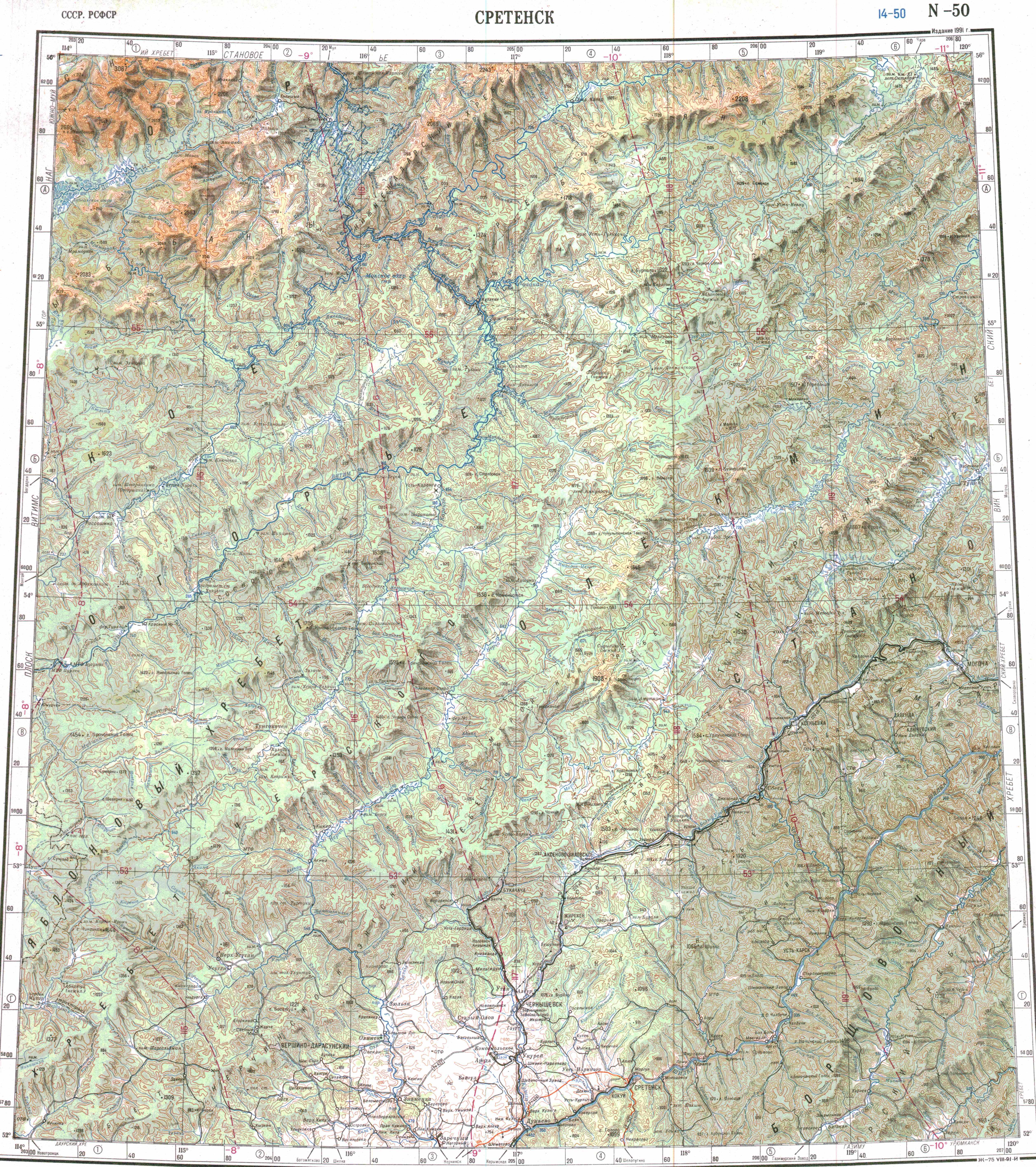
- ^ "N-50 Topographic Chart (in Russian)". Retrieved 11 July 2023.
- ^ "N-49 Chart (in Russian)". Retrieved 5 September 2021.
External links[edit]
 Media related to Southern Muya Range at Wikimedia Commons
This Buryatia location article is a stub. You can help Wikipedia by expanding it. |
This Zabaykalsky Krai location article is a stub. You can help Wikipedia by expanding it. |