
 French
 Deutsch
Sierra de Jájome
| Sierra de Jájome | |
|---|---|
| Cerro de Jájome | |
 | |
| Highest point | |
| Elevation | 2,395 ft (730 m) |
| Geography | |
| Location | Cayey, Guayama and Salinas in Puerto Rico |
| Parent range | Sierra de Cayey |
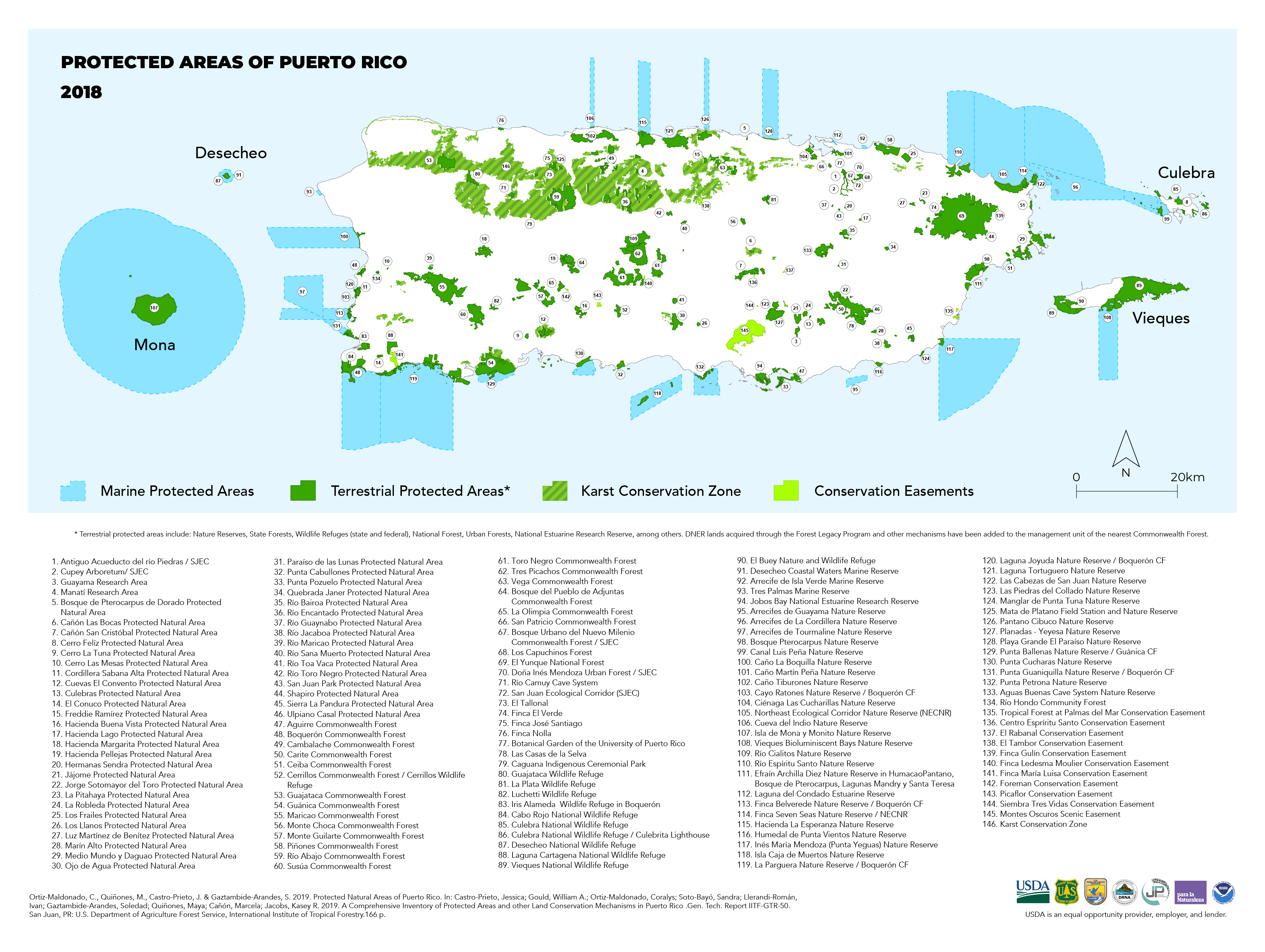
Sierra de Jájome is a mountain massif of the Sierra de Cayey located in the municipalities of Cayey, Guayama and Salinas in southeastern Puerto Rico. The mountain, often referred to as a mountain range (sierra), is protected as the Jájome Protected Natural Area (Spanish: Área Natural Protegida de Jájome or Área Natural Protegida Finca Jájome).[1] The Guayama Research Forest Area (Spanish: Bosque Experimental de Guayama) is also located on the massif.[2] La Robleda, another protected natural area, is located nearby.[3]
Geography[edit]
Jájome is part of the Sierra de Cayey and is located in the barrios Jájome Alto and Jájome Bajo of Cayey, barrio Carmen in Guayama, and barrio Quebrada Yeguas in Salinas. The Jájome River has its source at the easternmost part of the Sierra de Jájome.[4]
Gallery[edit]
-
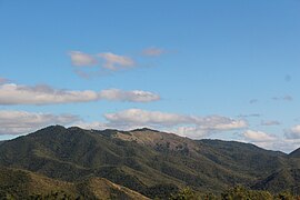 Cerro Jájome in the Guayama Research Area

References[edit]
- ^ United States Department of Agriculture, Forest Service (2019). "Puerto Rico Protected Natural Areas 2018". fs.usda.gov.
- ^ "Collaboration Updates Puerto Rico's Protected Areas Map and Inventory | Use Cases | The Caribbean LCC CPA". caribbeanlcc.databasin.org. Retrieved 2022-01-10.
- ^ Berríos, Marielisa Ortiz (2015-08-05). "La Robleda: un legado para las futuras generaciones". Atabey (in Spanish). Retrieved 2022-01-10.
- ^ "Geographic Names Information System". edits.nationalmap.gov. Retrieved 2022-01-10.