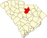
[3] Name on the Register[4] Image Date listed[5] Location City or town Description 1 Adamson Mounds Site Upload image July 16, 1970 (#70000591 ) Address Restricted Camden 2 Belmont Neck Site -38KE06 Upload image February 3, 2006 (#05001578 ) Address Restricted Camden 3 Bethesda Presbyterian Church Bethesda Presbyterian Church February 4, 1985 (#85003258 ) 502 Dekalb St. 34°14′46″N 80°36′19″W / 34.246111°N 80.605278°W / 34.246111; -80.605278 (Bethesda Presbyterian Church ) Camden 4 Boykin Mill Complex Boykin Mill Complex September 10, 1992 (#92001230 ) 8 miles south of Camden at the junction of South Carolina Highway 261 and County Road 2 34°07′42″N 80°34′17″W / 34.128333°N 80.571389°W / 34.128333; -80.571389 (Boykin Mill Complex ) Camden 5 Camden Battlefield Camden Battlefield October 15, 1966 (#66000707 ) 5 miles north of Camden on U.S. Routes 521 and 601 34°20′47″N 80°36′27″W / 34.346389°N 80.6075°W / 34.346389; -80.6075 (Camden Battlefield ) Camden 6 Zachariah Cantey House Zachariah Cantey House May 19, 1983 (#83002199 ) County Road 92 34°10′10″N 80°32′56″W / 34.169444°N 80.548889°W / 34.169444; -80.548889 (Zachariah Cantey House ) Camden 7 Carter Hill Upload image September 24, 1992 (#92001231 ) 10 miles south of Camden, east of U.S. Route 521 34°08′08″N 80°32′57″W / 34.135556°N 80.549167°W / 34.135556; -80.549167 (Carter Hill ) Camden 8 City of Camden Historic District City of Camden Historic District May 6, 1971 (#71000787 ) Bounded on the south by the city limits, on the east and the west by the former Southern railroad right-of-way, and on the north by Dicey Creek Rd. 34°15′16″N 80°36′21″W / 34.254444°N 80.605833°W / 34.254444; -80.605833 (City of Camden Historic District ) Camden 9 Cool Springs Cool Springs September 28, 1989 (#89001596 ) 726 Kershaw Highway 34°17′37″N 80°36′36″W / 34.293611°N 80.61°W / 34.293611; -80.61 (Cool Springs ) Camden 10 Thomas English House Thomas English House July 22, 1993 (#82003871 ) South Carolina Highway 92 , 0.6 miles west of its junction with South Carolina Highway 93 34°10′17″N 80°32′26″W / 34.171389°N 80.540556°W / 34.171389; -80.540556 (Thomas English House ) Camden 11 Historic Camden Revolutionary War Restoration Historic Camden Revolutionary War Restoration July 29, 1969 (#69000170 ) Southern area of the city, near DeKalb 34°13′52″N 80°36′52″W / 34.231111°N 80.614444°W / 34.231111; -80.614444 (Historic Camden Revolutionary War Restoration ) Camden 12 Kendall Mill Historic District Kendall Mill Historic District March 19, 1982 (#82003870 ) Roughly bounded by railroad tracks, Kendall Lake, Lakeshore Dr., McRae Rd., and Haile St. 34°15′33″N 80°35′28″W / 34.259167°N 80.591111°W / 34.259167; -80.591111 (Kendall Mill Historic District ) Camden 13 Liberty Hill Historic District Liberty Hill Historic District November 14, 1978 (#78002519 ) South Carolina Highway 97 34°28′18″N 80°48′13″W / 34.471667°N 80.803611°W / 34.471667; -80.803611 (Liberty Hill Historic District ) Liberty Hill 14 Benjamin McCoy House Upload image August 7, 1980 (#80003674 ) South of Cassatt on South Carolina Highway 15 34°19′39″N 80°25′59″W / 34.3275°N 80.433056°W / 34.3275; -80.433056 (Benjamin McCoy House ) Cassatt 15 McDowell Site Upload image July 16, 1970 (#70000592 ) Address Restricted Camden 16 Midfield Plantation Upload image April 20, 1978 (#78002518 ) Northeast of Boykin on South Carolina Highway 23 34°07′40″N 80°33′28″W / 34.127778°N 80.557778°W / 34.127778; -80.557778 (Midfield Plantation ) Boykin 17 Mulberry Plantation (Chesnut House) Mulberry Plantation (Chesnut House) November 25, 1980 (#80003673 ) 559 Sumter Highway 34°12′23″N 80°35′31″W / 34.206389°N 80.591944°W / 34.206389; -80.591944 (Mulberry Plantation (Chesnut House) ) Camden 18 Plane Hill Upload image September 26, 2022 (#100007390 ) 691 Cantey Ln. 34°10′58″N 80°31′42″W / 34.1828°N 80.5282°W / 34.1828; -80.5282 (Plane Hill ) Rembert vicinity 19 Russell-Heath House Russell-Heath House February 14, 1990 (#90000006 ) South Carolina Highway 522 , west of its junction with County Road 208834°32′23″N 80°44′25″W / 34.539722°N 80.740278°W / 34.539722; -80.740278 (Russell-Heath House ) Stoneboro 20 Seaboard Air Line Railway Depot Seaboard Air Line Railway Depot June 2, 2000 (#00000590 ) 1100 W. DeKalb St. (U.S. Route 1 ) 34°14′53″N 80°37′30″W / 34.248°N 80.625°W / 34.248; -80.625 (Seaboard Air Line Railway Depot ) Camden 
 French
 Deutsch
.jpg)

.jpg)


.jpg)


.jpg)