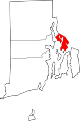
[3] Name on the Register[4] Image Date listed[5] Location City or town Description 1 Alfred Drowne Road Historic District Alfred Drowne Road Historic District June 10, 2005 (#05000584 ) Alfred Drowne Rd., Annawamscutt Rd., Washington Rd. 41°44′38″N 71°20′38″W / 41.743889°N 71.343889°W / 41.743889; -71.343889 (Alfred Drowne Road Historic District ) Barrington 2 Allen-West House Allen-West House December 3, 2013 (#13000887 ) 153 George St. 41°46′19″N 71°18′44″W / 41.771912°N 71.31229°W / 41.771912; -71.31229 (Allen-West House ) Barrington 3 Barrington Civic Center Barrington Civic Center December 12, 1976 (#76000198 ) County Rd. 41°44′29″N 71°18′33″W / 41.741389°N 71.309167°W / 41.741389; -71.309167 (Barrington Civic Center ) Barrington 4 Belton Court Belton Court June 30, 1976 (#76000037 ) Middle Highway 41°45′36″N 71°19′57″W / 41.76°N 71.3325°W / 41.76; -71.3325 (Belton Court ) Barrington 5 Blithewold Blithewold June 27, 1980 (#80000074 ) Ferry Rd. 41°39′14″N 71°16′07″W / 41.653889°N 71.268611°W / 41.653889; -71.268611 (Blithewold ) Bristol 1890s summer retreat established by Augustus Van Wickle, Pennsylvania coal magnate 6 Bristol County Courthouse Bristol County Courthouse April 28, 1970 (#70000011 ) High St. 41°39′48″N 71°16′17″W / 41.663333°N 71.271389°W / 41.663333; -71.271389 (Bristol County Courthouse ) Bristol Built in 1816 and was used for RI State legislator meetings until 1854. 7 Bristol County Jail Bristol County Jail April 24, 1973 (#73000048 ) 48 Court St. 41°40′10″N 71°16′32″W / 41.669444°N 71.275556°W / 41.669444; -71.275556 (Bristol County Jail ) Bristol 8 Bristol Customshouse and Post Office Bristol Customshouse and Post Office May 31, 1972 (#72000015 ) 420-448 Hope St. 41°39′58″N 71°16′31″W / 41.666111°N 71.275278°W / 41.666111; -71.275278 (Bristol Customshouse and Post Office ) Bristol 9 Bristol Ferry Lighthouse Bristol Ferry Lighthouse February 25, 1988 (#87001696 ) Ferry Rd. 41°38′35″N 71°15′37″W / 41.643056°N 71.260278°W / 41.643056; -71.260278 (Bristol Ferry Lighthouse ) Bristol 10 Bristol Waterfront Historic District Bristol Waterfront Historic District March 18, 1975 (#75000053 ) Bristol Harbor to E side of Wood St. as far N as Washington St. and S to Walker Cove 41°40′10″N 71°16′31″W / 41.669444°N 71.275278°W / 41.669444; -71.275278 (Bristol Waterfront Historic District ) Bristol 11 Benjamin Church House Benjamin Church House September 22, 1971 (#71000011 ) 1014 Hope St. 41°41′09″N 71°16′43″W / 41.685833°N 71.278611°W / 41.685833; -71.278611 (Benjamin Church House ) Bristol 12 Benjamin Aborn Jackson House Benjamin Aborn Jackson House September 19, 2008 (#08000903 ) 115 Nayatt Rd. 41°43′34″N 71°19′58″W / 41.726133°N 71.332703°W / 41.726133; -71.332703 (Benjamin Aborn Jackson House ) Barrington 13 Jennys Lane Historic District Jennys Lane Historic District March 6, 2008 (#08000152 ) Jennys Ln. and Mathewson and Rumstick Rds. 41°44′04″N 71°17′58″W / 41.734541°N 71.299406°W / 41.734541; -71.299406 (Jennys Lane Historic District ) Barrington 14 Juniper Hill Cemetery Juniper Hill Cemetery June 3, 1998 (#98000632 ) 24 Sherry Ave. 41°40′53″N 71°16′06″W / 41.681389°N 71.268333°W / 41.681389; -71.268333 (Juniper Hill Cemetery ) Bristol 15 Longfield Longfield July 17, 1972 (#72000016 ) 1200 Hope St. 41°41′49″N 71°16′47″W / 41.696944°N 71.279722°W / 41.696944; -71.279722 (Longfield ) Bristol 16 Mount Hope Bridge Mount Hope Bridge January 31, 1976 (#76000038 ) RI 114 over Narragansett Bay 41°38′25″N 71°15′32″W / 41.640278°N 71.258889°W / 41.640278; -71.258889 (Mount Hope Bridge ) Bristol Opened in 1929. Connects Bristol to the town of Portsmouth on Aquidneck Island. 17 Mount Hope Farm Mount Hope Farm May 2, 1977 (#77000023 ) Metacom Ave. 41°40′09″N 71°14′50″W / 41.669167°N 71.247222°W / 41.669167; -71.247222 (Mount Hope Farm ) Bristol 18 Nayatt Point Lighthouse Nayatt Point Lighthouse February 25, 1988 (#87001694 ) Nayatt Point 41°43′30″N 71°20′23″W / 41.725°N 71.339722°W / 41.725; -71.339722 (Nayatt Point Lighthouse ) Barrington 19 O'Bannon Mill O'Bannon Mill July 23, 1996 (#96000891 ) 90 Bay Spring Ave. 41°44′50″N 71°20′43″W / 41.747222°N 71.345278°W / 41.747222; -71.345278 (O'Bannon Mill ) Barrington 20 Poppasquash Farms Historic District Poppasquash Farms Historic District June 27, 1980 (#80000075 ) Off RI 114 41°40′45″N 71°17′44″W / 41.679167°N 71.295556°W / 41.679167; -71.295556 (Poppasquash Farms Historic District ) Bristol Includes Colt State Park and adjacent properties. 21 Joseph Reynolds House Joseph Reynolds House May 31, 1972 (#72000017 ) 956 Hope St. 41°41′01″N 71°16′46″W / 41.683611°N 71.279444°W / 41.683611; -71.279444 (Joseph Reynolds House ) Bristol Oldest three-story frame house in New England , dating to 1700. Used as headquarters by Lafayette during 1778 Rhode Island campaign. 22 St. Matthew's Episcopal Church St. Matthew's Episcopal Church August 22, 1991 (#91001024 ) 5 Chapel Rd. 41°44′34″N 71°20′37″W / 41.742778°N 71.343611°W / 41.742778; -71.343611 (St. Matthew's Episcopal Church ) Barrington 23 Warren United Methodist Church and Parsonage Warren United Methodist Church and Parsonage August 12, 1971 (#71000012 ) 27 Church St. 41°43′49″N 71°17′02″W / 41.730278°N 71.283889°W / 41.730278; -71.283889 (Warren United Methodist Church and Parsonage ) Warren 24 Warren Waterfront Historic District Warren Waterfront Historic District February 28, 1974 (#74000035 ) Bounded roughly by the Warren River, Belcher Cove, and the old town line (includes Main St. to Campbell St.) 41°43′51″N 71°17′04″W / 41.730833°N 71.284444°W / 41.730833; -71.284444 (Warren Waterfront Historic District ) Warren 
 French
 Deutsch


_State_House.jpg)


 Media related to National Register of Historic Places in Bristol County, Rhode Island at Wikimedia Commons