
 French
 Deutsch
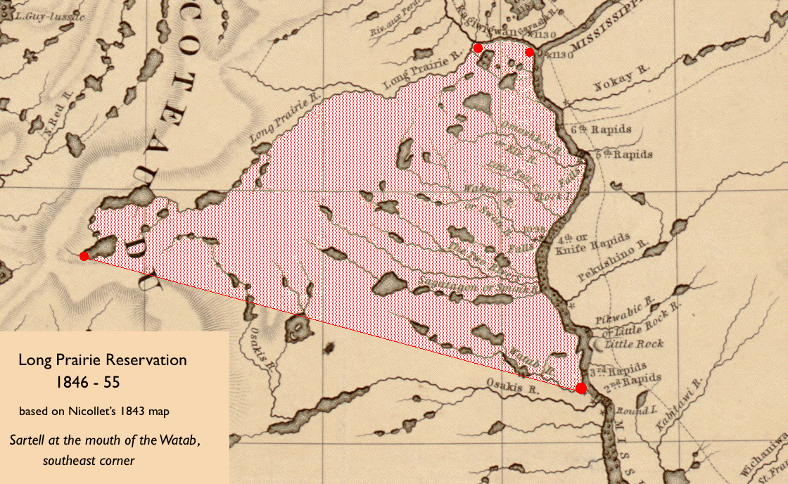
File:Watab-LongPrairieReservation1843Nicollet.gif
Size of this preview: 800 × 491 pixels. Other resolutions: 320 × 197 pixels | 640 × 393 pixels | 1,120 × 688 pixels.
Original file (1,120 × 688 pixels, file size: 337 KB, MIME type: image/gif)
| This is a file from the Wikimedia Commons. Information from its description page there is shown below. Commons is a freely licensed media file repository. You can help. |
| Description | English: Map of the 1846-55 Winnebago (Ho-Chunk) Reservation in central Minnesota based on landmarks in 1847 US Treaty with the Chippewa, using Joseph Nicolas Nicollet's 1843 map |
| Date | |
| Source | Original publication: Map of the Hydrographical Basin of the Upper Mississippi |
| Author | Joseph Nicolas Nicollet |
This work is in the public domain in the United States because it was published (or registered with the U.S. Copyright Office) before January 1, 1929. Public domain works must be out of copyright in both the United States and in the source country of the work in order to be hosted on the Commons. If the work is not a U.S. work, the file must have an additional copyright tag indicating the copyright status in the source country. Note: This tag should not be used for sound recordings. |
File history
Click on a date/time to view the file as it appeared at that time.
| Date/Time | Thumbnail | Dimensions | User | Comment | |
|---|---|---|---|---|---|
| current | 05:46, 9 October 2012 | | 1,120 × 688 (337 KB) | Tpkunesh | {{subst:Upload marker added by en.wp UW}} {{Information |Description = {{en|Map of the 1846-55 Winnebago (Ho-Chunk) Reservation in central Minnesota based on landmarks in 1847 US Treaty with the Chippewa, using Joseph Nicolas Nicollet's 1843 map}} |Sou... |
File usage
The following pages on the English Wikipedia use this file (pages on other projects are not listed):
Global file usage
The following other wikis use this file:
- Usage on de.wikipedia.org