
 French
 Deutsch
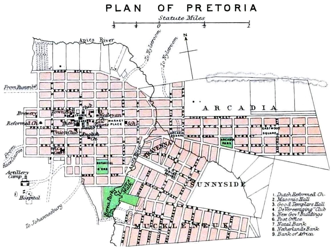
File:The Castle Line atlas of South Africa, Plan of Pretoria, 1895.jpg
Original file (1,166 × 883 pixels, file size: 287 KB, MIME type: image/jpeg)
| This is a file from the Wikimedia Commons. Information from its description page there is shown below. Commons is a freely licensed media file repository. You can help. |
Summary
| Description | English: Identifier: castlelineatlaso00lond (find matches) |
| Date | |
| Source | https://www.flickr.com/photos/internetarchivebookimages/14762912861/ |
| Author | Internet Archive Book Images |
| Permission (Reusing this file) | At the time of upload, the image license was automatically confirmed using the Flickr API. For more information see Flickr API detail. |
| Other versions | .jpg) |
| Flickr tags |
|
| Flickr posted date | 28 July 2014 |
Licensing
This image was taken from Flickr's The Commons. The uploading organization may have various reasons for determining that no known copyright restrictions exist, such as:
More information can be found at https://flickr.com/commons/usage/. Please add additional copyright tags to this image if more specific information about copyright status can be determined. See Commons:Licensing for more information. |
| This image, originally posted to Flickr, was reviewed on 2 October 2015 by the administrator or reviewer Christian Ferrer, who confirmed that it was available on Flickr under the stated license on that date. |
File history
Click on a date/time to view the file as it appeared at that time.
| Date/Time | Thumbnail | Dimensions | User | Comment | |
|---|---|---|---|---|---|
| current | 13:27, 10 August 2018 | | 1,166 × 883 (287 KB) | JMK | {{Information |description ={{en|1=[https://www.flickr.com/photos/internetarchivebookimages/tags/bookidcastlelineatlaso00lond The Castle Line atlas of South Africa : a series of 16 plates, printed in colour, containing 30 maps and diagrams, with an account of the geograaphical features , the climate, the mineral and other resources, and the history of South Africa. And an index of over 6,000 names]}} |date =1895 |source =https://www.flickr.com/photos/internetarchivebookimage... |
File usage
Global file usage
The following other wikis use this file:
- Usage on fr.wikipedia.org