
 French
 Deutsch
File:Shropshire outline map with UK (2009).png
No higher resolution available.
Shropshire_outline_map_with_UK_(2009).png (504 × 549 pixels, file size: 141 KB, MIME type: image/png)
| This is a file from the Wikimedia Commons. Information from its description page there is shown below. Commons is a freely licensed media file repository. You can help. |
.png)
Summary
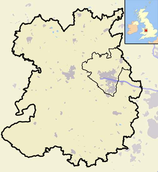
| Description | A map of the county of Shropshire, England, United Kingdom, showing the post-2009 district boundaries. |
| Date | |
| Source | Own work |
| Author | Jhamez84 |
Licensing
| I, the copyright holder of this work, release this work into the public domain. This applies worldwide. In some countries this may not be legally possible; if so: I grant anyone the right to use this work for any purpose, without any conditions, unless such conditions are required by law. |
File history
Click on a date/time to view the file as it appeared at that time.
| Date/Time | Thumbnail | Dimensions | User | Comment | |
|---|---|---|---|---|---|
| current | 20:06, 19 December 2008 | | 504 × 549 (141 KB) | Jza84 | == Summary == {{Information |Description=A map of the county of Shropshire, England, United Kingdom, showing the post-2009 district boundaries. |Source=self-made |Date=December 2008 |Author= Jhamez84 |Permission=See below |other_versions |
File usage
More than 100 pages use this file. The following list shows the first 100 pages that use this file only. A full list is available.
.png)
- Alnwick District
- Blyth Valley
- Borough of Berwick-upon-Tweed
- Borough of Oswestry
- Bridgnorth District
- Caradon
- Carrick, Cornwall
- Castle Morpeth
- Chester-le-Street (district)
- Chester (district)
- City of Durham (district)
- Congleton (borough)
- Cornwall Council
- Crewe and Nantwich
- Derwentside
- Easington District
- Ellesmere Port and Neston
- Kennet District
- Kerrier
- Macclesfield (borough)
- Mid Bedfordshire District
- North Cornwall
- North Shropshire
- North Wiltshire
- Penwith
- Restormel
- Salisbury District
- Sedgefield (borough)
- Shrewsbury and Atcham
- Shropshire Wildlife Trust
- South Bedfordshire
- South Shropshire
- Teesdale (district)
- Tynedale
- Vale Royal
- Wansbeck District
- Wear Valley
- West Wiltshire
- Talk:53rd (Shropshire) Regiment of Foot
- Talk:A. E. Housman
- Talk:AFC Telford United
- Talk:Anchor, Shropshire
- Talk:Battle of Shrewsbury
- Talk:Battlefield, Shropshire
- Talk:Bayston Hill
- Talk:Bridgnorth
- Talk:Caratacus' last battle
- Talk:Charles Darwin
- Talk:Church Stretton
- Talk:Cleehill
- Talk:Cleobury Mortimer
- Talk:Coalbrookdale
- Talk:Daniel Kawczynski
- Talk:Ellesmere, Shropshire
- Talk:Ellesmere College
- Talk:Flounders' Folly
- Talk:Haberdashers' Adams
- Talk:Hilda Murrell
- Talk:History of Shropshire
- Talk:Idsall School
- Talk:Ironbridge
- Talk:Ironbridge Gorge Museum Trust
- Talk:Joe Hart
- Talk:Ludlow
- Talk:Ludlow Castle
- Talk:Newport, Shropshire
- Talk:Oswestry
- Talk:Oswestry School
- Talk:Peter Thornley
- Talk:Plealey
- Talk:Religious views of Charles Darwin
- Talk:Richard of Shrewsbury, Duke of York
- Talk:River Severn
- Talk:River Teme
- Talk:Shelvock Manor
- Talk:Sheriffhales
- Talk:Shrewsbury
- Talk:Shrewsbury Castle
- Talk:Shrewsbury College
- Talk:Shrewsbury School
- Talk:Shrewsbury Town F.C.
- Talk:Shrewsbury railway station
- Talk:Shropshire
- Talk:Shropshire Union Railways and Canal Company
- Talk:Sin-eater
- Talk:Stanton upon Hine Heath
- Talk:Stokesay Castle
- Talk:Telford (UK Parliament constituency)
- Talk:Telford FM
- Talk:Telford Steam Railway
- Talk:Telford Tigers
- Talk:The Green Green Grass
- Talk:The Iron Bridge
- Talk:The New Saints F.C.
- Talk:The Quarry (park)
- Talk:Viroconium Cornoviorum
- Talk:Wellington, Shropshire
- Talk:Welsh Marches
- Talk:Weston Lullingfields
- Talk:Whixall
View more links to this file.
.png)