
 French
 Deutsch
File:San Juan, Metro Manila (2344411253).jpg

Size of this preview: 800 × 523 pixels. Other resolutions: 320 × 209 pixels | 640 × 418 pixels | 1,024 × 670 pixels | 1,280 × 837 pixels | 2,768 × 1,810 pixels.
Original file (2,768 × 1,810 pixels, file size: 1.11 MB, MIME type: image/jpeg)
| This is a file from the Wikimedia Commons. Information from its description page there is shown below. Commons is a freely licensed media file repository. You can help. |
.jpg)
Summary
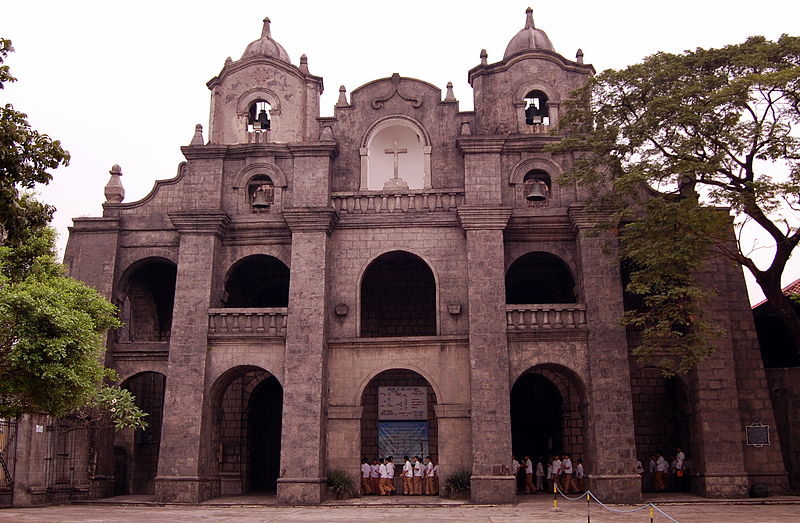
| Description | The Dominicans built the first parochial buildings in 1602 that were razed during the 1639 Chinese revolt. These were rebuilt in 1641, burned down during the British invasion of 1763, and rebuilt again in 1774. Nikon D40 (INAFI Board of Trustees' Meeting, February 2008). |
| Date | |
| Source | San Juan, Metro Manila |
| Author | Shubert Ciencia from Nueva Ecija, Philippines |
| Camera location | | View this and other nearby images on: OpenStreetMap |
|---|
.jpg¶ms=014.598534_N_0120.991058_E_globe:Earth_type:camera_source:Flickr_&language=en)
Licensing
- Object
The depicted Philippine architecture, 3D public art, or other freedom of panorama (FoP)-reliant work is in public domain because:
See Commons:Copyright rules by territory/Philippines#Public domain exceptions for FoP-reliant works for more information. Images of copyrighted architecture and public art are normally not allowed on Wikimedia Commons, unless there is an applicable freedom of panorama (FoP) in the works' country of origin. However, there is no such exception in Republic Act No. 8293 (The Intellectual Property Code of the Philippines), see Commons:Copyright rules by territory/Philippines#Freedom of panorama for more information.
|  |
- Photograph
This file is licensed under the Creative Commons Attribution 2.0 Generic license.
- You are free:
- to share – to copy, distribute and transmit the work
- to remix – to adapt the work
- Under the following conditions:
- attribution – You must give appropriate credit, provide a link to the license, and indicate if changes were made. You may do so in any reasonable manner, but not in any way that suggests the licensor endorses you or your use.
| This image, originally posted to Flickr, was reviewed on July 6, 2008 by the administrator or reviewer File Upload Bot (Magnus Manske), who confirmed that it was available on Flickr under the stated license on that date. |
File history
Click on a date/time to view the file as it appeared at that time.
| Date/Time | Thumbnail | Dimensions | User | Comment | |
|---|---|---|---|---|---|
| current | 18:03, 6 July 2008 | | 2,768 × 1,810 (1.11 MB) | File Upload Bot (Magnus Manske) | {{Information |Description= The Dominicans built the first parochial buildings in 1602 that were razed during the 1639 Chinese revolt. These were rebuilt in 1641, burned down during the British invasion of 1763, and rebuilt again in 1774. The city of San |
File usage
The following pages on the English Wikipedia use this file (pages on other projects are not listed):
Global file usage
The following other wikis use this file:
- Usage on bcl.wikipedia.org
- Usage on eo.wikipedia.org
- Usage on es.wikipedia.org
- Usage on incubator.wikimedia.org
- Usage on sl.wikipedia.org
- Usage on zh.wikipedia.org
.jpg)