
 French
 Deutsch
File:CoropunaSouthViewUSGS.jpg
No higher resolution available.
CoropunaSouthViewUSGS.jpg (640 × 409 pixels, file size: 25 KB, MIME type: image/jpeg)
| This is a file from the Wikimedia Commons. Information from its description page there is shown below. Commons is a freely licensed media file repository. You can help. |
Summary
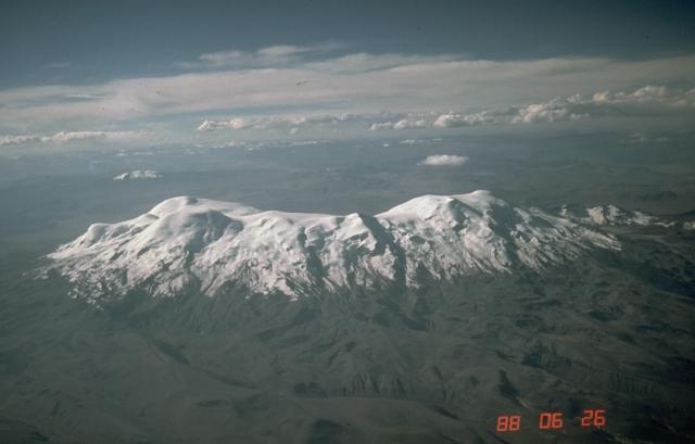
| Description | Aerial photo of Nevado Coropuna, Peru's largest and highest volcano, from the south. The true summit (left) is located at the NW end of the vast summit plateau. | |||
| Location | Southern Peru | |||
| Date | ||||
| Source | https://volcano.si.edu/volcano.cfm?vn=354003&vtab=Photos | |||
| Author | Norm Banks, U.S. Geological Survey | |||
| Permission (Reusing this file) |
|
File history
Click on a date/time to view the file as it appeared at that time.
| Date/Time | Thumbnail | Dimensions | User | Comment | |
|---|---|---|---|---|---|
| current | 04:25, 22 April 2007 | | 640 × 409 (25 KB) | Seattle Skier | == Summary == {{Information |Description= Aerial photo of Nevado Coropuna, Peru's largest and highest volcano, from the south. The true summit (left) is located at the NW end of the vast summit plateau. |Source=http://www.volcano. |
File usage
The following pages on the English Wikipedia use this file (pages on other projects are not listed):
Global file usage
The following other wikis use this file:
- Usage on ay.wikipedia.org
- Usage on be.wikipedia.org
- Usage on ca.wikipedia.org
- Usage on lt.wikipedia.org
- Usage on qu.wikipedia.org
- Usage on uk.wikipedia.org