
 French
 Deutsch
File:Atholl 28district29-1.png
No higher resolution available.
Atholl_28district29-1.png (368 × 456 pixels, file size: 17 KB, MIME type: image/png)
| This is a file from the Wikimedia Commons. Information from its description page there is shown below. Commons is a freely licensed media file repository. You can help. |
Summary
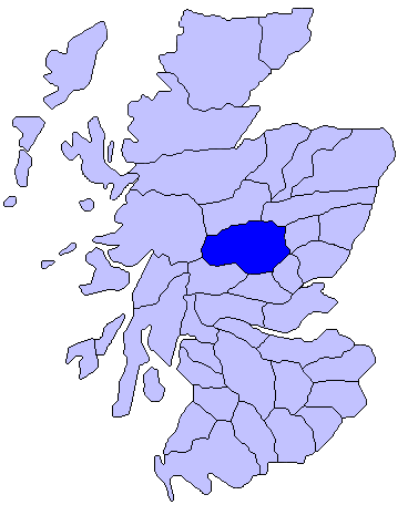
| Description | Français : Carte de l'Écosse montrant la situation du comté d'Atholl |
| Date | 2 June 2006 (original upload date) |
| Source | Transferred from en.wikipedia to Commons. |
| Author | Benson85 at English Wikipedia |
Licensing
Benson85 at the English-language Wikipedia, the copyright holder of this work, hereby publishes it under the following license:
| This file is licensed under the Creative Commons Attribution-Share Alike 3.0 Unported license. Subject to disclaimers. | ||
| Attribution: Benson85 at the English-language Wikipedia | ||
| ||
| This licensing tag was added to this file as part of the GFDL licensing update. |
 | Permission is granted to copy, distribute and/or modify this document under the terms of the GNU Free Documentation License, Version 1.2 or any later version published by the Free Software Foundation; with no Invariant Sections, no Front-Cover Texts, and no Back-Cover Texts. A copy of the license is included in the section entitled GNU Free Documentation License. Subject to disclaimers. |
Original upload log
The original description page was here. All following user names refer to en.wikipedia.
.PNG)
- 2006-11-25 16:56 Benson85 368×456× (17396 bytes) Map showing roughly the district of [[Atholl]] in [[Scotland]].
- 2006-06-02 19:17 Benson85 368×456× (17477 bytes) Map showing roughly the district of [[Atholl]] in [[Scotland]].
File history
Click on a date/time to view the file as it appeared at that time.
| Date/Time | Thumbnail | Dimensions | User | Comment | |
|---|---|---|---|---|---|
| current | 06:06, 11 June 2012 | | 368 × 456 (17 KB) | OgreBot | (BOT): Reverting to most recent version before archival |
| 06:05, 11 June 2012 |  | 368 × 456 (17 KB) | OgreBot | (BOT): Uploading old version of file from en.wikipedia; originally uploaded on 2006-06-02 19:17:20 by Benson85 | |
| 05:22, 1 March 2012 |  | 368 × 456 (17 KB) | Mtrepanier |
File usage
The following pages on the English Wikipedia use this file (pages on other projects are not listed):
Global file usage
The following other wikis use this file:
- Usage on ar.wikipedia.org
- Usage on be.wikipedia.org
- Usage on de.wikipedia.org
- Usage on fr.wikipedia.org
- Usage on ga.wikipedia.org
- Usage on it.wikipedia.org
- Usage on nn.wikipedia.org