
 French
 Deutsch
File:1804 German Edition of the Rennel Map of India - Geographicus - IndiaGerman-rennell-1804.jpg

Size of this preview: 491 × 600 pixels. Other resolutions: 196 × 240 pixels | 393 × 480 pixels | 629 × 768 pixels | 838 × 1,024 pixels | 1,677 × 2,048 pixels | 3,500 × 4,275 pixels.
Original file (3,500 × 4,275 pixels, file size: 4.86 MB, MIME type: image/jpeg)
| This is a file from the Wikimedia Commons. Information from its description page there is shown below. Commons is a freely licensed media file repository. You can help. |
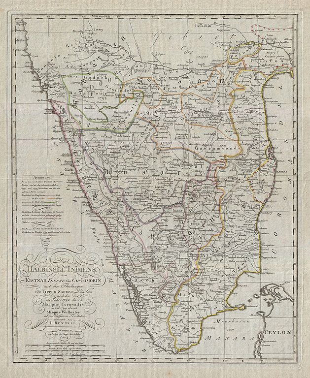
| Die Halbinsel Indiens vom Kistnah Flusse bis Cap Comorin mit den Theilungen von Tippo Sahebs Landern nach den in Jahre 1782 durch Marquis Cornwallis und 1799 durch Marquis Wellesley abgeschloffenen, Tractaten, entworfenvon I. Rennell. | ||||||
|---|---|---|---|---|---|---|
| Artist | ||||||
| Title | Die Halbinsel Indiens vom Kistnah Flusse bis Cap Comorin mit den Theilungen von Tippo Sahebs Landern nach den in Jahre 1782 durch Marquis Cornwallis und 1799 durch Marquis Wellesley abgeschloffenen, Tractaten, entworfenvon I. Rennell. | |||||
| Description | English: An extremely obscure German edition of Rennell's important late 18th century mapping of India. Covers the subcontinent roughly from Hyderabad and Goa south to Comorin and Ceylon (Sri Lanka). Shows the region divided into various princely states noting important forts, rivers, cities, towns, and roadways. This map is very scarce. We have been able to find no sales history on this item in the last 30 years, nor is known to be it available in any major collection. | |||||
| Date | 1804 (dated) | |||||
| Dimensions | height: 19 in (48.2 cm); width: 15 in (38.1 cm) | |||||
| Accession number | Geographicus link: IndiaGerman-rennell-1804 | |||||
| Source/Photographer |
| |||||
| Permission (Reusing this file) |
| |||||
| Other versions |
| |||||

_-_Geographicus_-_India-wyld-1838.jpg)
File history
Click on a date/time to view the file as it appeared at that time.
| Date/Time | Thumbnail | Dimensions | User | Comment | |
|---|---|---|---|---|---|
| current | 01:35, 24 March 2011 | | 3,500 × 4,275 (4.86 MB) | BotMultichillT | {{subst:User:Multichill/Geographicus |link=http://www.geographicus.com/P/AntiqueMap/IndiaGerman-rennell-1804 |product_name=1804 German Edition of the Rennel Map of India |map_title=Die Halbinsel Indiens vom Kistnah Flusse bis Cap Comorin mit den Theilunge |
File usage
The following pages on the English Wikipedia use this file (pages on other projects are not listed):
Global file usage
The following other wikis use this file:
- Usage on ar.wikipedia.org