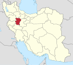
Dargazin, Hamadan
Dargazin Persian: درگزین | |
|---|---|
Village | |
| Coordinates: 35°21′38″N 49°04′32″E / 35.36056°N 49.07556°E[1] | |
| Country | Iran |
| Province | Hamadan |
| County | Dargazin |
| District | Central |
| Rural District | Dargazin-e Sofla |
| Population (2016)[2] | |
| • Total | 1,331 |
| Time zone | UTC+3:30 (IRST) |
Dargazin (Persian: درگزین), formerly Darjazin (درجزين), also Romanized as Darjazīn; also known as Darvazīn and Daryazīn,[3] is a village in, and the capital of, Dargazin-e Sofla Rural District of the Central District of Dargazin County, Hamadan province, Iran.[4]
At the 2006 National Census, its population was 2,629 in 689 households, when it was in the former Qorveh-e Darjazin District of Razan County.[5] The following census in 2011 counted 1,345 people in 396 households.[6] The latest census in 2016 showed a population of 1,331 people in 406 households.[2]
After the census, the district was separated from the county in the establishment of Dargazin County, which was divided into two districts of two rural districts each, with the city of Qorveh-e Dargazin as its capital.[4]
History[edit]
In the 11th century, the Darjazin area had a significant population of Mazdakis and the related Khorramites.[7] The Dargazini family of viziers was also from the area.[7]
The 14th-century author Hamdallah Mustawfi described Darjazin (as Darguzīn) as previously "merely a village of the A‘lam district" that had become "a provincial capital" by his lifetime.[8] He wrote that it had good agricultural lands that produced grain, cotton, grapes, and other fruits.[8] Its population, he said, were devout Sunnis of the Shafi'i madhhab (i.e. the Shafi'i sub-school of Islam) who followed the Shaykh al-Islam Sharaf ad-Din Darguzini.[8] The revenue of Darguzin, he wrote, was 12,000 dinars.[8]
The Ottoman traveller Evliya Çelebi passed through Darjazin in 1654 and left a description of the town's layout, as well as its garrison and fort.[7] Evliya associated the fort with an unspecified Sasanian king named Yazdegerd, which possibly refers to Yazdegerd I.[7] No traces of the fort survive today.[7] By the time of Evliya's visit, Darjazin's population had become Shi'i; he described the Moharram mourning rites observed here.[7] In the 1700s, Darjazin became contested between Iran and the Ottoman Empire.[7]
Shrine[edit]
The shrine of Emamzadeh Azhar in Darjazin is dated to the Ilkhanid era; it may be the tomb of either Shaykh Salman 'Aref Dargazini (13th century) or the above-mentioned Sharaf ad-Din Dargazini (14th century).[7] The shrine itself has a circular tower with a conical dome that reaches 12 m off the ground at its highest point.[7] There is a wooden chest in the shrine which bears the date 1056 AH, or 1646 CE; part of the chest is missing.[7]
References[edit]
- ^ OpenStreetMap contributors (19 October 2023). "Dargazin, Dargazin County" (Map). OpenStreetMap. Retrieved 19 October 2023.
- ^ a b "Census of the Islamic Republic of Iran, 1395 (2016)". AMAR (in Persian). The Statistical Center of Iran. p. 13. Archived from the original (Excel) on 21 April 2021. Retrieved 19 December 2022.
- ^ Darjazin can be found at GEOnet Names Server, at this link, by opening the Advanced Search box, entering "-3059496" in the "Unique Feature Id" form, and clicking on "Search Database".
- ^ a b Jahangiri, Ishaq (8 December 1397). "Letter of approval regarding country divisions in Razan County of Hamadan province". Laws and Regulations Portal of the Islamic Republic of Iran (in Persian). Ministry of Interior, Council of Ministers. Archived from the original on 31 July 2023. Retrieved 19 October 2023.
- ^ "Census of the Islamic Republic of Iran, 1385 (2006)". AMAR (in Persian). The Statistical Center of Iran. p. 13. Archived from the original (Excel) on 20 September 2011. Retrieved 25 September 2022.
- ^ "Census of the Islamic Republic of Iran, 1390 (2011)". Syracuse University (in Persian). The Statistical Center of Iran. p. 13. Archived from the original (Excel) on 17 January 2023. Retrieved 19 December 2022.
- ^ a b c d e f g h i j Aḏkāʾī, Parviz (1994). "DARJAZĪN". Encyclopaedia Iranica, Vol. VII, Fasc. 1. pp. 55–6.
- ^ a b c d Hamdallah Mustawfi (1919). Le Strange, Guy (ed.). The Geographical Part of the Nuzhat-al-Qulub. p. 76. Retrieved 10 October 2022.


 French
 Deutsch
