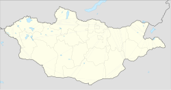
Chuluunkhoroot
Chuluunkhoroot Чулуунхороот сум ᠴᠠᠯᠠᠭᠤᠨᠬᠣᠷᠢᠶ᠋ᠠᠲᠤᠰᠤᠮᠤ | |
|---|---|
| Coordinates: 49°52′15″N 115°41′49″E / 49.87083°N 115.69694°E | |
| Country | Mongolia |
| Province | Dornod Province |
| Area | |
| • Total | 6,539 km2 (2,525 sq mi) |
| Time zone | UTC+8 (UTC + 8) |
Chuluunkhoroot (Mongolian: Чулуунхороот, stone corral), also Ereentsav (Эрээнцав), is a sum (district) center in the Dornod Province, Mongolia.[1] It is located very close to the Russian-Mongolian border, and sees frequent visits from Solov'yovsk on the Russian side. In 2009, its population was 1,609.[2]
History[edit]
It was established in the 1950s as a state farm collective, drawing settlers from other areas in the region, with tractors and large equipment mainly purchased from Russia. Due to this relatively large-scale settling, the town is an ethnic mix of Halh (60-65%), Buryat (about 30% from villages like Dashbalbar, Gurvanzagal, and Tsagaan Ovoo), and others (approx. 4-5%). Following the collapse of the Soviet Union, much of the Russian population left, taking their equipment with them, resulting in a rapid decline of the town's economic foundation. Buildings that housed Russian border troops became ruins and a small coal plant there was dismantled. Unemployment is upwards of 60% for young men between 18 and 25 years old, and alcoholism and domestic violence have increased. With recent international and provincial aid efforts, the town has begun to improve its conditions.
Transport[edit]
Chuluunkhoroot is on the Choibalsan - Borzya (in Russia) rail line. There is a passenger service to Choibalsan.[3]
References[edit]
- ^ Papers of the British Association for Korean Studies. British Association for Korean Studies. 1994. p. 192. Retrieved 31 July 2013.
- ^ Dornod Aimag Statistical Office. 2009 Annual Report Archived 2012-04-29 at the Wayback Machine
- ^ Lonely Planet Mongolia: Choibalsan transport (archived version 18 Jan 2012)


 French
 Deutsch
