
 French
 Deutsch
Cadolzburg
Cadolzburg | |
|---|---|
 Cadolzburg Castle (from 1260 seat of the Burgraves of Nuremberg) | |
 Coat of arms | |
Location of Cadolzburg within Fürth district 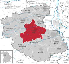 | |
 Cadolzburg  Cadolzburg | |
| Coordinates: 49°27′N 10°52′E / 49.450°N 10.867°E | |
| Country | Germany |
| State | Bavaria |
| Admin. region | Mittelfranken |
| District | Fürth |
| Subdivisions | 16 districts |
| Government | |
| • Mayor (2024–30) | Sarah Höfler[1] (SPD/BfC) |
| Area | |
| • Total | 45.44 km2 (17.54 sq mi) |
| Elevation | 352 m (1,155 ft) |
| Population (2022-12-31)[2] | |
| • Total | 11,414 |
| • Density | 250/km2 (650/sq mi) |
| Time zone | UTC+01:00 (CET) |
| • Summer (DST) | UTC+02:00 (CEST) |
| Postal codes | 90556 |
| Dialling codes | 09103 |
| Vehicle registration | FÜ |
| Website | www.cadolzburg.de |
Cadolzburg (outdated also Kadolzburg German pronunciation: [ˈkadɔlt͡sˌbuɐg], colloquially pronounced "Kalschbuʳch" [kalʃbuɐç] or "Sporch" [ʃbɔrχ] in the local dialect) is a municipality in the Middle Franconian district of Fürth, in Bavaria, Germany. It is situated 11 km (6.8 mi) west of Fürth. Its name derives from its central castle, first being mentioned in the year 1157.[3]
Geography[edit]
The topography varies significantly in its height.
Neighborhood[edit]
Neighboring Municipalities are: (beginning in the north then going clockwise)
Districts[edit]
Cadolzburg consists of the city itself and 15 farther districts:[4]
|
|
|
History[edit]
Middle Ages[edit]
The place was first mentioned in 1157 when the reeve of Kadolzburg, Helmericus de Kadoldesburc, agreed on a territorial exchange between the diocese of Würzburg the Heilsbronn Abbey. So the name derives from Burg des Kadold meaning "Kadold's castle". If the castle had been built by Duke Kadold, who in the year 793 founded the Herrieden Abbey, it would be an early medieval citadel from the 8th century. More likely, however, seems that it was erected by the allodium of the Abenbergers.[3] The earliest erected parts surviving until today were built around 1250 under the rule of the Hohenzollern, Conrad I. the Burgraves of Nuremberg and his son Fredrick III., as they took residence there. In the year 1397 Fredrick VI. was given all the land "under the mountains" (untergebirgisch) including the residence of Cadolzburg, but merely 20 years later he was gifted the Margraviate of Brandenburg and the title Elector of Brandenburg, his dynasty would later on become Emperors of Germany. Under the reign of his son Albrecht Achilles of Brandenburg Cadolzburg was used as a residence for hunting. In the 14th century the spelling "Cadelspurgk" became common and appeared in various documents form the free imperial city of Nuremberg. It formed part of the Margraviate of Ansbach and thus was part of the Franconian Circle since 1500.
Modern Times[edit]
In the late 18th century there were about 120 households in Cadolzburg. The jurisdiction and municipal power were possessed by the brandenburg-ansbach Office Cadolzburg. The landowner was the Kastenamt Cadolzburg, consisting of the castle, a brewhouse, 2 smitheries, one bakery, 2 pubs, 105 houses, 2 halffarms, 1 brick production, and the parish of Cadolzburg (possessing two farms).[5]
In the municipality edict of 1808 the tax district of Cadolzburg was established, the Municipaldistrict of Cadolzburg followed suit in 1810, being superimposable with the tax district. They were subjects in administration and jurisdiction to the Landgericht Cadolzburg and in financial administration to the Rentamt Cadolzburg (restyled Finanzamt Cadolzburg in 1920). It was classified as a Markt with a Magistrate of third class in 1818.[6] Since 1862 Cadolzburg was administrated by the Bezirksamt Fürth (restyled Landkreis Fürth in 1938), but the jurisdiction was left to the Landgericht Cadolzburg until 1879, from 1880 to the first of March 1931 it was given to the Amtsgericht Cadolzburg and since then, the Amtsgericht Fürth is the ordinary court. The financial administration was taken over by the Finanzamt Fürth on 1 January 1929. In 1961 the municipality had an extension of 4,486 km2.[7]
Incorporations into the municipality[edit]
First of January 1972 most parts of the municipality of Deberndorf and on July first the former Municipality of Roßendorf were incorporated into Cadolzburg.[6] 1. May 1978 Steinbach and the district of Seckendorf of the dissolved Municipality of Horbach followed.[8]
In the year 2007 Cadolzburg celebrated its 850th anniversary.
Demographics[edit]
Municipality of Cadolzburg
| Year | 1987 | 2007 | 2008 | 2009 | 2010 | 2011 | 2012 | 2013 | 2014 | 2015 | 2016 | 2017 |
|---|---|---|---|---|---|---|---|---|---|---|---|---|
| Inhabitants | 8003 | 10130 | 10180 | 10224 | 10297 | 10323 | 10392 | 10470 | 10683 | 10741 | 10976 | 11073 |
| Houses | 2052 | 2824 | 2833 | 2854 | 2871 | |||||||
| Source | [9] | [10] | [10] | [10] | [10] | [10] | [10] | [10] | [10] | [10] | [10] | [10] |
City of Cadolzburg (=Municipality of Cadulzburg until the Reform)
| Year | 1818 | 1840 | 1852 | 1855 | 1861 | 1867 | 1871 | 1875 | 1880 | 1885 | 1890 | 1895 | 1900 | 1905 | 1910 | 1919 | 1925 | 1933 | 1939 | 1946 | 1950 | 1952 | 1961 | 1970 | 1987 |
|---|---|---|---|---|---|---|---|---|---|---|---|---|---|---|---|---|---|---|---|---|---|---|---|---|---|
| Inhabitants | 976 | 1298 | 1333 | 1342 | 1344 | 1345 | 1319 | 1285 | 1237 | 1227 | 1280 | 1417 | 1494 | 1584 | 1655 | 1747 | 1870 | 2025 | 2215 | 3160 | 3309 | 3296 | 3480 | 3811 | 4257 |
| Houses | 136 | 165 | 212 | 216 | 239 | 300 | 388 | 554 | 1059 | ||||||||||||||||
| Source | [11] | [12] | [13] | [13] | [13] | [14] | [13] | [15] | [13] | [13] | [16] | [13] | [13] | [17] | [13] | [13] | [13] | [18] | [13] | [13] | [19] | [13] | [7] | [20] | [9] |
Politics[edit]
Municipality Council[edit]

Until 2002 the council had 20 members, since the communal elections in 2008 there are 24 members.
| CSU | SPD | Grüne | Independent | FW | Total | |
| 2002 | 8 | 8 | 1 | 2 | 1 | 20 seats |
| 2008 | 12 | 6 | 1 | 4 | 1 | 24 seats |
| 2014 | 11 | 6 | 2 | 3 | 2 | 24 seats |
(Last updated: Communal elections on 16. March 2014)
Mayor[edit]
From 1978 to 2002 Claus Pierer (SPD) was mayor of the Cadolzburg,[21] followed by Bernd Obst (CSU). On 2 March 2008 he was reelected with 79% of the votes against Hermann Zempel (SPD) with 21%. On 16. March 2014 Obst was elected for his third term with 76% of the votes, while his runup Diana Eichhorn (SPD) received 24%. He was re-elected in 2020. On 17 March 2024, Sarah Höfler (SPD/BfC) was elected mayor after Obst became Landrat of the district of Fürth. She received 56.9% of the votes.[22]
Twin cities[edit]
Notable buildings[edit]

Castle[edit]
The building to be seen nowadays is from the 13th to 18th century, it used to be one of the residences of the Hohenzollern dynasty as burgraves of Nuremberg. Frederick I. of Brandenburg rebuilt it entirely, and later died there in 1440. For the church dedicated to St. Cecilia he donated the altar (1420/25), on which he is depicted together with his wife Elisabeth of Bavaria-Landshut in the middle part, right under the crucifixion scene. The side parts show St. Cecilia together with their groom, St. Valerian. The altar was gifted to Frederick III. on his request and moved to Berlin. The original is today in the Jagdschloss Grunewald,[23] but the church displays a copy.[24] The Castle was not damaged during the Thirty Years' War.

1933–1945 a part of the castle, the so-called Neues Schloss (New Palace) was used as a Gebietsführerschule by the Hitler Youth.[25] At the end of the war the castle burned down and was left a ruin for various decades.[26] Since 1979 the Bavarian Administration of State-Owned Palaces, Gardens and Lakes together with the Bauamt Nuremberg-Erlangen is responsible for the reconstruction and maintenance of the castle. The reconstruction started in 1982 with the Castle itself and was finished in 2007 with the new creation of the gardens. For seven years the inner and outer parts of the castle were open to the public and events were held.[27]
In 2013, it was decided to transform the Altes Schloss (Old Palace) into an experiential museum.[27] In 2017 it was opened under the name "HerrschaftsZeiten. Erlebnis Cadolzburg".[28]
South to the Main Castle exists an Antecastle (Vorburg) consisting of multiple buildings from the 17th and 18th century and a walled garden. The Wall Tower with the included clock is a gothic element from the 13th/14th century.
Observation Tower[edit]

.JPG)
This tower (commonly called "the pencil"), being 25m, was built 1893 in a high place by the Lokalbahn Aktien Gesellschaft (LAG) in the neogothic style to boost tourism.[29] It used to be a popular destination for visitors from Fürth, especially when the cherry trees around the town bloomed. A square based wooden stairway goes five floors up; about half of the way there is a small balcony on one side of the tower, blocked by a wooden door. The roofed viewing platform based on a console looms over the upper part of the tower, which is slightly slimmer than the former part. The roof has decorative windows on every side. It is open from sunrise to sunset and can be entered for a small fee. In the roof of the tower peregrine falcons can be observed by webcam.[30]
Other sights[edit]
Most parts of the city wall from the 15th century are still existent, above the Torturm (tower gate) one can see the carved date "1476".
The lutheran Markgrafenkirche St. Cäcilia was built in the years 1750/51 as a classical baroque forme (Saalbau) over the original (most likely gothic) church house. Its interior is dominated by a matroneum going round the building, maintaining an organ in the west. The baptismal front originates in the baroque phase (1751). Noticeable is the crufying group with wooden sculptures from the school of Veit Stoß (Mary and John dating back to 1470/80 and the crucifix 1500).
Local museum (Heimatmuseum)[edit]
The 1668 built former Town Hall was restored and made a local museum by the Heimatverein das Rangau-Heimathaus. Visitors can learn in twelve rooms about the local history and the geology of the region.[31]
Economy and infrastructure[edit]
Transport[edit]
In the first half of the 1880s Cadolzburg was connected via stagecoach to Heilbronn, having a station of the Nuremberg-Crailsheim railway.[32] This lost its importance due to the annex of the Rangaubahn (the railway from Nuremberg via Fürth to Zirndorf). For a short time it was considered to further enlarge the line, exploring the quarries of the Dillenberg with the train but it was abandoned later due to difficulties with the topography.[32]: 3
The Highway 2409, a connection between the Bundesstraße 14 close to Roßtal and the Bundesstraße 8 close to Seukendorf, leads through the Municipality.
The public transport is organized by the Verkehrsverbund Großraum Nürnberg, the lines 136 and 152 connect Cadolzburg with neighboring towns and also a Regionalbahn from Fürth Central Station that terminates there.
In April 2016 there was a referendum whether or not to build a road around the town to reduce traffic within it. It was defeated with 69.61%.[33]
Education[edit]
Most High School students either visit the Dietrich-Bonhoeffer-Gymnasium in Oberasbach, the Wolfgang-Borchert-Gymnasium in Langenzenn or the Staatliche Realschule Zirndorf.
Companies[edit]
- Cadolto, producing buildings based on containers
- Schokoladenfabrik Riegelein, founded 1953
Public Institutions[edit]
There is a youth center Jugendzentrum Herz in Cadolzburg
Clubs[edit]
TSV Cadolzburg: The soccer department, which by far is the biggest part of the TSV, consists of eleven teams, have three normal and one small soccer field to play and compete.
Notable persons[edit]
- Albert III, Elector of Brandenburg
- Frederick III, Burgrave of Nuremberg
- Conrad I, Burgrave of Nuremberg
- Frederick I, Elector of Brandenburg
- Puchta family
- Johann Georg Pisendel
References[edit]
- ^ Liste der ersten Bürgermeister/Oberbürgermeister in kreisangehörigen Gemeinden, Bayerisches Landesamt für Statistik, 18 March 2024.
- ^ Genesis Online-Datenbank des Bayerischen Landesamtes für Statistik Tabelle 12411-003r Fortschreibung des Bevölkerungsstandes: Gemeinden, Stichtag (Einwohnerzahlen auf Grundlage des Zensus 2011)
- ^ a b Wiessner, W. W.-A. v. Reitzenstein.
- ^ "Bayerische Landesbibliothek Online (BLO)". bayerische-landesbibliothek-online.de. Retrieved 14 March 2019.
- ^ Adreß- und statistisches Handbuch für den Rezatkreis im Königreich Baiern: 1820 (in German). Priv. Kanzlei Buchdr. 1820.
- ^ a b Handbuch der bayerischen Ämter, Gemeinden und Gerichte 1799–1980. Bauer, Richard., Volkert, Wilhelm, 1928–. München: Beck. 1983. ISBN 3406096697. OCLC 20393338.
{{cite book}}: CS1 maint: others (link) - ^ a b "Digitale Bibliothek – Münchener Digitalisierungszentrum". daten.digitale-sammlungen.de. Retrieved 14 March 2019.
- ^ Historisches Gemeindeverzeichnis für die Bundesrepublik Deutschland : Namens-, Grenz- und Schlüsselnummernänderungen bei Gemeinden, Kreisen und Regierungsbezirken vom 27.5.1970 bis 31.12.1982. Germany (West). Statistisches Bundesamt. Stuttgart: Kohlhammer Verlag. 1983. ISBN 3170032631. OCLC 10562096.
{{cite book}}: CS1 maint: others (link) - ^ a b "Digitale Bibliothek – Münchener Digitalisierungszentrum". daten.digitale-sammlungen.de. Retrieved 14 March 2019.
- ^ a b c d e f g h i j k "Kommunalstatistik Cadolzburg" (PDF). Bayerisches Landesamt für Statistik.
- ^ "Bavarica | Band | Alphabetisches Verzeichniß aller im Rezatkreise nach seiner durch die neueste Organisation erfolgten Constituirung enthaltenen Ortschaften | Alphabetisches Verzeichniß aller im Rezatkreise nach seiner durch die neueste Organisation erfolgten Constituirung enthaltenen Ortschaften". bavarica.digitale-sammlungen.de. Retrieved 14 March 2019.
- ^ Vetter, Eduard (1846). Statistisches Hand- und Adreßbuch von Mittelfranken im Königreich Bayern (in German). Selbstverl. p. 64.
- ^ a b c d e f g h i j k l m n "Digitale Bibliothek – Münchener Digitalisierungszentrum". daten.digitale-sammlungen.de. Retrieved 14 March 2019.
- ^ "Bavarica | Band | Topographisch-statistisches Handbuch des Königreichs Bayern / Heyberger, Joseph | Topographisch-statistisches Handbuch des Königreichs Bayern / Heyberger, Joseph". bavarica.digitale-sammlungen.de. Retrieved 14 March 2019.
- ^ "Digitale Bibliothek – Münchener Digitalisierungszentrum". daten.digitale-sammlungen.de. Retrieved 14 March 2019.
- ^ "Digitale Bibliothek – Münchener Digitalisierungszentrum". daten.digitale-sammlungen.de. Retrieved 14 March 2019.
- ^ "Digitale Bibliothek – Münchener Digitalisierungszentrum". daten.digitale-sammlungen.de. Retrieved 14 March 2019.
- ^ "Digitale Bibliothek – Münchener Digitalisierungszentrum". daten.digitale-sammlungen.de. Retrieved 14 March 2019.
- ^ "Digitale Bibliothek – Münchener Digitalisierungszentrum". daten.digitale-sammlungen.de. Retrieved 14 March 2019.
- ^ "Digitale Bibliothek – Münchener Digitalisierungszentrum". daten.digitale-sammlungen.de. Retrieved 14 March 2019.
- ^ "Ehrung für Claus Pierer und Josef Lindecker". Retrieved 17 March 2014.
- ^ "Bekanntmachungen zur Bürgermeisterwahl am 03. März 2024". Markt Cadolzburg (in German). Archived from the original on 18 March 2024. Retrieved 18 March 2024.
- ^ "d0204". hdbg.de. Retrieved 15 March 2019.
- ^ "epv-online – EPD Bayern Meldung 050718". 22 February 2006. Archived from the original on 22 February 2006. Retrieved 15 March 2019.
- ^ "Bayerische Schlösserverwaltung | Burg Cadolzburg | Zeittafel". www.burg-cadolzburg.de. Retrieved 15 March 2019.
- ^ Werner., Kress, Hans (2003). Die Burg brennt! : April 1945 ; der Vorstoss der amerikanischen Armee von Neustadt über Cadolzburg nach Schwabach. Cadolzburg: Heimatverein Cadolzburg u.U. ISBN 3000110496. OCLC 76488157.
{{cite book}}: CS1 maint: multiple names: authors list (link) - ^ a b helmut (11 January 2019). "Schlossanlage Cadolzburg". Wiegel (in German). Retrieved 15 March 2019.
- ^ herr im hauß Die Cadolzburg als Herrschaftssitz der fränkischen Zollern im Mittelalter. Piereth, Uta, Karnatz, Sebastian, Wiesneth, Alexander, Karnatz, Sebastian, Piereth, Uta, Bayerische Schlösserverwaltung (1. Auflage ed.). München. 2017. ISBN 9783941637436. OCLC 992438399.
{{cite book}}: CS1 maint: location missing publisher (link) CS1 maint: others (link) - ^ Sylvia Fehlinger (15 October 2011). "Wandern bei Cadolzburg". Retrieved 29 April 2016.
- ^ "Der Aussichtsturm Cadolzburger Bleistift - Ausflugsziele um Cadolzburg". sporch.bayern (in German). Retrieved 17 April 2023.
- ^ "Landesstelle für die nichtstaatlichen Museen in Bayern". Archived from the original on 29 April 2014. Retrieved 15 March 2019.
- ^ a b Bleiweis, Wolfgang; Ramsenthaler, Peter (1996). Lokalbahn Nürnberg- Unternbibert-Rügland von der Frankenmetropole in den Rangau. Schweinfurt: H-und-L-Publ.-Souvenirs-Verl. Bleiweis. ISBN 3928786482. OCLC 75989136.
- ^ "Bürgerentscheid: Cadolzburger sagen Nein zur Umgehung – Fürth – nordbayern.de". www.nordbayern.de. Retrieved 9 January 2017.
Towns and municipalities in Fürth (district) | ||
|---|---|---|
| International | |
|---|---|
| National | |
| Geographic | |