Encoding and Referencing (Tiger)/Line 2003 vector map data, and the USGS GeoNames database. TopoQuest "USGS Maps: Free Image: Borrow and Streaming - Internet... 2 KB (212 words) - 00:01, 12 November 2023 |
 | United States Geological Survey (redirect from USGS) Topographic Maps". Topomaps.usgs.gov. Archived from the original on April 12, 2009. Retrieved April 30, 2017. "USGS Maps Booklet". erg.usgs.gov. Archived... 34 KB (3,664 words) - 17:46, 1 April 2024 |
Geographic Names Information System (redirect from USGS GNIS) The USGS Topographic Map Names database (TMNDB hereafter) was also 57 computer files containing the names of maps: 56 for 1:24000 scale USGS maps as with... 29 KB (3,557 words) - 15:37, 13 November 2023 |
United States Geological Survey (USGS). The site was a collaboration between Microsoft Research (MSR), Bing Maps, and the USGS. It was in operation from June... 5 KB (511 words) - 10:08, 18 December 2023 |
 | earliest maps known are of the heavens, geographic maps of territory have a very long tradition and exist from ancient times. The word "map" comes from... 33 KB (4,185 words) - 21:14, 15 April 2024 |
 | The National Map (USGS) National Geospatial Program (USGS) USGS Topographic Map Revision Archived 2013-06-05 at the Wayback Machine USGS Aerial Products... 8 KB (723 words) - 01:16, 18 December 2023 |
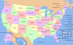 | Cartography of the United States (redirect from Online maps of the United States) United States is the history of surveying and creation of maps of the United States. Maps of the New World had been produced since the 16th century.... 2 KB (176 words) - 14:40, 19 April 2024 |
scale (ruler) designed to directly measure latitude and longitude on USGS maps. Roos, M., 1967. Variscale stereo point marking instrument, Photogrammetric... 463 bytes (40 words) - 16:35, 8 September 2020 |
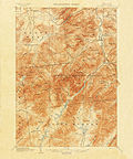 | Quadrangle (geography) (redirect from USGS quadrangle) "quadrangle" is a topographic map produced by the United States Geological Survey (USGS) covering the United States. The maps are usually named after local... 4 KB (361 words) - 01:11, 20 August 2023 |
The USGS DEM standard is a geospatial file format developed by the United States Geological Survey for storing a raster-based digital elevation model.... 7 KB (577 words) - 05:26, 10 December 2023 |