 | least 15 of Pittsburgh's bridges are visible in this aerial photo. Liberty Tunnels Local public transportation is coordinated by Pittsburgh Regional Transit... 26 KB (2,863 words) - 22:16, 5 April 2024 |
Pittsburgh Regional Transit (PRT, formerly Port Authority of Allegheny County) is the second-largest public transit agency in Pennsylvania and the 20th-largest... 46 KB (4,611 words) - 22:03, 27 March 2024 |
 | The Pittsburgh Light Rail (commonly known as The T) is a 26.2-mile (42.2 km) light rail system in Pittsburgh, Pennsylvania, and surrounding suburbs. It... 35 KB (3,977 words) - 07:41, 15 April 2024 |
 | Pittsburgh International Airport (IATA: PIT, ICAO: KPIT, FAA LID: PIT), formerly Greater Pittsburgh International Airport, is a civil-military international... 80 KB (6,544 words) - 13:41, 14 April 2024 |
 | The bridges of Pittsburgh play an important role in the city's transportation system. Without bridges, the Pittsburgh region would be a series of fragmented... 17 KB (749 words) - 14:09, 17 October 2023 |
 | Pittsburgh (/ˈpɪtsbɜːrɡ/ PITS-burg) is a city in the Commonwealth of Pennsylvania and the county seat of Allegheny County. It is the second-most populous... 234 KB (23,023 words) - 23:22, 6 April 2024 |
were located in Pittsburgh, Pennsylvania. The line connected Pittsburgh in the east with Youngstown, Ohio, in the Haselton neighborhood in the west and... 28 KB (2,786 words) - 19:20, 24 March 2024 |
 | The University of Pittsburgh Transportation System is a series of student shuttles serving the Oakland neighborhood of Pittsburgh, the city's intellectual... 3 KB (211 words) - 00:27, 25 May 2022 |
 | Interstate 376 (redirect from Interstate 76 in Pittsburgh) form new Interstate 376". Pittsburgh Post-Gazette. Retrieved June 12, 2009. Commonwealth of Pennsylvania Official Transportation Map (PDF) (Map). Pennsylvania... 64 KB (4,581 words) - 18:07, 1 March 2024 |
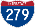 | Interstate 279 (redirect from Interstate 279 In Pittsburgh) Pitt Bridge in Pittsburgh, and the north end is in Franklin Park at I-79. It primarily serves at the main access route between Pittsburgh and its northern... 17 KB (1,080 words) - 05:14, 24 January 2024 |