 | TerraSAR-X, is an imaging radar Earth observation satellite, a joint venture being carried out under a public-private-partnership between the German Aerospace... 14 KB (1,452 words) - 21:53, 15 April 2024 |
German Aerospace Center (section TerraSAR-X) or international missions. TanDEM-X - TerraSAR-X add-on for Digital Elevation Measurement Prisma SATCOMBw TerraSAR-X Columbus BIRD - Bispectral InfraRed... 57 KB (5,440 words) - 20:03, 13 April 2024 |
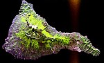
 | TanDEM-X (TerraSAR-X add-on for Digital Elevation Measurement) is the name of TerraSAR-X's twin satellite, a German Earth observation satellite using SAR (Synthetic... 5 KB (378 words) - 06:23, 22 October 2022 |
German space programme (section TerraSAR-X) provider Astrium. TerraSAR-X was launched on 15 June 2007 and has been in operational service since January 2008. With its twin satellite TanDEM-X, launched 21... 7 KB (4,116 words) - 14:01, 17 April 2024 |
program#Spacecraft design Earth observation satellites transmission frequencies TerraSAR-X: a German Earth observation satellite "Radar Bands". www.everythingweather... 13 KB (1,090 words) - 22:37, 25 April 2024 |
 | Interferometric synthetic-aperture radar (redirect from Interferometric SAR) observations. InSAR can also be used to monitor the stability of built structures. Very high resolution SAR data (such as derived from the TerraSAR-X StripMap... 34 KB (4,256 words) - 17:00, 29 April 2024 |
 | aperture radar where two passes of a radar satellite (such as RADARSAT-1 or TerraSAR-X or Cosmo SkyMed), or a single pass if the satellite is equipped with two... 30 KB (3,236 words) - 14:45, 26 February 2024 |
 | Lake Parime. The team presented its results in October 2019 at the TerraSAR-X / TanDEM-X Science Team Meeting held at the DLR’s (Deutschen Zentrum für Luft-... 66 KB (8,402 words) - 18:53, 8 May 2024 |
 | "TerraSAR-X Image Of The Month: Ground Uplift Under Staufen's Old Town". Spacemart. 22 October 2009. Retrieved 23 October 2009 – via TerraSAR-X radar... 8 KB (739 words) - 14:07, 20 December 2023 |
 | Synthetic-aperture radar (redirect from SAR algorithm) detection (SAHD) Synthetically thinned aperture radar TerraSAR-X Terrestrial SAR Interferometry (TInSAR) Very long baseline interferometry (VLBI) Wave radar... 77 KB (10,945 words) - 14:47, 12 March 2024 |