
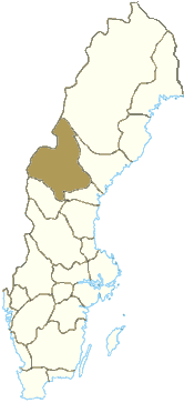
Ströms vattudal is an extensive water system in the northern parts of Jämtland in Sweden. The water system stretches from Kvarnbergsvattnet in the north...
740 bytes (72 words) - 19:55, 4 January 2024

(Strömsundsbron), a cable-stayed road bridge, bringing European route E45 over Ströms vattudal in Strömsund, opened in 1956. Strömsund's Municipal Building (Strömsunds...
4 KB (228 words) - 13:31, 2 May 2024
and politics. She befriends a woman named Sonja, and they travel to Ströms Vattudal where they enjoy nude swimming and other excursions. While hiking,...
4 KB (417 words) - 22:26, 11 June 2023

on the slopes of Ströms vattudal, the river that flows through the town. Among locals, the town itself is usually referred to as Ström or Flata (a reference...
10 KB (430 words) - 13:35, 20 January 2024

Strömsundsbron) is a cable-stayed road bridge, bringing road E45 over Ströms vattudal, in Strömsund, Jämtland, Sweden. The bridge is 332 m (1,089 ft) long...
2 KB (230 words) - 04:20, 4 December 2023
Finland 191 74 74 Konnevesi Finland 189 73 75 Bolmen Sweden 184 71 76 Ströms vattudal Sweden 183 71 77 Ondozero Ontajärvi Russia 182 70 78 Storuman Sweden...
23 KB (86 words) - 20:49, 7 February 2024
Donzère-Mondragon Canal 1956 – 1957 Strömsund Bridge Strömsund 182 m (597 ft) Ströms vattudal 1957 – 1959 Theodor Heuss Bridge Düsseldorf 260 m (850 ft) Rhine 1959...
94 KB (3,433 words) - 16:28, 5 May 2024

Faxälven Location Country Sweden Physical characteristics Source Ströms vattudal Mouth Ångerman River • coordinates 63°12′40″N 17°12′50″E / 63.21111°N...
2 KB (19 words) - 19:11, 28 November 2018
Lill-Jorm, Kvarnbergsvattnet (331 m) and afterwards the water system Ströms Vattudal (286 m), then it continues its journey and drains Fångsjön as Faxälven...
10 KB (1,320 words) - 20:35, 25 April 2024
089 ft) Cable-stayed Steel deck and pylons 75+182+75 European route E45 Ströms vattudal 1956 Strömsund 63°51′00.2″N 15°32′51.1″E / 63.850056°N 15.547528°E...
31 KB (502 words) - 15:28, 29 September 2023