
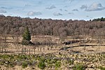
Signal de Botrange is the highest point in Wallonia and in Belgium, located in the High Fens (Hautes Fagnes in French, Hohes Venn in German, Hoge Venen...
5 KB (609 words) - 14:30, 8 September 2022

municipality of Büllingen, Liège Province Highest point — Signal de Botrange (694 m) Lowest point — De Moeren (−3 m) The Belgian National Geographic Institute...
19 KB (1,441 words) - 05:06, 28 April 2024
Its highest point, at 694 metres (2,277 ft) above sea level, is the Signal de Botrange near Eupen, and also the highest point in Belgium. A tower 6 metres...
18 KB (1,893 words) - 00:30, 3 November 2023

is not regarded as being in Italy, the highest peak would be Monte Bianco de Courmayeur (4,748 m). Bazardüzü is located on the territory of the Greater...
12 KB (491 words) - 19:44, 30 April 2024

standard). The altitude meter of Google Earth caused some doubt about Signal de Botrange (694 m TAW) as Belgium's highest point because its vertical reference...
3 KB (242 words) - 17:24, 16 April 2024

The Roer rises in the High Fens, near the 696-metre (2,283 ft) high Signal de Botrange in Belgium at an elevation of 660 metres (2,170 ft) above sea level...
7 KB (795 words) - 19:43, 13 May 2024

date it was also the highest municipality in Belgium, marked by the Signal de Botrange, at 694 metres (2,277 feet). It is the site of Reinhardstein Castle...
1 KB (160 words) - 21:45, 28 December 2022
national road connecting Malmedy to Signal de Botrange. Jean-Marie Pierret, Phonétique historique du français et notions de phonétique générale, Louvahin-la-Neuve...
1 KB (110 words) - 08:36, 10 February 2024

Vesdre. Its source is in the High Fens of eastern Belgium, near the Signal de Botrange. The Hoëgne flows through Theux, and ends in the Vesdre in Pepinster...
999 bytes (53 words) - 13:41, 18 July 2022
the third highest point at 674 metres (2,211 ft), after the nearby Signal de Botrange (694 metres (2,277 ft)) and the Weißer Stein (691 metres (2,267 ft))...
2 KB (225 words) - 00:20, 9 July 2022