 | Pictorial maps (also known as illustrated maps, panoramic maps, perspective maps, bird's-eye view maps, and geopictorial maps) depict a given territory... 13 KB (1,601 words) - 19:00, 13 January 2024 |
 | Hypsometric tints Map design Orthophotomap—A map created from orthophotography Pictorial maps Plat Road atlas Strip map Transit map Page layout (cartography)... 33 KB (4,185 words) - 21:14, 15 April 2024 |
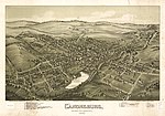
 | Cartography (redirect from Map making) Collaborative project to create a free editable map of the world Pictorial map – Map that uses pictures to represent features Planetary cartography –... 61 KB (7,307 words) - 04:01, 23 March 2024 |
 | Hall 1000 Commonwealth Ave Newton, MA City Government-Executive Offices - MapQuest". www.mapquest.com. Retrieved March 29, 2017. Wikimedia Commons has... 7 KB (534 words) - 21:24, 15 April 2024 |
 | writing, and even the Roman alphabet, owe their origins in some respects to pictorial representations. Images of any type may convey different meanings and... 24 KB (2,920 words) - 17:42, 28 April 2024 |
 | Fantasy cartography (redirect from Fictional map) Fantasy cartography, fictional map-making, or geofiction is a type of map design that visually presents an imaginary world or concept, or represents a... 30 KB (2,835 words) - 16:14, 11 November 2023 |
 | Pictorial map of Crusoe's island, the "Island of Despair", showing incidents from the book... 53 KB (6,277 words) - 15:38, 16 April 2024 |
 | the heart of USC's historic campus as it looks today. Show map of South Carolina Show map of the United States Location Bounded by Pendleton, Sumter,... 4 KB (330 words) - 01:45, 8 August 2023 |
 | 2005 United Nations Environment Programme map: Landcover of the Caucasus United Nations Environment Programme map: Population density of the Caucasus Food... 55 KB (5,656 words) - 00:12, 28 April 2024 |
 | identified in a pictorial map of 1682 by William Morgan. Reproduced in Barker, Felix; Jackson, Peter (1990). The History of London in Maps. London: Barrie... 24 KB (2,467 words) - 14:10, 13 March 2024 |