surveys, trace from aerial imagery and also import from other freely licensed geodata sources. OpenStreetMap is freely licensed under the Open Database License... 67 KB (5,938 words) - 10:44, 17 April 2024 |
Google Maps is a web mapping platform and consumer application offered by Google. It offers satellite imagery, aerial photography, street maps, 360° interactive... 158 KB (12,988 words) - 10:39, 25 April 2024 |
OpenDroneMap is an open source photogrammetry toolkit to process aerial imagery (usually from a drone) into maps and 3D models. The software is hosted... 5 KB (412 words) - 05:23, 22 January 2024 |
November 2010, OpenStreetMap mappers have been able to use imagery of Bing Aerial as a map background. At the end of January 2012, both Bing Aerial and Birds... 46 KB (3,254 words) - 20:50, 24 February 2024 |
 | it is also known as aerial videography. Platforms for aerial photography include fixed-wing aircraft, helicopters, unmanned aerial vehicles (UAVs or "drones")... 43 KB (4,823 words) - 17:26, 5 March 2024 |
original on 3 September 2015. Retrieved 23 July 2013. "Summary of Global Map". International Steering Committee for Global Mapping. Archived from the... 43 KB (510 words) - 15:17, 13 February 2024 |
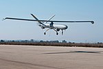 | An uncrewed aerial vehicle (UAV), commonly known as a drone, is an aircraft without any human pilot, crew, or passengers on board. UAVs were originally... 136 KB (12,586 words) - 00:38, 25 April 2024 |
 | The Palm Springs Aerial Tramway in Palm Springs, California, is the largest rotating aerial tramway in the world. It was opened in September 1963 as a... 15 KB (1,645 words) - 12:14, 11 February 2024 |
near Parapeti, Santa Cruz, Bolivia. Published Bing, HERE, OpenStreetMap, and Google aerial images show the runway is overgrown with trees and brush. Bolivia... 2 KB (68 words) - 20:09, 9 March 2023 |
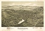 | Pictorial maps (also known as illustrated maps, panoramic maps, perspective maps, bird's-eye view maps, and geopictorial maps) depict a given territory... 13 KB (1,601 words) - 19:00, 13 January 2024 |