
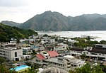
Okinotorishima (沖ノ鳥島, Okinotori-shima), or Parece Vela, is a coral reef, geologically an atoll, with two rocks enlarged with tetrapod-cement structures...
27 KB (3,122 words) - 15:33, 25 March 2024

Territorial disputes of Japan (section Okinotorishima)
to the dispute. Okinotorishima is an uninhabited atoll in the Philippine Sea. Discovered by European explorers[who?], Okinotorishima went unclaimed until...
14 KB (1,693 words) - 14:56, 14 September 2024
Islands, and three remote islands (Nishinoshima, Minamitorishima and Okinotorishima). In 1940, five municipalities were created in the islands, which had...
9 KB (646 words) - 18:39, 22 May 2024

Tokyo, and Okinotorishima, the southernmost point in Japan. Japan's claim on an exclusive economic zone (EEZ) surrounding Okinotorishima is contested...
220 KB (18,330 words) - 23:13, 17 September 2024
(EEZ) in Antarctica is challenged by Japan. Okinotorishima: Japanese claim to an EEZ around Okinotorishima is challenged by China, South Korea, and Taiwan...
24 KB (1,714 words) - 22:56, 11 September 2024

Iturup, an island de facto governed by Russia. The southernmost point is Okinotorishima; the westernmost is Cape Irizaki on Yonaguni Island in Okinawa Prefecture...
13 KB (593 words) - 14:13, 2 July 2024

villages were administered as part of Tokyo's government (Tōkyō-fu). Okinotorishima was added to the subprefecture in 1930, and the villages were finally...
10 KB (919 words) - 12:19, 14 September 2024

relations with China and Taiwan over the Senkaku Islands and the status of Okinotorishima. Japan is the third highest-ranked Asian country in the 2024 Global...
201 KB (16,463 words) - 23:39, 16 September 2024

underwater terrain and islands such as Minami-Tori-Shima, Benten-jima, Okinotorishima, and Yonaguni Japan in the Paleolithic List of extreme points of Japan...
9 KB (750 words) - 04:50, 21 August 2024
the Ogasawara Islands. Japan extends from 20° to 45° north latitude (Okinotorishima to Benten-jima) and from 122° to 153° east longitude (Yonaguni to Minami...
160 KB (15,342 words) - 02:07, 13 September 2024