According to the website (https://worldwind.arc.nasa.gov/), "WorldWind is an open source virtual globe API. WorldWind allows developers to quickly and...
20 KB (1,970 words) - 05:12, 6 April 2024
Globe 98, followed by Cosmi's 3D World Atlas in 1999. The first widely publicized online virtual globes were NASA WorldWind (released in mid-2004) and Google...
8 KB (974 words) - 08:19, 28 December 2023
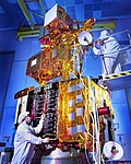
Landsat 7 (category NASA satellites orbiting Earth)
and data from Landsat 7 is collected and distributed by the USGS. The NASA WorldWind project allows 3D images from Landsat 7 and other sources to be freely...
13 KB (1,359 words) - 15:51, 2 March 2024
1975, NASA managed a program for the United States Department of Energy and the United States Department of Interior to develop utility-scale wind turbines...
22 KB (2,666 words) - 22:58, 29 July 2023
content management system GPS eXchange Format Keyhole satellite series NASA WorldWind Point of interest SketchUp file formats The Blue Marble Waypoint Wikimapia...
8 KB (779 words) - 04:59, 7 March 2024
Oblique Landsat image draped over digital elevation data (×5 vertical exaggeration), Spider crater; screen capture from NASA WorldWind...
4 KB (365 words) - 00:30, 7 May 2024
created in 2010 by the Air Force Research Laboratory, and based on the NASA WorldWind Mobile codebase its development and deployment grew slowly, then rapidly...
20 KB (1,961 words) - 11:10, 5 April 2024
nearly devoid of vegetation. A superimposition of the map with current NASA WorldWind satellite images shows the extent of flooding in the area of the salient...
7 KB (635 words) - 15:17, 29 January 2024
is fertile, lake with high water, Snow on Mount Kyllini (2.374 m), NASA WorldWind (8 km) Trees at the lake Oligyrtos Mountain, 100% forest, high water...
3 KB (305 words) - 22:46, 4 January 2024
Kalahari Desert (category Articles with WorldCat Entities identifiers)
Convergence Zone (ITCZ)/"Continental Trade winds". The ITCZ is the meeting area of the boreal trade winds with their austral counterparts what meteorologists...
22 KB (2,461 words) - 21:21, 1 April 2024


