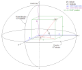
 | The International Terrestrial Reference System (ITRS) describes procedures for creating reference frames suitable for use with measurements on or near... 9 KB (763 words) - 09:20, 15 August 2023 |
 | The European Terrestrial Reference System 1989 (ETRS89) is an ECEF (Earth-Centered, Earth-Fixed) geodetic Cartesian reference frame, in which the Eurasian... 6 KB (585 words) - 18:43, 20 March 2024 |
 | The Geodetic Reference System 1980 (GRS80) is a geodetic reference system consisting of a global reference ellipsoid and a normal gravity model. Geodesy... 7 KB (945 words) - 05:26, 28 September 2023 |
 | versions, the ideal International Terrestrial Reference System (ITRS) and its realization, the International Terrestrial Reference Frame (ITRF). The most... 13 KB (767 words) - 19:40, 26 March 2024 |
 | The Military Grid Reference System (MGRS) is the geocoordinate standard used by NATO militaries for locating points on Earth. The MGRS is derived from... 15 KB (2,133 words) - 06:55, 13 February 2024 |
 | Geodetic datum (redirect from Geodetic reference system) systems, especially the World Geodetic System (WGS 84) used in the U.S. global positioning system (GPS), and the International Terrestrial Reference System... 29 KB (3,073 words) - 16:06, 31 December 2023 |
defined the IERS Reference Meridian, the International Terrestrial Reference System (ITRS), and subsequent International Terrestrial Reference Frames (ITRF)... 6 KB (553 words) - 18:36, 13 September 2023 |


