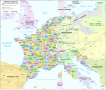
 | English German Karte des Rheinbundes (1812)... (2,067 × 2,362 (1.09 MB)) - 16:25, 24 March 2022 |
 | jpg Rheinbund 1812, political map, created by ziegelbrenner CC-BY-SA 3.0: https://commons.wikimedia.org/wiki/File:Rheinbund_1812,_political_map.png France... (2,052 × 1,728 (3.86 MB)) - 12:43, 9 February 2024 |
 | png" 2011-04-10T20:05:09Z Alphathon 680x520 (568373 Bytes) Improved Serbia, Montenegro and surrounding countries using data from "File:Serbia Map.png"... (450 × 456 (607 KB)) - 10:09, 25 April 2023 |
 | png" 2011-04-10T20:05:09Z Alphathon 680x520 (568373 Bytes) Improved Serbia, Montenegro and surrounding countries using data from "File:Serbia Map.png"... (450 × 456 (607 KB)) - 10:09, 25 April 2023 |
 | png" 2011-04-10T20:05:09Z Alphathon 680x520 (568373 Bytes) Improved Serbia, Montenegro and surrounding countries using data from "File:Serbia Map.png"... (450 × 456 (607 KB)) - 10:09, 25 April 2023 |
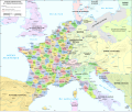 | jpg Rheinbund 1812, political map, created by ziegelbrenner CC-BY-SA 3.0: https://commons.wikimedia.org/wiki/File:Rheinbund_1812,_political_map.png France... (2,052 × 1,728 (2.84 MB)) - 16:50, 21 May 2023 |