 | Deer Flat Upper Embankment (National ID # ID00276) is a dam in the western United States in southwestern Idaho. Located in the Treasure Valley in Canyon... 5 KB (515 words) - 20:40, 18 September 2023 |
 | the Diversion Dam and Deer Flat Embankments are: Boise River Diversion Dam Deer Flat Upper Embankment Deer Flat Lower Embankment National Register of Historic... 3 KB (220 words) - 04:58, 6 August 2023 |
| Equalization trench in Deer Flat Reservoir excavated with steam shovel No. 1 from Upper Embankment. Earthwork at Upper Embankment completed. 1909 Outlet... 8 KB (749 words) - 15:51, 11 January 2023 |
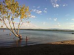
Governor’s Punch Bowl Grays Lake Henrys Lake Lake Lowell (part of the Deer Flat Upper Embankment reservoir) Lake Pend Oreille (largest lake in Idaho) Payette Lake... 38 KB (2,827 words) - 11:39, 10 February 2024 |
 | Embankment, offstream storage, Idaho Deer Flat Middle Embankment, offstream storage, Idaho Deer Flat Upper Embankment, offstream storage, Idaho Deerfield... 23 KB (2,401 words) - 19:14, 27 September 2023 |
 | Yuba–Bear Hydroelectric Project (section Deer Creek) into Dutch Flat No. 2 Forebay. The Dutch Flat Forebay Dam is an off-stream earthfilled embankment dam adjacent to the Bear River. The Dutch Flat Forebay... 19 KB (2,289 words) - 18:11, 28 March 2024 |
 | Kentucky in 1939. Webb discovered a circle of "paired-posts" inside of the embankment ring and ditch. The 48.5 feet (14.8 m) circle was made up of sixty two... 18 KB (1,404 words) - 23:07, 4 April 2024 |
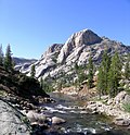 | Tuolumne River (redirect from Upper Tuolumne River) Oak Flat, followed by the Clavey River from the north a few miles after that. The North Fork of the Tuolumne joins from the north near the upper end of... 70 KB (7,726 words) - 19:16, 29 April 2024 |
 | had an 8–10-foot-high (2.4–3.0 m) and 5,298-foot-long (1,615 m) earthen embankment and ditch on three sides. The other side was the lake, now called Mound... 14 KB (948 words) - 13:25, 27 September 2023 |
 | The western half of the Greenway embankment is roughly at house eaves height giving a view over the surrounding flat area (see gallery pictures). Between... 17 KB (978 words) - 11:42, 30 March 2024 |