
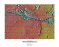
The Cebrenia quadrangle is one of a series of 30 quadrangle maps of Mars used by the United States Geological Survey (USGS) Astrogeology Research Program...
37 KB (4,850 words) - 22:36, 11 June 2024

Cebrenia was an ancient country in the Troad, the hinterland of Troy, beside the Dardanelles in what is now Turkey. The location of Cebrenia was described...
3 KB (321 words) - 00:39, 18 November 2023
Fossae is in the Ismenius Lacus quadrangle. Galaxias Fossae Trough, as seen by HiRISE. Image in the Cebrenia quadrangle. Hephaestus Fossae: two views,...
15 KB (1,630 words) - 19:05, 10 April 2024

that fell from the sky during past climatic conditions. Location is Cebrenia quadrangle. Unlike mudcracks, which are dominated by T-junctions, polygonal...
29 KB (3,208 words) - 18:01, 22 July 2024

quadrangle. Close-up of lobate debris apron (LDA), as seen by HiRISE under HiWish program Lobate debris apron in Phlegra Montes, Cebrenia quadrangle....
81 KB (9,712 words) - 07:17, 11 June 2024

Hrad Vallis (category Cebrenia quadrangle)
Hrad Vallis is an ancient outflow channel in the Cebrenia quadrangle of Mars, located at 38.7° north latitude and 224.7° west longitude. It is 825 km...
2 KB (178 words) - 13:36, 10 May 2023
The Coprates quadrangle is one of a series of 30 quadrangle maps of Mars used by the United States Geological Survey (USGS) Astrogeology Research Program...
35 KB (4,510 words) - 19:50, 5 September 2024

Here, a group of craters are partially exposed. Image located in Cebrenia quadrangle. Large areas of Mars are covered by a mantle that coats all but the...
45 KB (4,571 words) - 09:29, 11 September 2024

Viking 2 (category Cebrenia quadrangle)
Palus quadrangle. Tear-drop shaped islands caused by flood waters from Maja Valles, as seen by Viking Orbiter. Image is located in Oxia Palus quadrangle. The...
24 KB (2,244 words) - 14:38, 17 September 2024
the Cebrenia quadrangle. These locations are 55.57° N, 150.62° E; 43.28° N, 176.9° E; and 45° N, 164.5° E. Two others are in the Diacria quadrangle: 46...
102 KB (11,134 words) - 12:42, 8 September 2024