 | Bathymetry (/bəˈθɪmətri/; from Ancient Greek βαθύς (bathús) 'deep', and μέτρον (métron) 'measure') is the study of underwater depth of ocean floors (seabed... 27 KB (3,759 words) - 17:47, 15 March 2024 |
 | Lidar (redirect from Airborne laser bathymetry) frequency doubled solid-state IR laser output is the standard for airborne bathymetry. This light can penetrate water but pulse strength attenuates exponentially... 128 KB (14,556 words) - 09:51, 5 April 2024 |
 | Satellite-Derived Bathymetry (SDB) is the calculation of shallow water depth from active or passive satellite sensors. The technology requires a sensor... 6 KB (615 words) - 09:59, 19 March 2024 |
 | Challenger Deep (section Surveys and bathymetry) submersibles, remotely operated underwater vehicles, benthic landers, and sonar bathymetry. The differences in depth estimates and their geodetic positions are scientifically... 173 KB (19,837 words) - 20:33, 10 April 2024 |
 | Lake Huron (category Articles using infobox body of water without alt bathymetry) Huron Michigan lighthouses National Geophysical Data Center (1999). "Bathymetry of Lake Erie and Lake Saint Clair". National Oceanographic and Atmospheric... 31 KB (3,175 words) - 13:20, 27 April 2024 |
 | measurement of altitude is called altimetry, which is related to the term bathymetry, the measurement of depth under water. Altitude can be determined based... 6 KB (731 words) - 06:05, 4 October 2023 |
 | bathymetric profiles which are vertical sections through a feature. The use of bathymetry and the development of bathymetric charts dates back around the 19th century... 9 KB (1,920 words) - 18:30, 14 January 2024 |
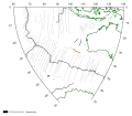 | Diamantina Fracture Zone (section Bathymetry) which are believed to be new species. The first high-resolution multibeam bathymetry of the central DFZ was collected between June 2014 and June 2016, for... 7 KB (850 words) - 19:23, 3 September 2023 |
 | Mariana Trough (section Location and Bathymetry) the mantle. Where not covered by sediments, the seafloor is deeper and bathymetry more rugged than normal. The most recent, "zero-age" seafloor of the Philippine... 8 KB (1,041 words) - 19:10, 15 July 2021 |
 | Bathymetry of the ocean floor showing the continental shelves and oceanic plateaus (red), the mid-ocean ridges (yellow-green) and the abyssal plains (blue... 33 KB (4,185 words) - 21:14, 15 April 2024 |