 | Aerial photography (or airborne imagery) is the taking of photographs from an aircraft or other airborne platforms. When taking motion pictures, it is... 43 KB (4,823 words) - 17:26, 5 March 2024 |
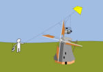 | aerial photography (KAP) is a type of photography. A camera is lifted using a kite and is triggered either remotely or automatically to take aerial photographs... 12 KB (1,256 words) - 14:45, 8 January 2024 |
 | Pigeon photography is an aerial photography technique invented in 1907 by the German apothecary Julius Neubronner, who also used pigeons to deliver medications... 39 KB (3,993 words) - 09:18, 11 December 2023 |
Strip aerial photography (or aerial strip photography, or continuous strip photography) is a method of aerial photography that uses a high-speed, low-altitude... 896 bytes (106 words) - 06:13, 17 December 2016 |
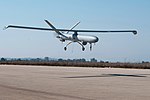 | their use expanded to many non-military applications. These include aerial photography, area coverage, precision agriculture, forest fire monitoring, river... 136 KB (12,586 words) - 13:32, 17 April 2024 |
 | as being the world's first air force. After the invention of photography, primitive aerial photographs were made of the ground from manned and unmanned... 45 KB (4,898 words) - 02:44, 1 March 2024 |
Sherman Fairchild (redirect from Fairchild Aerial Surveys) cities began using aerial mapping, as they found it was faster and less expensive than the ground surveys of the time. Aerial photography proved to be a successful... 27 KB (2,736 words) - 00:56, 3 February 2024 |
Google Maps (redirect from Google Aerial View) consumer application offered by Google. It offers satellite imagery, aerial photography, street maps, 360° interactive panoramic views of streets (Street... 158 KB (12,979 words) - 23:41, 17 April 2024 |
Nacional; SANDIVRA) is an aerial photography service of the Peruvian Air Force, it is part of its Directorate of Surveillance and Aerial Reconnaissance. It is... 3 KB (229 words) - 06:58, 6 April 2024 |
waves Aerial (television), an over-the-air television reception antenna Aerial photography Aerial, Georgia, a community in the United States Aerial (magazine)... 1 KB (162 words) - 11:55, 12 April 2024 |