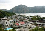
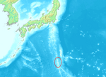
 | Nishi-no-shima (Japanese: 西之島, "western island") is a volcanic island located around 940 km (584 mi) south-southeast of Tokyo, that is part of the Volcano... 35 KB (3,495 words) - 05:01, 21 April 2024 |
 | (南硫黄島, Minami-Iōtō, lit. "South Sulphur Island") 3.54 km2 Nishinoshima (西之島, lit. "Western Island"; also known as Rosario Island), a single isolated... 9 KB (646 words) - 19:40, 8 April 2024 |
 | (3,005 ft) Farther north but in the same volcanic arc is: Nishino-shima (西之島, literally Western Island), 4.10 square kilometres (1.58 sq mi), 200 metres... 10 KB (638 words) - 11:01, 18 December 2023 |
 | Parece Vela Reef: Japanese: 沖ノ鳥島 (Okinotori Shima) Rosario Island: Japanese: 西之島 (Nishino Shima) Volcano Islands: Japanese: 火山列島 (Kazan Rettō) Ōmura (大村)... 43 KB (1,864 words) - 06:47, 12 April 2024 |
 | 53 sq mi). It increases in area due to volcanic eruptions such as Nishinoshima (西之島), the natural expansion of the islands, and land reclamation. This table... 148 KB (14,669 words) - 22:34, 22 April 2024 |
 | 139.3875°E / 34.044722; 139.3875 (Ōnohara-jima) 5.46 2010 3 Nishinoshima 西之島鳥獣保護区 Tokyo 27°14′49″N 140°52′28″E / 27.246944°N 140.874444°E / 27.246944;... 32 KB (712 words) - 19:25, 4 December 2021 |
 | Japanese). 69 (2): 30–35. doi:10.11475/sabo.69.2_30. ISSN 0286-8385. 区域図 聟島、西之島、北硫黄島 [Area Map: Mukojima, Nishinoshima, North Iwojima] (PDF) (in Japanese)... 6 KB (466 words) - 12:05, 27 April 2024 |